What's new

The Treasure of Captain William Kidd.

So why does the Key chart mention "Wood", and "20 Turtles"?..
1749018452759.webp

Some have speculated that 20 Turtles is some kind of secret code, or that it means to "Turn Turtle" or flip the chart upside-down. In the literature from the era, sailing ships required lots of wood, water, and food. So whenever they stopped at a port or island, they had to resupply these important provisions. I think that "wood" and "20 Turtles" was written by Kidd as a shopping list and as a reminder that these items were readily available on the island.
 
Last edited:
Very interesting thread, I stumbled across by web search. I have been studying the so-called Palmer-Kidd charts/maps (I prefer to call them maps than nautical charts) for many years and am writing a lengthy article for a journal. Some of my observations:

1. The Palmer-Kidd maps are almost certainly not what they purport to be, at least one (Hardy Chest) is a proven hoax. If you research the provenance of this map you cannot trace it beyond Arthur Hill Cutler (1930s), an antique seller who sold the Hardy Chest (with a map in its false bottom) to Hubert Palmer, a solicitor and collector of pirate artefacts. The Hardy Chest came with a pedigree note stating that the chest came from the "late Miss Pamela Hardy, great-niece of Captain T. Masterman Hardy" and it ultimately derived from Ned Ward, one of Kidd's shipmates whose descendant (an unnamed great-grandson) sold it to T. M. Hardy. According to this story (recorded by Wilkins, 1935), the chest was passed down generations of the Hardy family. Pamela Hardy was the great-niece of T. M. Hardy who was bequeathed the chest by his brother John Hardy (in other words, Pamela was his great-granddaughter). The problem is - Pamela Hardy was not a real person. This provenance of the Hardy chest/map was entirely fabricated, its time-line does not make sense and this has long been known if you do some research. No records of Pamela Hardy exist, nor are there any records of her living in the English town (Eastbourne) she was said to have resided. She was rumoured (by Harold T. Wilkins) to have died in Spain, but there are no death records and John Hardy was a childless bachelor who left all his property in his will to his sisters, so he could not have had a great-granddaughter. The pedigree is also complicated by the fact John Hardy (1771- 1822) died before T. M. Hardy. We are not told when or why the latter passed on the chest to his brother.

2. Pamela Hardy's name appears on dubious pedigree notices for objects said to have been owned by Lord Nelson. Many of these were apparently sold by Cutler and were acquired by Palmer. If you search for certain Lord Nelson objects, you find Pamela Hardy's name mentioned in auctions with similar pedigree notices but these are without doubt fabrications and the provenance was made up (none of the Nelson objects with Pamela Hardy's name attached are traceable to having once been is his or his family's possession.) There are numerous sources that discuss these objects not being not authentic (I have quoted a few below). Interestingly, some of these dubious objects found their way into museums but are now recognised as not being remotely genuine e.g., a toy coach and horses (Royal Museums Greenwich) said to have been owned by Nelson's daughter:

Model coach and two horses in metal plate, painted with a driver and passenger. A mechanism makes the horses bob up and down when the toy is pulled along. It reputedly belonged to Nelson's daughter Horatia but it has a very dubious provenance.

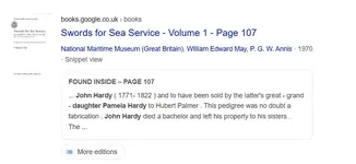
Swords for Sea Service Volume 1
By National Maritime Museum (Great Britain), William Edward May, P. G. W. Annis (1970)

1749037083539.webp


I don't yet own The Authentic Nelson (2005) but this book has information on page 87:

1749038806643.webp


There is also a (deleted for rule violation) on a forum dedicated to Nelson:

The name Pamela Hardy jogged my memory and reminded me about where I had come across this information. It's in 'The Authentic Nelson' by Rina Prentice. Miss Hardy's name appears on numerous documents guaranteeing the authenticity of a huge number of items which had been purportedly bequeathed to her by her great grandfather, John Hardy, brother of the Admiral. John Hardy, however, died unmarried, and left all his property to his sisters. The 'Captain Kidd' chest mentioned above is one of the items with the false Pamela Hardy provenance.

3. According to Wilkins, Hubert Palmer also acquired another map from Arthur Hill Cutler, inside the Morgan Chest. Although the provenance of this chest is not proven to be a fabrication like the Hardy Chest, the evidence certainly suggests this object has a fake pedigree. According to Cutler, the Morgan Chest was given to him by a man named Dan Morgan, who claimed descent from Sir Henry Morgan, the lieutenant governor of Jamaica. Palmer received the chest from Cutler (Howlett, however, states Morgan directly sold it to Palmer, see below). Dan Morgan is not the same individual as the American revolutionary war general of the same name who was related to Henry Morgan. There is scant evidence of the 20th century Dan Morgan having existed, although according to Wilkins he knew him personally and quoted a letter from him in his book Captain Kidd and his Skeleton Island (I have seen a photograph claimed to be Dan Morgan but it is by no means definitely him). However, even if a real individual, his claimed descent from Sir Henry Morgan is almost certainly a fabrication. There are no genealogical records showing this and the story of how he came across the Morgan Chest is hardly credible. If you search for sources about Dan Morgan, you suspiciously find little to nothing aside from Wilkin's books; later literature primarily quotes or relies on Wilkins.

4. Further, according to Wilkins, Hubert Palmer obtained a third map from Arthur Hill Cutler. This map was not inside a chest but a bureau. Wilkins provides very little information but the story goes, the bureau came from a "Mr. R" from London. Palmer had either discovered the map in the presence of Cutler (in his antique shop), or according to Howlett (see below) with his brother at home. There is no way to verify if this chest actually came from London and Cutler did not provide the actual name of the seller (only his first initial). The map which was found in the bureau is initialled "W.K. [William Kidd] 1669" with the name "Sarah" underneath. The problem with this date, is Sarah Bradley would not have used Kidd's name until they were married (~20 years later). This inconsistency points to map being a fake, and this is suggested as well by a forensic report (see below).

5. According to Wilkins, yet another (fourth) map came from Cutler who told Palmer he came into possession of a workbox (with a secret compartment); this map has been described as the "Skeleton Map" or "Key Chart". Little information is provided how Cutler obtained it, aside from the vague mention of an "old naval man". An analysis of the writing on the map by experts (see below) suggests with high probability this map is another fake.

6. There is a disagreement about the dates of when Hubert Palmer first saw or purchased the aforementioned four antiques (Hardy Chest, Morgan Chest, bureau and workbox) from Cutler, and secondly, who exactly discovered the maps inside them. According to Wilkins who had met with Palmer and corresponded with him directly by letters, Palmer had purchased three of these objects knowing the maps had already been found in them by previous owners (this version states Palmer himself found the secret map in the bureau in the presence of Cutler). In contrast, Anthony Howlett (author of the article "The Mystery of Captain Kidd's Treasure" in World Wide Magazine, 1958) who corresponded with Elizabeth Dick (Palmer's housekeeper), shortly after Palmer died, stated that it was Palmer who discovered all of the maps. Wilkins and Howlett also disagreed on the dates of when Palmer purchased the two chests, bureau and workbox. These differences are outlined by G. J. Bath in his book 1. The Maps: In Search of Skeleton Island. Bath prefers Wilkin's version of events while George Edmunds (Kidd: The Search for his Treasure, 1996), Howlett's. Who is correct? Bath quotes private letters Palmer had sent Wilkins seemingly confirming Wilkin's version of events (how Palmer came into possession of the maps). Howlett's version is wildly inaccurate and even contradicts Palmer's own writings about how he acquired these objects and maps. That said, there are a few mistakes in Wilkin's accounts.

7. Much misinformation has been written online about experts confirming the authenticity of the maps. Part of this stems from (a) confusing the dating of the chests, bureau and workbox with the maps and (b) the writing on the maps with the date of the parchments. All the antiques undoubtedly pre-date the 20th century; various sources estimate late 17th to mid-18th century, when Captain Kidd was alive or within about half-a-century of his death (they were not made in the 20th century so were not recent when Palmer came across or purchased them), however, that does not mean the maps are that old (or the engravings on these objects such as an engraving on the bureau are 17th or 18th century). In 1951, one of the maps - from the bureau was forensically investigated by Home Office Forensic Science Laboratory; Bath and Edmunds both quote the outcome of the forensic report which concluded the cardinal points on the map "was not in use on maps for many years after the death of Captain Kidd" and that the ink used on the parchment was likely "produced about two hundred years after Kidd was hanged". Combined with other evidence, this report concluded the map being "a comparatively recent production on what might very well be an old sheet of parchment". Indeed, it is possible that the parchments are themselves old (17th century) but the ink or drawings on them are not as the forensic report concluded. You can see the cardinal point (compass star) on the bureau map:

1749064811223.webp


8. It has been claimed R. A. Skelton, Head of the Map Room at the British Museum in the late 1940s confirmed the Kidd-Palmer maps are authentic. This is incorrect; as noted by an expert, Peter Barber (from the Map Library, British Library) in 2008:

According to a letter written by R.A. Skelton, the Head of the Map Room at the British Museum, in 1959 recalling events of 10 years previously (no copy survives of his original letter), one of the maps was brought in for inspection either by Mr Palmer or by his housekeeper. Skelton's language was extremely guarded and he commented only that the chart had been "drawn on the back of a perfectly genuine will of the late 17th century. The chart itself contained little evidence of the precise locality represented, although . . .it appeared to be somewhere in the China Sea. While the chart contained no features which would forbid us to suppose that it was drawn in the early 18th century, it had also nothing to associate it, so far as I could see, with Captain Kidd".
Skelton only ever examined one of the maps, and concluded the parchment was late 17th century, not the ink or drawing.
Furthermore, Barber points out that the "cabinets" (i.e., the two chests and bureau) date to the mid-eighteenth century:

The maps themselves, however, are dated 1669 (a period about which nothing is known of Kidd's career) and subsequent research has revealed that the cabinets in which Palmer claimed to have found the charts dated from the mid-eighteenth century and so could have had nothing to do with the Captain.
However, some sources date the bureau slightly earlier but the workbox apparently dates to the late 17th century. The antiques themselves are therefore a mix of late 17th to mid-18th century origin, while the parchments (the maps were drawn on) late 17th century. This is not surprising since as a hoax - the maps would not convince anyone if furniture/parchments appeared modern. Someone took old parchments but had used much more recent ink and drawing styles to make the maps. Barber is quoted by Bath as having personally seen the Skeleton Map and easily determined it was modern (20th century):
...a twentieth century artifact can be seen by the hand it is written.

9. The question remains who was behind the hoax? Edmunds believes Wilkins made the fake maps but I think he is mistaken. The evidence instead points to Arthur Hill Cutler as the hoaxer who was the source for all four Kidd-Palmer maps and we know he definitely made up a false pedigree for the Hardy Chest. Secondly, Cutler sold many other antiques of dubious pedigree and provenance; his shop contained for example, many fake objects said to have been owned by Lord Nelson which were not and whose authenticity was widespread questioned. All that said, Edmunds should be applauded for both his books and diligent research. He also deserves credit for changing in mind in light of the overwhelming evidence the maps are hoaxes.

10. Is there a mystery left to solve? Arguably, yes. Despite the maps are not what they purport to be (Captain Kidd never drew or owned them), I think is is very likely the hoaxer (Cutler) buried a treasure in the late 1920s (possibly genuine pirate antiques in his collection) and provided clues on these maps that point to a real location. I am working on an article which will attempt to identify the spot. I also think Cutler provided both obvious and subtle hints these maps have a fake pedigree. For example, Ned Ward in the pedigree of the Hardy Chest is a nod to the late 17th century humorist and satirist of the same name.
 
Last edited:
Very interesting thread, I stumbled across by web search. I have been studying the so-called Palmer-Kidd charts/maps (I prefer to call them maps than nautical charts) for many years and am writing a lengthy article for a journal. Some of my observations:

1. The Palmer-Kidd maps are almost certainly not what they purport to be, at least one (Hardy Chest) is a proven hoax. If you research the provenance of this map you cannot trace it beyond Arthur Hill Cutler (1930s), an antique seller who sold the Hardy Chest (with a map in its false bottom) to Hubert Palmer, a solicitor and collector of pirate artefacts. The Hardy Chest came with a pedigree note stating that the chest came from the "late Miss Pamela Hardy, great-niece of Captain T. Masterman Hardy", who bought it from by Ned Ward, one of Kidd's shipmates. According to this story, after T. Masterman Hardy died it was bequeathed by him to his brother John Hardy, whose great-grand-daughter was Pamela Hardy. The problem is - Pamela Hardy was not a real person. This provenance of the Morgan chest/map was entirely fabricated and this has long been known if you do some research. No records of Pamela Hardy exist. She was rumoured (by Harold T. Wilkins) to have died in Spain, but there are no death records and John Hardy was a childless bachelor (he had no daughter). Another major hole in the pedigree is John Hardy died before T. Masterman Hardy, so it was not possible for him to have even been bequeathed the Hardy Chest.

2. Pamela Hardy's name appears on dubious pedigree notices for objects said to have been owned by Lord Nelson. Many of these were apparently sold by Cutler and were acquired by Palmer. If you search for certain Lord Nelson objects, you find Pamela Hardy's name mentioned in auctions with similar pedigree notices but these are without doubt fabrications and the provenance was made up (none of the Nelson objects with Pamela Hardy's name attached are traceable to having once been is his or his family's possession.) There are numerous sources that discuss these objects not being not authentic (I have quoted a few below). Interestingly, some of these dubious objects found their way into museums but are now recognised as not being remotely genuine e.g., a toy coach and horses (Royal Museums Greenwich) said to have been owned by Nelson's daughter:


Swords for Sea Service Volume 1
By National Maritime Museum (Great Britain), William Edward May, P. G. W. Annis (1970)

View attachment 2211129

I don't yet own The Authentic Nelson (2005) but this book has information on page 87:

View attachment 2211132

There is also a (deleted for rule violation) on a forum dedicated to Nelson:


3. According to Wilkins, Hubert Palmer also acquired another map from Arthur Hill Cutler, inside the Morgan Chest. Although the provenance of this chest is not proven to be a fabrication like the Hardy Chest, the evidence certainly suggests this object has a fake pedigree. According to Cutler, the Morgan Chest was given to him by a man named Dan Morgan, who claimed descent from Sir Henry Morgan, the lieutenant governor of Jamaica. Palmer received the chest from Cutler (Howlett, however, states Morgan directly sold it to Palmer, see below). Dan Morgan is not the same individual as the American revolutionary war general of the same name who was related to Henry Morgan. There is scant evidence of the 20th century Dan Morgan having existed, although according to Wilkins he knew him personally and quoted a letter from him in his book Captain Kidd and his Skeleton Island (I have seen a photograph claimed to be Dan Morgan but it is by no means definitely him). However, even if a real individual, his claimed descent from Sir Henry Morgan is almost certainly a fabrication. There are no genealogical records showing this and the story of how he came across the Morgan Chest is hardly credible. If you search for sources about Dan Morgan, you suspiciously find little to nothing aside from Wilkin's books; later literature primarily quotes or relies on Wilkins.

4. Further, according to Wilkins, Hubert Palmer obtained a third map from Arthur Hill Cutler. This map was not inside a chest but a bureau. Wilkins provides very little information but the story goes, the bureau came from a "Mr. R" from London. Palmer had either discovered the map in the presence of Cutler (in his antique shop), or according to Howlett (see below) with his brother at home. There is no way to verify if this chest actually came from London and Cutler did not provide the actual name of the seller (only his first initial). The map which was found in the bureau is initialled "W.K. [William Kidd] 1669" with the name "Sarah" underneath. The problem with this date, is Sarah Bradley would not have used Kidd's name until they were married (~20 years later). This inconsistency points to map being a fake, and this is suggested as well by a forensic report (see below).

5. According to Wilkins, yet another (fourth) map came from Cutler who told Palmer he came into possession of a workbox (with a secret compartment); this map has been described as the "Skeleton Map" or "Key Chart". Little information is provided how Cutler obtained it, aside from the vague mention of an "old naval man". An analysis of the writing on the map by experts (see below) suggests with high probability this map is another fake.

6. There is a disagreement about the dates of when Hubert Palmer first saw or purchased the aforementioned four antiques (Hardy Chest, Morgan Chest, bureau and workbox) from Cutler, and secondly, who exactly discovered the maps inside them. According to Wilkins who had met with Palmer and corresponded with him directly by letters, Palmer had purchased three of these objects knowing the maps had already been found in them by previous owners (this version states Palmer himself found the secret map in the bureau in the presence of Cutler). In contrast, Anthony Howlett (author of the book "The Mystery of Captain Kidd's Treasure" in World Wide Magazine, 1958) who corresponded with Elizabeth Dick (Palmer's housekeeper), shortly after Palmer died, stated that it was Palmer who discovered all of the maps. Wilkins and Howlett also disagreed on the dates of when Palmer purchased the two chests, bureau and workbox. These differences are outlined by G. J. Bath in his book 1. The Maps: In Search of Skeleton Island. Bath prefers Wilkin's version of events while George Edmunds (Kidd: The Search for his Treasure, 1996), Howlett's. Who is correct? Bath quotes private letters Palmer had sent Wilkins seemingly confirming Wilkin's version of events (how Palmer came into possession of the maps). Howlett's version is wildly inaccurate and even contradicts Palmer's own writings about how he acquired these objects and maps. That said, there are a few mistakes in Wilkin's accounts.

7. Much misinformation has been written online about experts confirming the authenticity of the maps. Part of this stems from (a) confusing the dating of the chests, bureau and workbox with the maps and (b) the writing on the maps with the date of the parchments. All the antiques undoubtedly pre-date the 20th century; various sources estimate late 17th to mid-18th century, when Captain Kidd was alive or within about half-a-century of his death (they were not made in the 20th century so were not recent when Palmer came across or purchased them), however, that does not mean the maps are that old (or the engravings on these objects such as an engraving on the bureau are 17th or 18th century). In 1951, one of the maps - from the bureau was forensically investigated by Home Office Forensic Science Laboratory; Bath and Edmunds both quote the outcome of the forensic report which concluded the cardinal points on the map "was not in use on maps for many years after the death of Captain Kidd" and that the ink used on the parchment was likely "produced about two hundred years after Kidd was hanged". Combined with other evidence, this report concluded the map being "a comparatively recent production on what might very well be an old sheet of parchment". Indeed, it is possible that the parchments are themselves old (17th century) but the ink or drawings on them are not as the forensic report concluded. You can see the cardinal point (compass star) on the bureau map:

View attachment 2211231

8. It has been claimed R. A. Skelton, Head of the Map Room at the British Museum in the late 1940s confirmed the Kidd-Palmer maps are authentic. This is incorrect; as noted by an expert, Peter Barber (from the Map Library, British Library) in 2008:


Skelton only ever examined one of the maps, and concluded the parchment was late 17th century, not the ink or drawing.
Furthermore, Barber points out that the "cabinets" (i.e., the two chests and bureau) date to the mid-eighteenth century:


However, some sources date the bureau slightly earlier but the workbox apparently dates to the late 17th century. The antiques themselves are therefore a mix of late 17th to mid-18th century origin, while the parchments (the maps were drawn on) late 17th century. This is not surprising since as a hoax - the maps would not convince anyone if furniture/parchments appeared modern. Someone took old parchments but had used much more recent ink and drawing styles to make the maps. Barber is quoted by Bath as having personally seen the Skeleton Map and easily determined it was modern (20th century):


9. The question remains who was behind the hoax? Edmunds believes Wilkins made the fake maps but I think he is mistaken. The evidence instead points to Arthur Hill Cutler as the hoaxer who was the source for all four Kidd-Palmer maps and we know he definitely made up a false pedigree for the Hardy Chest. Secondly, Cutler sold many other antiques of dubious pedigree and provenance; his shop contained for example, many fake objects said to have been owned by Lord Nelson which were not and whose authenticity was widespread questioned. All that said, Edmunds should be applauded for both his books and diligent research. He also deserves credit for changing in mind in light of the overwhelming evidence the maps are hoaxes.

10. Is there a mystery left to solve? Arguably, yes. Despite the maps are not what they purport to be (Captain Kidd never drew or owned them), I think is is very likely the hoaxer (Cutler) buried a treasure in the late 1920s (possibly genuine pirate antiques in his collection) and provided clues on these maps that point to a real location. I am working on an article which will attempt to identify the spot. I also think Cutler provided both obvious and subtle hints these maps have a fake pedigree. For example, Ned Ward in the pedigree of the Hardy Chest is a nod to the late 17th century humourist and satirist of the same name.
Thanks for the compendium of the Palmer maps. I was waiting for a long time of someone coming to this forum and not just declaring that those maps are a hoax and we are to stupid to see that but actually reasoning the opinion. What an immense contribution!

Its is a long list it will take a while to study and verify. I have not made up my mind about the degree of authenticity or hoax of those charts. It always seemed to me an real island being behind those maps independently if the island had any treasure associated with Kidd. Treasure hunters to this day gather information but are reluctant to share that information often taking it with them to the next world. The information of those maps could be at least partly authentic even if the charts themself s are not.
 
So why does the Key chart mention "Wood", and "20 Turtles"?..
View attachment 2211120
Some have speculated that 20 Turtles is some kind of secret code, or that it means to "Turn Turtle" or flip the chart upside-down. In the literature from the era, sailing ships required lots of wood, water, and food. So whenever they stopped at a port or island, they had to resupply these important provisions. I think that "wood" and "20 Turtles" was written by Kidd as a shopping list and as a reminder that these items were readily available on the island.
It is the most detailed and in my opinion disproportionate part of the maps. 20 refers in all probability to the "20 feet" in the description below. It is the 'x' that marks the spot but using the number instead.

Wood would be some trees or other vegetation in contrast to the dry probably sandy and rocky landscape that dominates the rest of the island. Apart from "woods" above it referring to a small forest.

Turtles are just that - two beaches known for turtles landing ashore to lay their eggs at certain times in a year. An island known to pirates to supply them with a very important source of food as they have very few places in the world that are far enough from civilization giving them an undisturbed place for all kind of activities - smuggling (as in "Smugglers cove"), restocking food (turtles can be kept alive for quite a long time on board of a ship) and water (wood and woods are places to look for it). It also provides for a save anchorage to hide and doing repairs (wood is needed). And of course for all kind of social activities that are better to be done ashore (woman, duels, drinking and gambling) because of usually prohibited on board, And of course dividing the plunder with the possibility to hide one's own share in some spot on the island.
 
I am trying to get hold of copies of the following books/articles relevant to the so-called Kidd-Palmer maps. If anyone has them or access you can reply in this thread, send a private message or email me: oliveratlantis@gmail.com.

:tchest:

1. It is not widely known that Harold T. Wilkins published an article on the Kidd-Palmer maps before he published his magnum opus Captain Kidd and His Skeleton Island: the Discovery of a Strange Secret Hidden for 266 Years (1935). He first mentioned the maps two years earlier in an article: "Captain Kidd's Treasure", The Passing Show May 6 (1933) v2 #59. Unfortunately, I have been unable to find this article to read online anywhere nor the magazine issue to buy on Ebay/Abebooks/Amazon, etc. A couple of The Passing Show issues have been scanned and uploaded to archive.org (e.g., here) but none are this same issue.

Contents of v2 #59 [it appears Wilkins' article is two pages (pp. 5-6)]:

1749231808007.webp


The article is briefly discussed in a footnote by Monaghan (1933).

1749231492817.webp


2. Wilkins published another article on the Kidd-Palmer maps in December 1936 in The Scottish Field. I do not know the article title and have been unable to find it online, however, the article does exist as confirmed by G. J. Bath. As can be seen in Bath's book, Wilkins showed one his own highly distorted versions of the Kidd-Palmer maps (the "Desert Island" map) in the article.

1749240205240.webp


3. Book reviews of Wilkins Captain Kidd and His Skeleton Island were published in 1935 in The Listener. Wilkins then responded to at least one these as can be seen in the snippets below (Google Books) dated 3 July 1935.

1749240717838.webp


1749244202685.webp


On page 39:

1749240819134.webp


1749240920463.webp


1749244243173.webp


The reviewer may have also responded to Wilkins letter as a reply?

1749244821834.webp


I would be interested in reading Wilkins letter in response to these critical book reviews in full as well as the book review. As can be seen in the snippet above, Wilkins responded to a critical review. Does anyone have access to the full letter?

There was apparently an earlier review + reply and I would be interested in reading that as well.

1749245194525.webp


1749245765753.webp


A review also appeared in The Literary Digest (22 May, 1937). I do not have the full article, only a snippet:

1749244358400.webp


Another review from The Saturday Evening Post (1939?). I only have a snippet:

1749244476344.webp


A detailed review appeared in Naval Review (London), vol. 23 (1935):

1749244698507.webp


I am especially interested in reading this review but have been unable to find it online aside from this snippet.
 
Hello Cryptid 1990

You might be able to contact Pennsylvania State University that has in their library, Naval Review (London)., Volume 23
Contributor Naval Society, London Published 1935 to get the extract your after.

Also Newspapers and journals Creator "The Naval Review" (Publisher)
Production date 1913 Place made Titchfield, Fareham, Hampshire Catalogue number LBY E. 5 / 229 non have been digitized.

Crow
 
I found it! Edward Rowe Snow, a New England author, was well-known for writing about pirate history, legends, and lore in the region. He also hosted a radio show. Among his intriguing items was this reproduction of a map he claimed led to Captain Kidd's treasure, which he believed was buried somewhere in New England. He gave the map to some of his radio show listeners.

While I never took it too seriously, my love for maps led me to purchase it years ago. Some suggest that this is actually a reproduction of a 1699 map of Cocos Island. Though I think it’s likely just another false Kidd map, I’ve always believed in leaving no stone unturned. So, here it is for your viewing pleasure!

I realize this isn’t the best image, so later today I’ll try setting up proper lighting and using a better camera to capture a clearer and sharper photo.
A variant of this map was published in Life (magazine) many decades ago but I have not been able to find the issue.

It appears in G. J. Bath's book 1. The Maps: In Search of Skeleton Island.

1749341401621.webp
 
hello, The journey>Kidd's charts to a lone island in the S Pacific is very complex and therefore impossible to cover in a few sentences here. 'Anson's Gold' spells it out in detail, which is why it is a big book. The book was not written out of frustration but because new research uncovered what really went on. And I don't make a penny out of the book, Amazon does that! What it reveals is for the benifit of you the treasure hunter, I am but the scribe. Thank you for your kind words re my Kidd book, but that is/was the first half of the story. The charts are a hoax/deception/fraud to lead you astray, very cleverly done because you need the key (100) to unlock them making you believe it really is an island in the South China Seas. Besides that, anyone with a knowledge of old English maps will tell you the cartography is modern, the creator trying to make them look like an old chart after that in 'Treasure Island'. Have you researched B Keiser on Juan Fernandez Island? Look at the island shape and turn it upside down, what have you got: the Kidd (Key) charts! Another stepping stone on the journey. I could tell you more but how much space/pages can I use?? (By the way, the author Harold Wilkins is the culprit!)
I appreciate the time and research you put into Anson's Gold. I own a copy (on my book shelf):

1749394524384.webp


While I agree the maps are a hoax, it does not make sense Harold T. Wilkins drew the Kidd-Palmer charts. The researcher G. J. Bath managed to obtain private letters Wilkins wrote to his own brother and Hubert Palmer. It is clear from these letters that Wilkins was not involved in the hoax. For example, Wilkins corresponded with his brother to state he believed the maps were genuine and his brother had also been investigating the maps convinced of their authenticity. Would Wilkins really have duped his own brother? Very unlikely and I think his brother would have known or suspected if that happened. The letters between Wilkins and Palmer reveal neither were in on the hoax. Palmer, first invited Wilkins to visit his "museum" (personal collection of pirate antiques) to examine a few of the maps. Wilkins seemingly had no prior knowledge of the maps until Palmer wrote to him. Furthermore, the maps poorly resemble treasure maps Wilkins actually drew which have quite a distinctive style. I think if Wilkins was the hoaxer or was somehow involved in drawing these maps, there would be similarity to any of his actual maps.

As I pointed out in my other post, the evidence points to Mr. Cutler as the hoaxer of the maps (all four maps were sold by him to Hubert Palmer and if you try to trace owners before Cutler, you find fake pedigrees of these objects the maps were found in such as secret compartments). Cutler is known to have sold a bunch of fake Lord Nelson objects as well or at least objects with dubious provenance (the records of ownership being fabricated), and some of those ended up in Palmer's personal collection.

I can recommend G. J. Bath's book trilogy for accessing Wilkins private letters, background to the discovery of the maps (very well researched) and other bits of useful information. However, his idea that the maps are somehow related to Oak Island (the "money pit") and geometry is nonsense in my opinion (one of his books is dedicated to geometry of Oak Island which I found very unconvincing). Similar to Anson's Gold, he also links the Kidd-Palmer maps to dozens of other maps from different time-periods and by several different authors. I think that is a mistake and pointlessly complicates things, unless you take into account the consideration the hoaxer was inspired by Treasure Island. The main problem with both these books is they jump all over the place and are hard to follow. One minute it is the Kidd-Palmer maps, next Juan Fernandez Island, next the "money pit", next Shepherd’s Monument (Lord Anson’s estate)... 🫠
 
Nice collection.

Personally I think people read too much into H T Wilkins. his treasure was book sales with punters buying his books. He was not above stretching the truth. That is trouble with treasure book authors they tend to blur fact and fiction to suit their agenda and pet theory. H T Wilkins may of had an interest making maps for his books and his articles. What appears he failure was clearly differentiate between real maps and ones he had drawn himself.

Here is one from from memory I think 1935 popular mechanics magazine article. this map nothing to do with his illustrated treasure map of Kids treasure. Yet many thing seem similar as if they was done by the same hand.. He claimed the following map was given to king Charles II pertaining to shipwrecks off Guayaquil. It was not quite true? A map was given? but not the that map He had drawn below for his article.


Screenshot 2025-06-07 115903.webp


His map copied and drawn from the real William Hackes map dated that was given to Charles the 2nd below in 1683.

e9646.webp


There is great irony as he added three galleon wrecks on his made map. Yet it was actually site of shipwreck treasure.Did Wilkins know it in 1935 of the shipwrecks or just lucked out in making the map?

I cannot remember the names of the other two. Jesús María de la Limpia Concepción” was one of them.

This wreck of La Capitana became the largest loss ever experienced by the Spanish South Seas (Pacific) Fleet, of which the Jesus María de la Limpia Concepción was the Capitana or lead vessel in 1654. The vessel weighed 1,150 tons, was 122 feet long and had a beam of 40 feet. Carrying 60 guns, this was the flagship of the Viceroyalty in Peru. On October 26th, 1654, the pilot, Miguel Benitez, was confident the ship would clear the reefs at Punta Santa Elena and continue on to Isla de Plata. At 11PM that night breakers were spotted, but by that time is was too late to maneuver and by daylight the ship had hit the reef three times and lost its rudder. There was already 8 feet of water in the hold and everyone was exhausted. Later testimony from the crew noted there was difficulty getting the anchors down because there were piles of unregistered cargo stored on the foredeck and on top of the anchor cables. On this dreadful morning people began to panic and some of the wealthier passenger began scheming and paying the boatswain to get them ashore. Some passengers tried loading their pockets with gold and silver and swimming to shore. Twenty people died in their attempt to reach safety. By high tide, Captain Sosa was able to maneuver the Capitana closer to shore and ground her in shallow water. For greater access to the treasure and other valuables below deck, they burned the ship to the water line.

Official records reported the loss of 3,000,000 pesos of silver, augmented to a total of as much as 10 million pesos when contraband and private consignments were taken into account. By comparison, the entire annual silver production in Peru at that time was only about 6-7 million pesos. This implies that the Concepcion was carrying almost 1½ years of production by the Spanish!

For eight years afterward, Spanish salvagers officially recovered over 3,000,000 pesos of coins and bullion. Captain Sosa recovered 1,500,000 Pesos and a later salvor recovered another 2,000,000 pesos. This caused a major scandal because only 3,000,000 pesos were recorded to be on board the ship. Later estimates put that total around 10,000,000. Ironically, the main salvager of the Capitana in the 1650s and early 1660s was none other than the ship’s silver master, Bernardo de Campos, whose fault it was that the ship was overloaded with contraband in the first place! The unreachable lower section held on to the remaining treasure for divers to find in our time.

There is member here on tnet. was involved in the salvage of the treasure in 1993. But I leave further detail for him to add. if he do so wishes.

Getting back to if Wilkins had any reason to fake the Kidd Palmer maps. I agree with Cryptid 1990 who had clearly shown. Most likely Arthur Hill Cutler had the best motive, flogging fake artifacts . As for Wilkins the himself the story sold books and regardless if he personally believed them or not.

So making determinations from maps that had over whelming have shown to be fake is a fools folly.


Crow
 
Last edited:
I cannot remember if this has been posted before? but. Here is the agreement for William Kidd to get 10% of the treasure sized from any captured pirates.


03107.00239p1.webp


transcript

Articles of Agreemt. made this seaventh day of February 1695/6 between Robert Livingston Esqr. & Capt. Williame Kidd of the one part & Richard Blackham of the other part.

1st. The said Robert Livingston & Capt. William Kidd do joyntly & sevally agree with the said Richard Blackham, that in case the said Capt. Kidd do not meet with the Pirates, which went from new England Rode Island, New Yorke & Elsewhere, or do not take from any of the pyrates or from any the Kings Enemyes such goods mchandizes or [struck: other] any things of value as being devided as mentoned in Articles between the said Robert Livingston & Capt. William Kidd of the one part & Richard Earle of Bellomont on the other part bearing Date the 10th day of October 1695 shall fully recompense the said Richard Blackham for the money by him expended in buying the said one fifteenth part of the sd. Ship & primisses that thou they shall refund & repay to ye sd. Richard Blackham ye whole money by him to be advanced in Sterling money or money Equivalent thereunto on or before the 25th. day of March wch shall be in the year of our Lord 1697 ye dangers of the seas & of the Enemy & mortality of the sd. Capt. Kidd allways excepted, upon paymt whereof ye said Robt. Livingston & Wm. Kidd are to have the sole pperty in ye sd. Ship & furniture & this Indenture to be delivered up to them wth all other Covents & obligations thereunto belonging.

Sealed & delivered Robt. Livingston &
In the p[re]sence of us. Wm Kidd

Samll. Spiser
Richd. Raper
John Wallis
 
Last edited:
In 1951, one of the maps - from the bureau was forensically investigated by Home Office Forensic Science Laboratory; Bath and Edmunds both quote the outcome of the forensic report which concluded the cardinal points on the map "was not in use on maps for many years after the death of Captain Kidd" and that the ink used on the parchment was likely "produced about two hundred years after Kidd was hanged". Combined with other evidence, this report concluded the map being "a comparatively recent production on what might very well be an old sheet of parchment".
Compass roses or "cardinal points" were used long before Kidd. Also the Palmer maps are sketches not charts so the compass rose is a very simple design but I can't see why it would not be used in the 17th century. The Portuguese used an arrow like the one in the maps.

For the ink it is difficult to impossible to know without the originals.

We have the original letters from Kidd so an analyses of the writing is
maybe the best way to verify authenticity.

There is all those skull and bones symbols in the furniture but in the 17th century those would not have been associated with piracy but either taken as christian symbols or free-masonic (Kidd was Scottish living in New York's upper class so it is quite possible that he was a member of an early lodge)

In any case even if the furniture are not authentic it doesn't necessarily mean the maps are fake as well. They could be originals or copies of and used to get a much better price selling antique furniture to collectors.

I do not say that those maps are authentic (or even drawn by Kidd) and I understand those who dismiss them as fake but neither I can see a prove of them being a hoax. There are some indication to the later but I do not see them to amount of a prove that could stand up in a court. It will be difficult to decide the question without having access to the originals or finding at least the island.
 
I appreciate the time and research you put into Anson's Gold. I own a copy (on my book shelf):

View attachment 2211805

While I agree the maps are a hoax, it does not make sense Harold T. Wilkins drew the Kidd-Palmer charts. The researcher G. J. Bath managed to obtain private letters Wilkins wrote to his own brother and Hubert Palmer. It is clear from these letters that Wilkins was not involved in the hoax. For example, Wilkins corresponded with his brother to state he believed the maps were genuine and his brother had also been investigating the maps convinced of their authenticity. Would Wilkins really have duped his own brother? Very unlikely and I think his brother would have known or suspected if that happened. The letters between Wilkins and Palmer reveal neither were in on the hoax. Palmer, first invited Wilkins to visit his "museum" (personal collection of pirate antiques) to examine a few of the maps. Wilkins seemingly had no prior knowledge of the maps until Palmer wrote to him. Furthermore, the maps poorly resemble treasure maps Wilkins actually drew which have quite a distinctive style. I think if Wilkins was the hoaxer or was somehow involved in drawing these maps, there would be similarity to any of his actual maps.

As I pointed out in my other post, the evidence points to Mr. Cutler as the hoaxer of the maps (all four maps were sold by him to Hubert Palmer and if you try to trace owners before Cutler, you find fake pedigrees of these objects the maps were found in such as secret compartments). Cutler is known to have sold a bunch of fake Lord Nelson objects as well or at least objects with dubious provenance (the records of ownership being fabricated), and some of those ended up in Palmer's personal collection.

I can recommend G. J. Bath's book trilogy for accessing Wilkins private letters, background to the discovery of the maps (very well researched) and other bits of useful information. However, his idea that the maps are somehow related to Oak Island (the "money pit") and geometry is nonsense in my opinion (one of his books is dedicated to geometry of Oak Island which I found very unconvincing). Similar to Anson's Gold, he also links the Kidd-Palmer maps to dozens of other maps from different time-periods and by several different authors. I think that is a mistake and pointlessly complicates things, unless you take into account the consideration the hoaxer was inspired by Treasure Island. The main problem with both these books is they jump all over the place and are hard to follow. One minute it is the Kidd-Palmer maps, next Juan Fernandez Island, next the "money pit", next Shepherd’s Monument (Lord Anson’s estate)... 🫠
Map 11.webp

The above is from Wilkins and it's clear that he did not create the Palmer maps as he writes: "Legend at base (but not as on my chart)". That means he was surprised that the text differs from his chart. Also this excludes that Cutler was the creator. Both charts must have had an common origin and I assume it was some treasure hunting group that had collected all kind of charts and both Cutler and Wilkins took at least their inspiration from those charts.

With Wilkins it is clear that he created his charts on base of what he did know from other sources. Cutler may have added some text to the charts ("W.K 1669" most probably) to associate the charts with Kidd so he could get a higher price for his furniture but I doubt he did create them.

Maybe Cutler bought some collection of documents and maps from the estate of a treasure hunter. there was nothing in them that would associate them with Kidd so he added "W.K. 1669" in the first map (mixing up 1669 with 1699 - an easy to make mistake). The maps had not much value without any prove of authenticity so he created the hidden compartments in some furniture he could make believe came from Kidd. Now both the maps and the furniture had a much higher value.

It seems to me that both Cutler and Wilkins preserved some information on a buried treasure (not necessarily Kidd's) that would have been lost otherwise. At least I would not exclude this possibility.
 
Last edited:
As noted by Peter Barber, the "cabinets" (the two chests and bureau) date to the mid-eighteenth century, although wax found inside the bureau was tested and dates slightly earlier. It is possible wax from decades earlier was used by whoever first owned the bureau (c. 1750s). There is another object related to the Kidd-Palmer maps; this is the "Yunnan parchment". According to the auctioneers, who in 2012, sold a small oak box and mirror (the parchment came with), the box dates to the early 18th century. The only Kidd-Palmer object that apparently dates to when Captain Kidd was alive is the workbox (late 17th century). Considering only one of these objects dates to the time period of Captain Kidd, the provenance of these objects from the outset is dubious since they were said to have been owned by him and/or his shipmates. Records of ownership have also been proven to have been made up for at least one of these objects i.e., the Hardy Chest (the pedigree of who owned this chest and passed it on or who bequeathed it is fabricated).

The four objects (2 x chests, bureau, and workbox) the maps were found in, cannot be reliably traced to any of the owners Wilkins mentions in his Captain Kidd and his Skeleton Island. Basically, the owners of all these furniture pieces cannot be determined prior to Arthur Cutler in the 1930s, who sold them to Hubert Palmer. Furthermore, it was also Cutler who acquired the Yunnan parchment and sold it to Palmer. Another coincidence? I think not. When you take into further consideration, a bunch of fake Lord Nelson objects were also sold by Cutler; some ended up in Palmer's collection as well as were sold by auctioneers, the evidence points to him as the hoaxer. Pamela Hardy never existed; aside from the Hardy Chest her name was attached to Lord Nelson objects of dubious provenance. Several of these were sold in 1933.

The following is a footnote by John Gore in his 1935 book Nelson's Hardy and his Wife (page 4).

1749686039907.webp


From this it is evident the same hoaxer made up the same fake pedigree for the Hardy Chest, not realising John Hardy in his will did not leave anything to an "illegitimate son" (there is no evidence for a son; Hardy died a childless bachelor), and left everything he owned, to his sisters. There are no birth or death records for "Pamela Hardy" because she is entirely fictional.

More information on the collection sold in 1933:

1749687354086.webp


1749687412657.webp


This snippet does not mention Cutler, but usefully the researcher G.J Bath accessed these auction records to find the seller was Cutler, more specifically, Cutler sold this specific collection of Nelson objects to a man named Herbert Elliot, who in turn sold them to someone "anonymous" (possibly none other than Hubert Palmer). You can find that information on pages 40-41 of his 1. The Maps: In Search of Skeleton Island. It should be noted, although Palmer is not directly named, his name is mentioned in other sources as having sold other dubious/fake Lord Nelson objects (almost certainly he purchased from Cutler):

It came into the possession of the School in 1932: indeed this was the first time its existence was known to the School authorities. It originally belonged to Captain Thomas Masterman Hardy, R.N., Lord Nelson's great friend. It was bequeathed by him to John Hardy, who left it to his great-granddaughter, Miss Pamela Hardy. From her it was purchased by Mr. Hubert Palmer, of Eastbourne, who retained it for a few years only, and then offered it for sale with many other Nelson relics. It was purchased in 1932 for the School from Messrs. Christie's. It has a brass plate affixed to it, presumably added by Hardy, inscribed:

Box used by
Horatio Nelson
at his School
at North Walsham
Norfolk, 1770
.​
1749688039611.webp


It would be interesting to compare the above writing on this pencil box with writing on some of the Kidd-Palmer maps.
 

Attachments

  • 1749685378018.webp
    1749685378018.webp
    27.1 KB · Views: 41
It would be interesting to find out and confirm if this Arthur Cutler was real person or not?

Crow
 
Hello Cryptid. You've given us a lot to digest. Family histories from past centuries are often laced with inaccuracies and gaps that are very difficult to verify. I know this from researching my own family tree. Thomas Masterman Hardy had two brothers and five sisters. Who's to say that Pamela couldn't have been a descendant of one of Hardy's sisters? Since Hardy was appointed the first Baronet, even his female descendants would carry on the family name. Or that the 'Pamela' name may have been a place marker for some other unknown or as yet unidentified Hardy relative? Also, author George Edmunds does believe that the charts do lead to a secret island and a hidden treasure. ..Just not Captain Kidd's. The most disturbing part of your post, is that you mention the name Harold Wilkins as a reference eleven times. We have already established in this thread that Wilkins was a dishonest writer, a charlatan and an outright liar. If you want to score some credibility to your claims, especially if you intend to use them in your upcoming article, I would strongly suggest that you do Not use Wilkins' name or quote his book 'Captain Kidd and his Skeleton Island' in any context as valid reference sources for your conclusions.

From your first sentence you seem to have already predetermined the charts to be fake. Why would Arthur Cutler go to such great lengths to deceive Palmer just to sell him some second hand objects? There are many details in these cartographs that can't just be attributed to chance, and these clues should not be dismissed due to one man questioning their provenance. All that said, I can appreciate your opinion on this issue and I will give your observations due consideration.

"10. Is there a mystery left to solve? Arguably, yes. Despite the maps are not what they purport to be (Captain Kidd never drew or owned them), I think is is very likely the hoaxer (Cutler) buried a treasure in the late 1920s (possibly genuine pirate antiques in his collection) and provided clues on these maps that point to a real location. I am working on an article which will attempt to identify the spot."

That says it all! You believe that a British antique dealer hid his own treasure on a tropical island in the 1920's, and then drew the 'fake' Kidd maps so that Palmer could find its location? That notion is even more convoluted than the Lord Anson's treasure story. I can't wait to hear your follow-up conclusions to this very imaginative theory.
 
November 1936 Wilkins 'Modern Mechanix' story posted for curiosity.
Interesting that in this article, T. M. Hardy's last living relative is not named,
but is simply referred to as "The spirited old lady".

1749867298669.webp


Link:
 
I’ve read through this thread with great interest as I’ve undertaken some fairly extensive research into the matter, not all of which has yet been published, and some of my work, and material, has actually been mentioned and illustrated here.

I own a good portion of Harold Wilkins’ files including correspondence between Wilkins and Palmer concerning the discovery of the maps, and this demonstrates that the reports by Howlett and Edmunds are way off the mark.

Palmer knew full well that the chests contained maps before he bought them. Only the bureau was purchased not knowing of the map it contained, and this was discovered on Hill Cutler’s premises with his ‘help’ and encouragement. Note that the discovery was not made at Palmer’s home and his brother was not present.

The sequence of the discoveries is also being misrepresented, as also which map was found in which item of furniture. I don’t feel it’s of great importance: the real message is that Howlett’s account is wrong.

I feel that of greater significance is the reactions to Wilkins himself and a failure to understand his motives in all this. Wilkins got hold of the instructions on the maps he drew through an associate who had access to the file in which they were held. He also possessed an outline of the island to which the instructions were said to apply, which the owners were unable to identify but believed was Juan Fernandez, which is why Wilkins used its 17th century representation for his maps.

The outline of the actual island to which the instructions apply is published in Captain Kidd and His Skeleton Island as ‘John S’s Rough Map’ and it's obviously Oak Island. Thus, the instructions on all five maps associated with Wilkins and Palmer actually pertain to Oak Island!

I’ve been trying to get this across to people for forty years, but nobody is listening! It’s possible to identify the underlying ground plan of Oak Island, the placing of the rocks, tree and triangles, and thereby determine what each of the instruction sets mean and where on the island they’re actually pointing.

Kidd is a red herring. Wilkins wrongly assumed that the Captain Kidd mentioned in relation to the original maps was the pirate of that name.

The actual solution to the map instructions has been lambasted time and again on the Oak Island forum here through a refusal to consider that the instructions could be the very evidence that there was a planned deposit on the island.

If you dig out my posts on the subject, ignoring all the insults and hassle I received, you might appreciate what I'm trying to say. My latest book on the maps and Oak Island is more comprehensive, having the title The Oak Island Concealment: Seeing Beyond the Money Pit, and is available through Amazon.

Geoff Bath
 
I’ve read through this thread with great interest as I’ve undertaken some fairly extensive research into the matter, not all of which has yet been published, and some of my work, and material, has actually been mentioned and illustrated here.

I own a good portion of Harold Wilkins’ files including correspondence between Wilkins and Palmer concerning the discovery of the maps, and this demonstrates that the reports by Howlett and Edmunds are way off the mark.

Palmer knew full well that the chests contained maps before he bought them. Only the bureau was purchased not knowing of the map it contained, and this was discovered on Hill Cutler’s premises with his ‘help’ and encouragement. Note that the discovery was not made at Palmer’s home and his brother was not present.

The sequence of the discoveries is also being misrepresented, as also which map was found in which item of furniture. I don’t feel it’s of great importance: the real message is that Howlett’s account is wrong.
I came to the same conclusion and appreciate your research. Wilkins (1935) is much more reliable than Howlett (1958) in regards to the sequence of the Kidd-Palmer map discoveries, dates, and who found them. We know this because as you document in your books, Palmer corresponded with Wilkins when he was alive and these private letters support Wilkins' version of events (concerning the maps) and not Howlett's (who never corresponded with Palmer but his housekeeper, after he died). There are also many other inconsistencies and dubious statements in Howlett's article. He can also be blamed for the widespread misinformation the British Museum, cartography "experts" and even (unnamed) "leading authorities" verified the Kidd-Palmer maps as authentic. This never happened (at least the British Museum has made statements contradicting it) and he never provided a shred of evidence.

Old image (I have since rearranged these but I own your book trilogy).

1749900299866.webp


I feel that of greater significance is the reactions to Wilkins himself and a failure to understand his motives in all this. Wilkins got hold of the instructions on the maps he drew through an associate who had access to the file in which they were held. He also possessed an outline of the island to which the instructions were said to apply, which the owners were unable to identify but believed was Juan Fernandez, which is why Wilkins used its 17th century representation for his maps.

My view is Wilkins was not involved in the hoax. I am surprised you disagree when one of your books publishes private letters Wilkins had with his own brother concerning the Kidd-Palmer maps. Both believed in their authenticity, spent years trying to locate the island and repeatedly stated they believed the maps were genuine, and I think it is implausible Wilkins would have duped or tricked his own brother. His brother would have almost certainly known or suspected if that was the case. There is also the fact the Kidd-Palmer maps do not closely resemble other maps we know actually Wilkins drew. Wilkins had a distinctive style of drawing.

The outline of the actual island to which the instructions apply is published in Captain Kidd and His Skeleton Island as ‘John S’s Rough Map’ and it's obviously Oak Island. Thus, the instructions on all five maps associated with Wilkins and Palmer actually pertain to Oak Island!

I’ve been trying to get this across to people for forty years, but nobody is listening! It’s possible to identify the underlying ground plan of Oak Island, the placing of the rocks, tree and triangles, and thereby determine what each of the instruction sets mean and where on the island they’re actually pointing.

Kidd is a red herring. Wilkins wrongly assumed that the Captain Kidd mentioned in relation to the original maps was the pirate of that name.

The actual solution to the map instructions has been lambasted time and again on the Oak Island forum here through a refusal to consider that the instructions could be the very evidence that there was a planned deposit on the island.
If you dig out my posts on the subject, ignoring all the insults and hassle I received, you might appreciate what I'm trying to say. My latest book on the maps and Oak Island is more comprehensive, having the title The Oak Island Concealment: Seeing Beyond the Money Pit, and is available through Amazon.

Geoff Bath

I was not aware of The Oak Island Concealment: Seeing Beyond the Money Pit (an update of the third book?), and will be sure to buy it. I do not though personally support the Oak Island identification with any of the Kidd-Palmer maps but I am interested in your research on Wilkins, the private letters you have published, and so on. It is unfortunate that George Edmunds took Howlett's version of events as gospel truth, when we know they are incorrect based on Palmer's private letters he sent to Harold T. Wilkins. Howlett's version of events that Palmer discovered all the maps was from the outset highly improbable.

Finally, Mr. Bath since you are here, can you answer the following questions?

1. Do you have a copy of Wilkins "Captain Kidd's Treasure", The Passing Show May 6 (1933) v2 #59 or know where I can read it?
2. Do you know what the article Wilkins published (December 1936) in The Scottish Field was titled or know where I can read it?
3. Your books mention a 1940 article published by Wilkins and another map
4. Do you have access to book reviews and Wilkins letters about Captain Kidd and His Skeleton Island in The Listener (1935)? As I noted in one of my earlier posts, Wilkins responded by writing letters responding to his critics in The Listener (1935) and I am interested in reading those letters. Below is a snippet from one of Wilkins letters responding to a book review.

1749906404850.webp


5. Wilkins wrote an article in 1940 in which he published the following map you labelled "Flood Map".
Do you know what the article was titled and in what magazine/journal? Do you have a copy?
[note Wilkins' drawing style is rather unique and does not closely resemble the Kidd-Palmer maps]

1749906507965.webp

6. I could be mistaken but I believe in one of your books you mention that Wilkins wrote an article on the Kidd-Palmer charts in the early 1950s. I have not been able to find that. I own a copy of New Facts About Mysterious Captain Kidd and His Skeleton Island Chests: The Strange Story of a Secret Cunningly Hidden for 272 Years and Discovered in 1943 (Haldeman-Julius Co., 1947) and I thought for many years that was his last publication on the maps but I then came across a possible early 1950s article (?).
 
Last edited:
I own a good portion of Harold Wilkins’ files including correspondence between Wilkins and Palmer concerning the discovery of the maps, and this demonstrates that the reports by Howlett and Edmunds are way off the mark.

Palmer knew full well that the chests contained maps before he bought them. Only the bureau was purchased not knowing of the map it contained, and this was discovered on Hill Cutler’s premises with his ‘help’ and encouragement. Note that the discovery was not made at Palmer’s home and his brother was not present.
Hello Mr Bath. Not that it affects the validity of the charts, but how do you know this? Your statement does not follow the accepted narrative, and it is contradictory to the correspondence letters written by Palmer to Wilkins.

The sequence of the discoveries is also being misrepresented, as also which map was found in which item of furniture. I don’t feel it’s of great importance: the real message is that Howlett’s account is wrong.

I feel that of greater significance is the reactions to Wilkins himself and a failure to understand his motives in all this. Wilkins got hold of the instructions on the maps he drew through an associate who had access to the file in which they were held. He also possessed an outline of the island to which the instructions were said to apply, which the owners were unable to identify but believed was Juan Fernandez, which is why Wilkins used its 17th century representation for his maps.

The outline of the actual island to which the instructions apply is published in Captain Kidd and His Skeleton Island as ‘John S’s Rough Map’ and it's obviously Oak Island. Thus, the instructions on all five maps associated with Wilkins and Palmer actually pertain to Oak Island!
It's obvious to anyone that the Kidd-Palmer charts were clearly Not drawn by Wilkins. And I strongly disagree that they intended to depict Juan Fernandez, or Oak Island. I also don't believe that the "Guernsey mugs" or the John S's rough map have anything to do with Kidd.

I’ve been trying to get this across to people for forty years, but nobody is listening! It’s possible to identify the underlying ground plan of Oak Island, the placing of the rocks, tree and triangles, and thereby determine what each of the instruction sets mean and where on the island they’re actually pointing.

Kidd is a red herring. Wilkins wrongly assumed that the Captain Kidd mentioned in relation to the original maps was the pirate of that name.

The actual solution to the map instructions has been lambasted time and again on the Oak Island forum here through a refusal to consider that the instructions could be the very evidence that there was a planned deposit on the island.

If you dig out my posts on the subject, ignoring all the insults and hassle I received, you might appreciate what I'm trying to say. My latest book on the maps and Oak Island is more comprehensive, having the title The Oak Island Concealment: Seeing Beyond the Money Pit, and is available through Amazon.
If not Kidd then who? There are no accounts that Kidd was ever anywhere near Oak Island. I'm sorry but at 44.5123° north latitude, I'm betting that Oak Island has never had a coral reef nor has it ever been visited by sea turtles. Maybe there's a good reason that nobody is listening.
 
I’ve read through this thread with great interest as I’ve undertaken some fairly extensive research into the matter, not all of which has yet been published, and some of my work, and material, has actually been mentioned and illustrated here.

I own a good portion of Harold Wilkins’ files including correspondence between Wilkins and Palmer concerning the discovery of the maps, and this demonstrates that the reports by Howlett and Edmunds are way off the mark.

Palmer knew full well that the chests contained maps before he bought them. Only the bureau was purchased not knowing of the map it contained, and this was discovered on Hill Cutler’s premises with his ‘help’ and encouragement. Note that the discovery was not made at Palmer’s home and his brother was not present.

The sequence of the discoveries is also being misrepresented, as also which map was found in which item of furniture. I don’t feel it’s of great importance: the real message is that Howlett’s account is wrong.

I feel that of greater significance is the reactions to Wilkins himself and a failure to understand his motives in all this. Wilkins got hold of the instructions on the maps he drew through an associate who had access to the file in which they were held. He also possessed an outline of the island to which the instructions were said to apply, which the owners were unable to identify but believed was Juan Fernandez, which is why Wilkins used its 17th century representation for his maps.

The outline of the actual island to which the instructions apply is published in Captain Kidd and His Skeleton Island as ‘John S’s Rough Map’ and it's obviously Oak Island. Thus, the instructions on all five maps associated with Wilkins and Palmer actually pertain to Oak Island!

I’ve been trying to get this across to people for forty years, but nobody is listening! It’s possible to identify the underlying ground plan of Oak Island, the placing of the rocks, tree and triangles, and thereby determine what each of the instruction sets mean and where on the island they’re actually pointing.

Kidd is a red herring. Wilkins wrongly assumed that the Captain Kidd mentioned in relation to the original maps was the pirate of that name.

The actual solution to the map instructions has been lambasted time and again on the Oak Island forum here through a refusal to consider that the instructions could be the very evidence that there was a planned deposit on the island.

If you dig out my posts on the subject, ignoring all the insults and hassle I received, you might appreciate what I'm trying to say. My latest book on the maps and Oak Island is more comprehensive, having the title The Oak Island Concealment: Seeing Beyond the Money Pit, and is available through Amazon.

Geoff Bath
Thanks for passing by. It's a lively thread of pirates posting their case for their favorite islands. The tone is a bit ruff but we are in the end all good friends here even we slit some throats from time to time :icon_pirat:

I hope you can contribute to our quest and clear-up the confusion which map was discovered when and in which furniture by whom and also where those maps come originally from. From my research they can neither come from Wilkins nor Cutler. What did surprise me is that some information in the "Avery the Pirate" letter fits with the description and the drawing of the Palmer maps (see https://www.treasurenet.com/threads/did-william-kidd-find-henry-averys-treasure.709634/)

In any case I am more interested in finding the original "Treasure Island" as it is a place next to paradise, shangri-la or eldorado. A mythical hidden pirate island...
 

Users who are viewing this thread

Back
Top Bottom