Speaking of books, gang
Here is one that is must have for the serious THer
The name is legendary by now, Kenworthy... oh sure you have the
occasional malcontent who puts his books down but really just between
you and me
they are really trying to push themselves UP..!

Spanish Monuments and Trail Markers that lead to Treasure in the United States
http://www.amazon.com/Spanish-Monum...re-United/dp/0963215612/?tag=treasurenet01-20
2 new from $49.95 and 2 used from $120
From the Author quote...
"A HEART IS THE SIGN/SYMBOL FOR "GOLD" both on written, coded and drawn maps as well as TRAILMARKERS AND MONUMENTS. The origin of this symbols meaning did not come from the Bible, as most did. This meaning came from an old Spanish adage: "A SPANIARD'S SOUL MAY YEARN FOR GOD, BUT HIS HEART FOREVER YEARNS FOR GOLD." This relationship of heart and gold was reinforced in symbolism by the historians who wrote about Cortez' response to Montezuma when Montezuma asked Cortez the question: "-WHY DO YOU SO MUCH DESIRE GOLD?" and Cortez answered "-BECAUSE WE SPANIARDS HAVE A DISEASE OF THE HEART WHICH CAN BE CURED ONLY BY GOLD." - So look more than twice when you see a heart carved on a large rock in the desert or on a mountain side, if it was made by the spanish there is a gold mine or golden treasure nearby. The King of Spain ORDERED all treasure/mine trails to be monumented according to Spain's drawings of markers/monuments. The Palace of Governors in Mexico City and Santa Fe (New Mexico) INSTRUCTED the exploration groups, haciendas, mining/explorers etc. in the basics of both monument meanings and map codes.
Both Mexico City and Santa Fe regulated and enforced the King's rule, received the King's 15% to 20% fee from the haciendas/miners etc., required the trail monuments to be built so that if they wanted to "inspect/check" the operations without notice, they could easily find and follow the monumented trail into desolate mountainous terrain. Also, if all miners were to meet with some great disaster, the King of Spain could again locate and re-establish the mine - or retrieve the hidden treasure by following the monumented trail.
Therefore, the trail markers to and from were required as well as treasure/mine maps. Note: All treasure/mine maps symbols/signs etc. were also identical in use and meaning throughout this New World. Also, a standard or special list of "measurements were used on treasure/mine maps because Spain could not operate with hundreds of different codes, measurement and different monument/marker meanings when they were dealing with so many mines in the New World.
If we think about it for a minute, it becomes very clear that Spain was extremely wise in requiring "special and specific" codes, measurements, markers and monuments on treasure trails and maps in the New World. Spain had literally thousands of mines (gold, silver, emeralds, amethysts, mercury, etc.) in Mexico, Columbia, Cuba, The United States, Peru, Guatemala etc. with many of them in desolate, distant and dangerous areas of the world. With such a number of mines they could not afford to have separate or different meanings in codes, symbols, maps and treasure/mine trail markers and monuments. Therefore, for example, even though each province/state in Spain did have a different "vara length" and the length of a league may have changed three (3) times in 300 years, but TREASURE TRAIL MONUMENTS, CODES AND MEASUREMENTS NEVER CHANGED.
The kings of Spain required "road signs" monuments and trailmarkers to be constructed about every 1,200 feet both to and from the treasure/mine. Spot just any one of these while fishing, hunting, hiking or treasure seeking and follow the trail--to a prize bigger than the lottery."
This book has over 100 actual photos of classic Spanish markers & monuments (in the field) as well as their meanings and instructions.
~~~
The book is out of print and the cost is now double its original price but still worth the money
for the data, the pictures and examples shown in this book. Kenworthy for those who dont know
had a benefactor/investor, one John Wayne,,yep that John Wayne, the Duke himself. Charles has
passed on now and is survived by his son Tiger Kenworthy but he was
very through in his investigations, he actually found a way to get info out of the Archives in Spain
and the Vatican..He never knew what he would get, as the information was random , but unique
original and he was gracious enough to publish it for the little guy like us, to have a shot at learning
enough of the code to the break the rest...now the books themselves are doing better value wise than
my 401k which by now is a 200.5k! lol ouch it only hurts when I laugh!
If you buy this book you will learn quicker than the 'trial and error' method that I and others have
had to use over the last 2-3 decades.
hmmm now how do you send hints, that you would rather have this than another striped tie?!
rangler
Father's Day is Sunday, do you know where your Dad is??
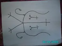
 Its meaning due to its locatin are fustrating to me.
