whats the best web site

Google works for me. Type in the name of the city and state or country, when the results come up just click on "images" link / tab.

Just a caveat: You may see some images that would not be suitable for a work environment (NFSW) -- kinda like looking for friends on facebook.
 

looking for pictures of train stop at hawes ,not the radio tower,its in san bernardino county calif. along hwy 58 ,near hinkley.
thank you brad
 

Brad, just for fun, I did some extensive searching using Google, Bing and
a few other search engines. I'm also somewhat familiar with the area myself,
so I was curious as I had never heard of Hawes.

Did find some images of the Hawes Auxiliary Airfield, and when I looked
up the location on Google Maps (34°55′30″N 117°22′27″W) I could see
that the RR tracks ran on the north side of Hwy 58, the opposite side
from where the Hawes fields are.

Could you be thinking of a stop at Kramer Junction? It's only about 10
miles down the track from the fields.
 

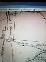
thats the right place.if you look on google earth,you will see a lot of trails come to the same spot at the tracks just north of the hawes radio tower, thats where the hawes stop was,ive been there allot of times detecting.some dump pits.it on some old track maps.i went to the barstow train museum,but they had no pictures,kramer was the biggest stop in that area.lots of history out there.there was also another stop[ jimgrey] between, kramer and hawes .i found some kind of a processing place a fuel miles north of the tracks.
thanks for the help guys, brad
 

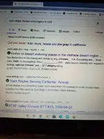
i Resized_20200903_134758.webpjust google this. train stops,hawes and jimgrey in calif it looks cool will read all of it later.
brad
 

good read,but no pictures.
bradResized_20200903_142516.webp
 

Top Member Reactions

Users who are viewing this thread

Latest Discussions

Back
Top Bottom