Arch1
Jr. Member
- Joined
- Nov 10, 2015
- Messages
- 44
- Reaction score
- 56
- Golden Thread
- 0
- Primary Interest:
- All Treasure Hunting
- #1
Thread Owner
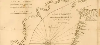
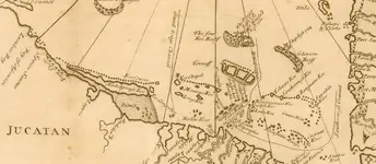
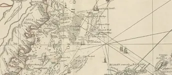
Hey all- since it's been a little quiet here lately, I found a few in my pastime of looking at maps. I'm sure some of our experts here know of them already, but would love to here more info on some. Not getting much on Wrecksite, but I'll limit my use of the Google to start a new conversation. Maps below....
The maps north is rotated, so it points to the left. First image shows this, with the wreck of The Dove on the upper right, 1714....

Second map is the lower section- multiple wrecks again in the upper right....

Let me know what you cats think!
Cheers;
ARCH1
The maps north is rotated, so it points to the left. First image shows this, with the wreck of The Dove on the upper right, 1714....

Second map is the lower section- multiple wrecks again in the upper right....

Let me know what you cats think!
Cheers;
ARCH1


