Ellie Baba
Hero Member
Hey Springfield,
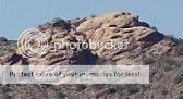
A question for you and the Gang and a cool photograph of a mountain in the depository area. I know you have a good eye.
T'net will not let me log in on my computer; it reads; You are unable to log in. Please check your cookie settings. I have tried everything and I am not having trouble with my laptop.
Ellie B


![heart mountain pictures_Page_1 [Desktop Resolution].jpg](/data/attachments/404/404962-8df1f343b8cb5a923538cb63d16a1768.jpg)

 <as I sit here with grey overcast skies, driving wind and rain mixed with snow>