The "Peralta" Stone Maps --- On Their Own

Hey Joe,

I found the rock house pic along with some pics taken with my old Canon AE-1 35mm film camera. Marius...you wanted some examples of carved rock?

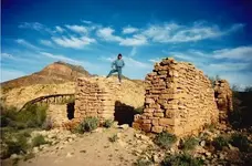
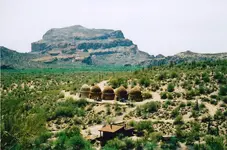
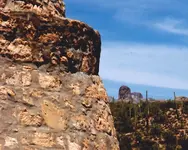
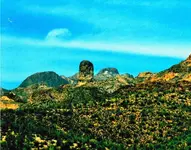
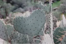
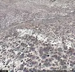
Stone house on the south side of Gila River; note trestle in background. Cabin we stayed in just below coke ovens. Took a pic of the Finger of God (FOG) with edge of coke oven close up. The cactus hearts are not as common as all of those heart rocks. Cool legend concerning the Aztecs and the flag of Mexico.

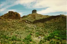
Somehiker and Springfield; You guys would love this place, however we would have to spend about a week out there in the middle of July and or August to see all the sights. There is an old camp site by the tank next to the arrow and the big heart. Note the three eye catcher rocks up-center left and compare size with GMC Jimmy (this is our camp area). These are the same eye catchers found by the R-rock pictured with the 7,L, skull, and 9 crescent, etc.

Brian on Stone House-rs.jpg Coke Ovens&cabin-rs.jpg Coke Oven & FOG.jpg FOG -rs.jpg Prickley Pear Heart.jpg heart mountain pictures_Page_2.jpg

My brother-in-law Brian standing on top of the stone house. Enjoy!

By the way, this is where we start our journey with the Peralta Stone Maps and I can prove it!

Ellie B
 

Last edited:
Plus those are old photos. After all that rain I bet those bushes that look like a cross are not so cross like now. You must keep in mind with GE you are looking at the way things were several years ago. Sure in hell not the way things looked 1 or 2 hundred years ago or they way they look today.
 

sgtfda

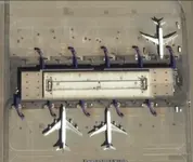
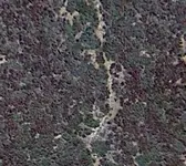
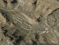
You have right . Before 150 years , this arrow was more compact and more clear . Now , in GE are different only the 3D mountain shapes . The 2D shapes are the same . If you believe how the things is different in GE than in reality , tell me , in this picture the planes are helicopters and the building is a tepee ?

GE.jpg
 

Last edited:
sgtfda

You have right . Before 150 years , this arrow was more compact and more clear . Now , in GE are different only the 3D mountain shapes . The 2D shapes are the same . If you believe how the things is different in GE than in reality , tell me , in this picture the planes are helicopters and the building is a tepee ?

View attachment 935288


That's a silly argument and comparison imho
 

That's a silly argument and comparison imho

I believe you understand only what you want . What is on the ground is the same . Only heigh and depth change .
If you don't know , never mind , but I believe your imput was little offensive . The word " little " was to make the proposition longer .
 

Last edited:
Google earth updates photos in populated areas. They use older photos in remote unpopulated areas. If you are using GE as a tool for remote areas you need to understand that tool. I recently spent some time in one of these remote areas crawling under brush cutting my way. This very heavy brush was not on the GE photo.
 

From the size of the Boulders and the angle of the hill, looks like G.E. flattened the formation. To me it looks like a sharp ridge with weathering at the base.

Thought I did a Thread on G.E. and the problems it has :dontknow:

Mother Nature meeting technology usually gets weird.

grab_005.jpggrab_006.jpg


Looks pretty easy to get through on a computer screen.
grab_007.jpg

Until you find your in the thick of it wondering what happened to that path :laughing7:
View attachment 935371
 

Please be aware you can adjust the amount of 3-D effect you observe in the image, so when viewed from an angle it exaggerates topographical elements.
 

sgtfda

You have right . Before 150 years , this arrow was more compact and more clear . Now , in GE are different only the 3D mountain shapes . The 2D shapes are the same . If you believe how the things is different in GE than in reality , tell me , in this picture the planes are helicopters and the building is a tepee ?

View attachment 935288

Marius,

Didn't you hear about the groundhog that the rover photographed on Uranus? Took the scientists days to figure out that it was just a strange looking rock.

You're a good sport, right?

Later,

EB
 

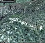
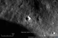
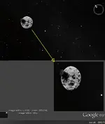
You never know what you'll find on Google Earth. Go to 'Moon View'. It'll take you a while, but turn on the grid overlay and locate 22°42'38.26" N, 142°34'50.72" E.

GoogleEarth_Image.jpg
 

No more offensive than your original question imho...

If you believe how the things is different in GE than in reality , tell me , in this picture the planes are helicopters and the building is a tepee ?
 

You never know what you'll find on Google Earth. Go to 'Moon View'. It'll take you a while, but turn on the grid overlay and locate 22°42'38.26" N, 142°34'50.72" E.

View attachment 935422

Went looking, but just as when googlehiking the earth, I got distracted and found a couple of other things during my Appolo 17 tour.
First was this......

Apollo 17 tour.png

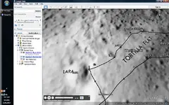
Tortilla Flat on the Moon ???

Back on Earth....

Tortilla Flat.png

And from Tortilla Flat on the moon.....

moonview.png

So like you said....."You never know what you'll find"
 

Last edited:
No more offensive than your original question imho...

If you believe how the things is different in GE than in reality , tell me , in this picture the planes are helicopters and the building is a tepee ?

Paul

What is for you offensive , maybe is not for others . My post was adressed to sgtfda . If you like to play the defence advocate , just think to use better words , as befits to a court . :nono:
 

Your Honor I Object.

Clearly some of this evidence is fabricated...............based on hearsay from witnesses who were not at the scene and blurry images from a technology that is still in its infancy. :laughing7:

(Disclaimer: This is directed at no particular individual/individuals and is meant for entertainment purposes only)
 

Last edited:
I'll say this again.

G.E. is a useful tool, However, and this is for those that have never been in the Superstitions, it can be Dangerous to make Assumptions about the images it renders. G.E. can make the terrain look like a walk in the park, nice rolling hills scattered brush easy dry washes to navigate.

So for those that have never been in the Superstitions reality is far different, those rolling hills are covered with loose rock and plants with thorns, along with the occasional critter that may or may not rattle a warning from its hiding spot. Using dry washes to travel, they are full of rocks and sand and the occasional boulder or bedrock outcroppings that you may be unable to climb. Also wasps, bees, and other insects enjoy the small pools of water.

It may look like a short hike of a couple miles, maybe less than an hour to get to that funny carving you see on the computer screen, 3 or 4 hours later (need to stop and remove a few thorns catch your breath drink some water and get your bearings) you get to that "carving" made by some plant shadows and boulders. "Maybe if I climb that hill across the way I can see it better." 3 hours of scrambling up loose rock, looking for a way to get up that rock face that only looked like a couple feet but is actually 50 feet high, you look out and see nothing that you saw on your computer.

Guess What.............you are now 6 or 7 hours into your hike that should only have been maybe 3 hours. Did you bring enough water? Flashlight, cause your going to be walking in the dark and probably to tired to make good time. Do you have what you need to survive overnight, gets pretty cold in the winter as soon as that sun goes behind the ridge.

G.E. is a useful tool if used wisely and you understand its faults, just do not base your perceptions on what you see on the screen. If you do get a chance to hike the Superstitions, be prepared and you won't be disappointed at the incredible vastness and beauty of the area.
 

Just for clarification, I don't believe Barry Storm mentioned the number 18, as in the number of mines found by the Peraltas in the first edition of his book. (1939) Here is Higham's comment on 18 mines: "Whether they had eight mines or eighteen is not established." To put a finer point on it, he was saying that in relation to the Spanish miners having "mines all the way from the Four Peaks area to La Sombrera Peak.

Both of the above statements are from the author's first editions.

Good luck,

Joe Ribaudo
 

My understanding leads me to believe that Mexican or even Spanish mines are not the large mines we associate with American mines. Not saying large Mexican mines did not exist at that time, perhaps more of a rarity, rather they chased the ore in small crawl space sized holes. When the ore tapped out, start another hole in the same area and so on. Smaller hole, less work, less evidence, smaller workforce, and less to shore up to keep from collapsing. Not sure how one could surmise the number of mines in the area, maybe easier to look at how many areas are good for mining.

I wonder how many old Mexican holes were enlarged by American prospectors?

I wonder how 18 is related to deception?
 

Last edited:

Top Member Reactions

Users who are viewing this thread

Back
Top