Al D
Bronze Member
- Joined
- Jul 23, 2011
- Messages
- 2,094
- Reaction score
- 3,547
- Golden Thread
- 0
- Location
- Gold canyon AZ
- Detector(s) used
- DJI Air 2S
- Primary Interest:
- Cache Hunting
Possible mine tailings

Howdy Alan M,View attachment 2103811
Possible mine tailings

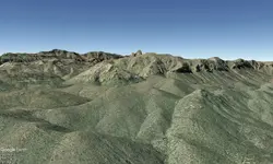
Where is the giant quartz vein my profile pic shows it next to the dots.I have never seen a series of parallel ravines adjacent to a cliff face.
but who knows, there are a lot of strange things in those mountains
best regards


Not as amazed as I am that you almost spit that outI started researching this mine a year ago and figured out where it is, im really amazed that know else has figured out the puzzle.


Been up there a couple of times already. Didn’t feel dangerous, except maybe that mountain lion at Whiskey Spring. Oooo oooo that smell!Super Dangerous your on the right track though.
Been up there a couple of times already. Didn’t feel dangerous, except maybe that mountain lion at Whiskey Spring. Oooo oooo that smell!
The priest is exactly how I got to my pic with the three red hills. To the right of those hills is the waltz mine the top of the two white dots is the entrance and horizontally you can see the large quartz vines. Yes to get in that cave you have to get in there coming through the top with deadly consequences if you fall.Been up there a couple of times already. Didn’t feel dangerous, except maybe that mountain lion at Whiskey Spring. Oooo oooo that smell!
Try using 4 Peaks Mnt. into your equation of the prThe priest is exactly how I got to my pic with the three red hills. To the right of those hills is the waltz mine the top of the two white dots is the entrance and horizontally you can see the large quartz vines. Yes to get in that cave you have to get in there coming through the top with deadly consequences if you fall.
I think that the priest is a representation of 4 PeaksThe priest is exactly how I got to my pic with the three red hills. To the right of those hills is the waltz mine the top of the two white dots is the entrance and horizontally you can see the large quartz vines. Yes to get in that cave you have to get in there coming through the top with deadly consequences if you fall.
Try using 4 Peaks Mnt. into your equation of the pr
I think that the priest is a representation of 4 P
The priest is a bruja which rhymes with brucula it's a Spanish word. Brucula is a compass, it's a map and not a riddle.Try using 4 Peaks Mnt. into your equation of the pr
I think that the priest is a representation of 4 Peaks
At least that's how I got to the pic I posted awhile back.The priest is a bruja which rhymes with brucula it's a Spanish word. Brucula is a compass, it's a map and not a riddle.
At least that is how I got to the pic with the three hills and huge quartz vein. Heck anyone can be right though it's all guessing. I doubt I'll ever go there.The priest is a bruja which rhymes with brucula it's a Spanish word. Brucula is a compass, it's a map and not a riddle.
You should go there, I remember my 1st time in the Superstition Mountains. I felt like Braveheart after he won in battle.At least that's how I got to the pic I posted awhile back.
At least that is how I got to the pic with the three hills and huge quartz vein. Heck anyone can be right though it's all guessing. I doubt I'll ever go there.
You should go. I remember the 1st time I went in the Superstition Mountains, I felt like Braveheart after his 1st victory.https://youtu.be/ms9jg1r2aQw?si=To6hjPEto-vjLWsTAt least that's how I got to the pic I posted awhile back.
At least that is how I got to the pic with the three hills and huge quartz vein. Heck anyone can be right though it's all guessing. I doubt I'll ever go there.
Which 4 peaks? Those with Brown, or the ones that line up in front of them viewed from the park?Try using 4 Peaks Mnt. into your equation of the pr
I think that the priest is a representation of 4 Peaks