You can ignore the above, there is no such system of putting irregular portions at the bottom of a section. More often they are found on the north or the west side.
From your question you want to claim on a Lot or Aliquot that exceeds 40 acres? Since you can only claim 20 acres each you can't take the whole quarter quarter with only two claimants?
It would be helpful if you could distinguish between a non-segregating Lot and a segregating Lot but for the purposes of this general discussion both can be treated the same way.
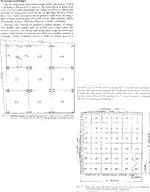
Irregular sections are the norm in most of California so your question is an important one. First you need to understand that the law requires you
describe your claim by aliquot part if possible. There is no legal requirement that your claim exactly fits a surveyed part - you only need to describe which aliquot parts (or Lots) your claim can be found in if there is a survey in place.
Let's say your Lot is 42 acres. Obviously you can't claim the whole 42 acres with two locators so you are going to have to describe by the survey part as well as metes and bounds. Something like "the south 1320 feet of Lot 3" is adequate if the lot is taller in one dimension only. In more complex situations you may need to describe each boundary line by distance and direction. If there is a survey in place that description will be described from known survey pins. Each case is different. The key point is your description must enable someone to find the claim boundaries on the ground.
Obviously with these irregular claims you will not be able to take advantage of California's liberal staking laws regarding whole survey parts but you were going to stake all the corners anyway - right?

A descriptive map showing how the claim fits in the survey part(s) can be useful. Please avoid the standard "map" used on many California locations - it is more confusing than helpful. I suggest putting the aliquot portion description on the first page and then putting the metes and bounds on the second page along with your map. If you have more than two pages you can put that metes and bounds on any page you choose. The BLM usually only looks at the first page when filling out their mining claim entries so as long as they have the Township, Section and quarter section on the first page they are happy.
I've described many many claims by this method. A few have been challenged by the ever watchful BLM and they have all passed inspection once that second page with the map is actually looked at by their cadastral employee. Claims are made for minerals - not surveys. As long as you do not exceed your maximum acreage or come up with long strips or unnecessary irregular shapes you are good to go on a claim that may cover portions of several aliquots or Lots. The standard the BLM uses is "as regular and compact as possible". There is no standard or law that says you must use the survey lines for your claim boundaries.
Heavy Pans