An X in the desert

Alex Burke

Hero Member
Joined
Apr 3, 2013
Messages
869
Reaction score
700
Golden Thread
0
Location
NorCal
Detector(s) used
BH, GB2
Primary Interest:
Prospecting

Attachments

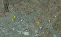
Ok of the 69 people who viewed the thread only 18 of you put in the tough effort of opening the file lol. I'll post a screenshot next time I go on GE too lazy right now;) Any thoughts from people who actually looked at it?
 

X

it wont open for my windows 8 machine. x can be a cross or a x. While there was some structure and things like peaks and water sources on line with the Cross. I need more info and pictures. I like the directions pointed out by the cross or x.
 

Last edited:
I tried to open it as well I have windows 7 Professional...no luck just a blank screen!

I will try i via google maps

Terry (The Old Guy)
 

I'm not sure the whole area is REE rich I had an idea to maybe claim what I could there because we rely heavily on rare earth minerals from china and Russia and we need the supply for many military applications. The pentagon released a report saying its a security thing to have a decent supply on hand as well as a few other things I read. I thought it might be smart to claim the few spots in US where they could be mined assuming a big company or govt hasn't already claimed them.
 

pictures wouldn't load for me?
 

Idk it's a kml file I think you have to save it then open in earth I can't remember if that might be the issue. Or have earth open when you click it sorry I'm not more help. I don't know how to post screen shots I should prob learn tho one of these days. It's just an open pit mine with an x at the east side nothing amazing really.
 

Windows 7 Pro opened it right up. That thing is cool! How big is the X?
 

Wow, that ^^^^^^ was my 100th post!
 

I finally got it open on google maps..,.looks like a bomb target..that area was used as a bombing and gunnery area during WWII and into the 1950's..

Terry (Old body - Young mind)
 

I finally got it open on google maps..,.looks like a bomb target..that area was used as a bombing and gunnery area during WWII and into the 1950's..

Terry (Old body - Young mind)


There seems to be some other crosses around,, I don't think I found them all. The circles are interesting too as they might be flat.

rerosscircle.webp
 

There seems to be some other crosses around,, I don't think I found them all. The circles are interesting too as they might be flat.

<img src="http://www.treasurenet.com/forums/attachment.php?attachmentid=798314"/>

Cool thanks for the screenshot. I have trouble with google earth too other guys or gals in thread I have XP too. I think it helps to disable the flash that's embedded in google chrome; the original one is the same once updated and now I don't get shockwave flash errors and as many random windows crashes. Youtube runs better now too. I try to just use google earth as only thing running otherwise it just runs slow. To disable the extra flash app follow this tutorial. http://www.howtogeek.com/103292/how-to-fix-shockwave-flash-crashes-in-google-chrome/

The extra crosses and circle are weird but I don't know much about open pit mining or the history of the area other than what I read in this thread. Thanks for contributing some good theories. The circles sound strange too.
 

Old ICBM Silo? Bomb range makes sense to.?
 

This area is the old mining operations at Eagle Mountain- Eagle Mountain, California - Wikipedia, the free encyclopedia. It is the old Kaiser Steel mine, as in Kaiser Healthcare, that was in operation for many years and had a whole city built just to support it's own workforce. It was later a California prison for many years. Lots of great reading available online about this area and this mine online. You can't get near the mine or the ghost town of Eagle Mountain anymore, it is all fenced and on constant guard by caretakers in vehicles that will not let you near the area. That "X" may be the end of the Kaiser claim, an ICBM site, or like others said, maybe a target for bombing.
I didn't realize this was my first post on this site after lurking for 6 years, lol!
 

Last edited:
Lol well welcome lurker! I guess we can be friends even though your an angels fan, I still see rally monkeys in my sleep and still haven't figured out how we lost that World Series game 6. But I digress thanks for solving the thread mystery, and post more often, at least yearly lol.
 

My grandfather was a surveyor years ago and he showed me several just like it near Grand Couley dam they were used for survey work from long distances. They still use them doing surveys but they also use them for flight navigation training, using a compass and a stopwatch.
 

Top Member Reactions

Users who are viewing this thread

Back
Top Bottom