You are using an out of date browser. It may not display this or other websites correctly.
You should upgrade or use an alternative browser.
You should upgrade or use an alternative browser.
Aztec-Aztalan- Cibola Discovery EVIDENCE ( KEY TO DISCOVERY - NAVAGATION BY ANCIENT )
- Thread starter Aztalan
- Start date
Aztalan
Jr. Member
- #22
Thread Owner
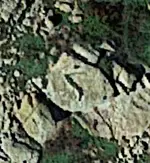
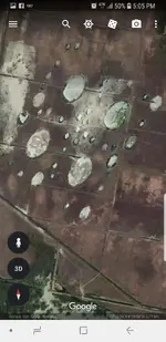
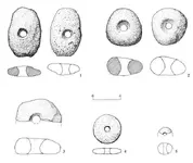
Theres alot more but this give you an idea. They vary in size. If they had to navigate around a river the triangles were small that lead to river crossings then another small triangle leading them back on track to the larger triangles. Here is the tool they used. They held it up to their eye and centered the left leg of triangle upon left leg of triangle then they navagated toward area in the distance it lined upon. The stone tool simply put their focus on a distant spot on the horizon- distance. 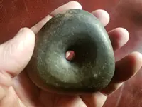


Aztalan
Jr. Member
- #23
Thread Owner
As far as a connection to things I can tell you there has been a claim by an explorer who believes he has found Atlantis in Spain. I would have to agree with his discovery for the simple reason there are these triangles in Spain and they lead directly to his discovery I am talking dead on top of it. So the questian is which came first the chicken or the egg did the people of Atlantis come from Aztlan or did the Atlantis civilization travel to north America and establish Aztlan. One thing is for sure they are one and the same people.
https://www.express.co.uk/news/weir...ound-plato-atlantica-donana-national-park/amp
https://www.express.co.uk/news/weir...ound-plato-atlantica-donana-national-park/amp
Theres alot more but this give you an idea. They vary in size. If they had to navigate around a river the triangles were small that lead to river crossings then another small triangle leading them back on track to the larger triangles. Here is the tool they used. They held it up to their eye and centered the left leg of triangle upon left leg of triangle then they navagated toward area in the distance it lined upon. The stone tool simply put their focus on a distant spot on the horizon- distance. View attachment 1654327View attachment 1654327
I’ve found that the lower left point on this shape of triangle has something of importance near it. Could the technique you describe be used to find the shortest distance between two points hundreds of miles apart. For example, could it take you to a mountain range, where you are forced to make a detour, and show you how to get back to the line, after you have negotiated the range.
Aztalan
Jr. Member
- #28
Thread Owner
Many instruments of old I am sure had many different uses and could be applied to as needed. Without this stone I would have not been able to find anything that I have found. That simple fact tells me of it's intended use. I could use anything with a small hole in it so the point isnt as much the tool but the fact they used triangles for navagation. That is fact with the proof each triangle leads to a place of importance.
I’ve found that the lower left point on this shape of triangle has something of importance near it. Could the technique you describe be used to find the shortest distance between two points hundreds of miles apart. For example, could it take you to a mountain range, where you are forced to make a detour, and show you how to get back to the line, after you have negotiated the range.
Can your triangles be used to navigate the shortest route between points. And what do you intend to do with this information. Are you going to share with everybody, write a book or look for treasure.
somehiker
Silver Member
- Joined
- May 1, 2007
- Messages
- 4,365
- Reaction score
- 6,435
- Golden Thread
- 0
- Primary Interest:
- All Treasure Hunting
Many instruments of old I am sure had many different uses and could be applied to as needed. Without this stone I would have not been able to find anything that I have found. That simple fact tells me of it's intended use. I could use anything with a small hole in it so the point isnt as much the tool but the fact they used triangles for navagation. That is fact with the proof each triangle leads to a place of importance.
As proof, I will be looking forward to seeing actual photos of what can be seen from eye level at each of the places which you consider to be important. Google sat views unfortunately, are too often misleading IMO.
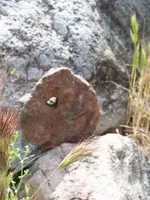
As to how the migrating people who eventually became known as the Aztec may have marked the trails which they followed during their 200+year journey to the Valley of Mexico ?
They left a trail of footprints that would last a thousand years or more.
They weren't the first to do so in the field of course, since others had preceded the Mexica along the same already well worn trails though the deserts and mountains, and who likely also created these or similar petros to mark their own routes. But it was the Aztec artists who in many cases, used footprints.......not triangles, to show the pathways and directions of travel relevant to their history.
Here's an example from Arizona...
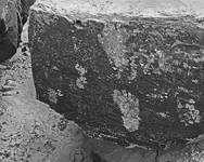
....very simple to create and use for marking a trail....easily recognized at ground level
....consecutive right and left footprint in the direction of travel, just as used on the migration and many other Aztec Codices.
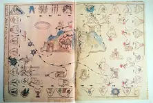
Last edited:
Similar threads
- Replies
- 0
- Views
- 298
- Replies
- 2
- Views
- 217
Users who are viewing this thread
Total: 1 (members: 0, guests: 1)

