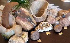
This area also looks promising..
YAVAPAI COUNTY, ARIZONA
In central Arizona, Yavapai County ranks first among the gold producing counties, having produced over 3,500,000 ounces of lode gold and over 300,000 ounces of placer gold.
In the Bagdad area which is located 42 mile west of Prescott, there are many area mines in southwest part of the Eureka district. This area had a total production of around 60,000 ounces., 1887-1951, mainly from production at the Hillside Mine which was a major lode gold mine in the area.
In the Black Canyon City district, in the southeast part of county, located between east foothills of the Bradshaw mountains and the Aqua Fria River, there was a total production of around 50,000 ounces of gold. There are many area mines, especially the Howard mine, and 1 mile below there were some productive placers gold deposits. In all regional watercourse and slope wash gravels in this district you can find placer gold. Along Black Canyon at several places, in gravel deposits, placer gold is reported. Near Turkey, there are some small placers worked annually. Between mouth of Arrastra creek and Cleator and in American and Mexican gulches, there were some productive placers. For 20 miles along Humbug, French, and Cow creeks, you will find the famous Humbug placers. In the upper gravels to 20 feet deep in the Humbug placers you can find flake and flour gold at or near bedrock you can find some very coarse gold.
At Bumblebee, which is north of Black Canyon City, you will find the Bumblebee and Bland Hill mines which were productive lode gold mine. South of Bumblebee you will find the ****** Brown, Blanchiana, and Gillespie mines which were also major lode gold mines. If you go south 3 miles, a gravel bar in Black Canyon Creek, is said to have produced very rich placer ground. If you go east of Bumblebee by 4 miles, on west bank of Aqua Fria Canyon, you will find the Richinbar Mine which produced lode gold and silver.
In the south part of the county at Castle Hot Springs, near upper Castle Creek, you will find the Castle Creek district. The major mines in this district are the Golden Aster, Swallow, Whipsaw, Jones, and Copperopolis, all of which produced lode gold. In the Wickenburg mountains 1 mile north of the Castle Hot Springs road and 10 miles east of Morristown, you will find the Golden Slipper lode gold mine.
North of Cherry 1.5 miles, you will find the Bunker Mine, the Federal and the Leghorn mines, which were all intermittently worked for there lode gold content. If you go West by Northwest of Cherry by 2 miles, you will fin the Gold Bullion Mine which was a lode gold mine with minor copper production. If you go southwest of cherry by 2 miles, you will find the Logan Mine which produced some lode gold.
Near Cleator, west on road. along old railroad grade, in area of several square miles north of Crown King and east of Towers Mountain, you will be in the Pine Grove district, site of the Crown King Group of mines, which were very rich, site of 300 ton flotation mill operated in 1934 for lode gold, silver and minor copper, zinc. Northeast of the Crown King, the Philadelphia Mine and the Nelson Mine (Just east) which were also major lode gold and silver mines. If you go north of Cleator by 2 miles, you will find the Fairview Tunnel at an elevation of 7,200 feet, this is said to be an extension of the Nelson Mine vein, produced a large quantify of lode gold. There are also many other lode gold mines in this area, around 200 or more. South of the Pine Grove district, on the Humbug side of the divide, the Tiger district, on south slopes of Wasson Peak, you will find the Oro Belle and Gray Eagle mines and mill, they were principal producers from 1907-1909 of lode gold, silver, and copper.
East of Congress by a little more than 2 miles, to old mining camp of Stanton, there are many area mines that produce lode gold. The LDMA has there patented property in this area. If you go northwest of Congress by 3 miles, in southeast part of the Date Creek mountains, you will find the Congress Mine which had a total production between 1887-1959, of around 400,000 ounces of lode gold. .5 miles west the Congress Extension produced major lode gold. In northwest several mile, at southwest margin of the Date Creek mountains, the Martinez district, numerous old mines produced lode gold. If you go southeast 4.5 miles, you will find the old camp of Octave, just above camp and on flat topped mountain above adjoining Stanton, the Weaver-Rich Hill district, area mines and placers you can find huge nuggets in surface debris of Rich Hill. Along southwest front of the Weaver mountains, lode mines produced 100’s of thousands of ounces of gold.
At Constellation, which is 15 miles northeast of Wickenburg, you will find the Gold Bar Mine which was a major lode gold producer. Other area mines of the Black Rock district produced some rich lode gold deposits as well. About 4.5 miles north of Wickenburg, the Oro Grande Mine, was a major producer of lode gold. If you go east 7 miles from Constellation, near the head of Amazon Gulch, or 16 miles northeast of Wickenburg, you will find the Groom Mine and 30-ton ball mill. This was a major lode gold producer. Northwest of the Groom Mine, is the Arizona Copper Belt Mining Company Mine, which produced lode gold and copper.
At Cordes, which is north of Phoenix , at Poland Junction, west past power station, take left or lower dirt road, and in stream gravels along road you can find placer gold. If you go southwest of Cordes, to south foothills of the Bradshaw mountains, which is about 45 mile north by northwest of Phoenix, you will find the Tiptop Mine (and district), which was a producer of about 10,000 ounces lode gold, 1875-1959.
Out of Denvey by 16 miles, in south part of the Black Hills on headwaters of Cherry Creek, the Cherry Creek district at east foot of the Black Hills, you will find the Monarch Mine (and several others nearby) that were major lode gold mines. South of the Monarch, the Etta, Gold Ring, and Conger mines also produced some lode gold.
North of Hillside Station by 8.5 miles and about .75 miles of the Santa Maria River, you will find the Mammoth Mine which produced some lode gold deposits. About 13 miles from Hillside Station and 3.5 miles west of the Bagdad Highway, in sections 4 and 9 of township 13N and range 8W, you will find the Crosby Mine which was a major lode gold producer. If you go northwest of Hillside Station by 18 miles, you will find the Eureka placers along Burro Creek, principal producers were in all area gulches, bench gravels you can find placer gold. If you take the Bagdad highway from Hillside Station for about 20 miles, take a road west 1 mile, you will see the Cowboy Mine which produced lode gold, with lead. Out the Kingman on highway 28 miles, then 4.5 mile south to the south part of Grayback Mountain, is the location of Southern Cross Mine, it consisted of shallow workings for lode gold, minor copper. 32 miles from Hillside Station in a deep canyon on east side of Boulder Creel, in sections 16 and 21 of township 12N and range 9W, is the location of the Hillside Mine, this mine has 2 miles of underground of tunnels.
In Jerome, in the Verde district, on east slope of the Black Hills just west of the Verde River, mammoth copper district abandoned around 1950), had a total production of by product gold through 1959 of 1,571,000 ounces.
If you go south by southeast of Kirkland by 9 miles, in Placerita, French, and Cherry gulches, many productive placers that were extensively worked in 1930s can be found. Also at Blind Indian Creek and Mill Creek drainage’s placer gold can be found.
In Peeples Valley to the west along Model Creek, there were some productive placers.
In Poland, at north foot of Big Bug Mesa, accessible from the Black Canyon highway, you can find the Poland-Walker Tunnel, look on dumps for gold. .25 mile west of tunnel and mesa from rd. branching northeast from the Senator highway, about 1/8 mile south of the Hassayampa bridge, is the location of the Money Metals Mine was a productive lode gold mine. West 1 mile and about .5 mile north of Big Bug Creek, the Hennetta Mine and mill produced lode gold, with silver, lead, copper. On the south of mesa, in area of Turkey Creek is The Turkey Creek district which was a noted early day producer of gold and silver. 1 mile north of Pine Flat, the Cumberland Mine and mill was a noted producer. All area watercourse and slope wash gravels of area contain placer gold.
Prescott Arizona was originally settled by placer miners, becoming territorial capital in 1864. In the Columbia district, all area creeks produce placer gold. South along upper reaches and main course of Granite Creek is the location of the Granite Creek placers, which was discovered in the 1860s, South to headwaters of the Hassayampa River, along entire course of river to county line 2 mile north of Wickenburg there are many lode mines and placers along all regional watercourse beds, benches, terraces, and hillsides. If you go east of Prescott by 4 miles and just south of the Dewey road, is the location of the Bullwhacker Mine which produced high grade, coarse gold nuggets. If you go south of Prescott by approximately 5 miles in New England Gulch, which is a tributary of Granite Creek), rich early placers existed here. In all regional creek and watercourse beds, benches, and slope-wash gravels you can find placer gold. If you go south 5 miles, area of upper Groom Creek, the Groom Creek district, you can find many mines, e.g., Midnight Test, Empire, King-Kelly-Monte Cristo, Victor, and Home Run that produced rich lode gold deposits. If you go south 6 miles, on west slope of the Bradshaw mountains, the Hassayampa-Groom district, along the Hassayampa River, many placers that produced thousands of ounce of gold.
At Rock Springs which is 46 miles north of PHOENIX, at Mile Post 246 turnoff to the Maggle Mine and find some rich placer ground.


 Please move to Idaho.

 I love California but after this post now I want to move to Arizona.