British Columbia Tofino Wrecks

Cash

Jr. Member
Aug 6, 2007
29
4
Detector(s) used
Aquapulse 1B
XP Deus
Primary Interest:
All Treasure Hunting
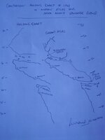
Hi all, would anyone have an idea as to the possibilities of pre-1800 wrecks off Tofino - so much washes up on the beaches from Japan and there was a big trade from Japan Im not sure if around Tofino I know of wrecks (fur traders) and other 1800 + wrecks on the coast all the way down to Victoria, I was curious if anyone had opinions or ideas as the the feasiblity, a rich vessel does not always have to have been Spanish or a nation of note. Any clues? thanks Cash
 

OP
OP
C

Cash

Jr. Member
Aug 6, 2007
29
4
Detector(s) used
Aquapulse 1B
XP Deus
Primary Interest:
All Treasure Hunting
Thanks for that, but no real answers any one out there have any idea about Tofino????? thanks
 

hmmm

Hero Member
Jun 9, 2007
830
95
Primary Interest:
All Treasure Hunting
IS THERE A CASH REWARD?
 

mariner

Hero Member
Apr 4, 2005
877
18
There are lots of wrecks in the Tofino/Clayoquot Sound area, someknown, some not yet found.

The Hera sank there in 1899 while carrying a cargo of 60,000 quarts of Ranier beer and 11 grand pianos to Hawaii (they had planned quite a party!) Its location is well marked.

Then there is the Calama that sank in 1906 and the Emma Utter that went in 1880.

However, pride of place,. if you can find her, will be the remains of the Tonquin, one of the first of Astor's ships to come to the North West Coast. It is sometimes referred to as the Holy Grail of North West wrecks. It sank about 1811, if my memory serves me, after a confrontation between its captain and the local Indians. The captain, who was a real piece of work, is thought to have deliberately exploded the ship's powder supply, and the ship sank almost immediately afterwards. There is some debate about exactly where this event took place, but I am pretty sure it took place near the entrance to Clayoquot Sound, and there is a small island called Tonquin near the supposed spot. A couple of years ago, a local diver found what he believed to be one of the Tonquin's anchors in that area, but he was refused a recovery permit, and would not disclose the exact location when a well known archaeologist managed to get one and turned up complete with a team intending to film the finding of this famous wreck.
The only account of the sinking comes from an Indian who was on the Tonquin as an interpreter and who later told the story to one of the clerks at the trading post as Astoria, Washington. Some people think that the event took place further north, but the first Catholic priest in that area reported that the Clayoquot Indians kept finding blankets that the Tonquin had been carrying. No treasure on board, no beer, and no grand pianos, but a wreck of great historic significance.

Mariner
 

hmmm

Hero Member
Jun 9, 2007
830
95
Primary Interest:
All Treasure Hunting
if you find a beach with a unusual amount of glass pottery ect, think habitation site, ;D not ship wreck. look on shore for evidance, like indian middens,if the spanish or who ever was anchored for long periods of time, the garbage is tossed over board.
 

ivan salis

Gold Member
Feb 5, 2007
16,794
3,809
callahan,fl
🏆 Honorable Mentions:
1
Detector(s) used
delta 4000 / ace 250 - used BH and many others too
unless the ship was carrying plates os "trade goods" -- see if their all the same type -- if theres lots of shards all of the same type and style (age) bingo they might have had them aboard as "trade goods" -- and the pottery shards can assist in finding out the vessels nationailty & in dating the wreck . lots of shards of a "mixed" nature-- differant types and styles and times = habitation area --Ivan
 

Mackaydon

Gold Member
Oct 26, 2004
24,118
22,893
N. San Diego Pic of my 2 best 'finds'; son & g/son
🏆 Honorable Mentions:
2
Detector(s) used
Minelab Explorer
Primary Interest:
Shipwrecks
Cash:
You might try both of Gibbs' books: Shipwrecks of the Pacific Coast and Shipwrecks off Juan de Fuca.
Other potential sources include the archived Department of Transport records and those of the Canadian Coast Guard.
At one time, about 40 years ago, The Bamfield station was prominent; perhaps they are still today--and may have some archives worth reading.

Of course, at Tofino, there was also a motor lifeboat station, and those archived records might hold what you are looking for.
 

OP
OP
C

Cash

Jr. Member
Aug 6, 2007
29
4
Detector(s) used
Aquapulse 1B
XP Deus
Primary Interest:
All Treasure Hunting
Thanks for the posts so far, if I had rudder issues or was broken after a storm left at the oceans mercy while on a trade route my likely place to end up ashore and aground would be Tofino, beaches there collect goodies from Japan regulary and the Spanish traded with Japan so why is it not feesible to think that they ended up beached in or on this coast or even stopped for repairs and trade? Have a good Sunday - thanks Mackaydon - ;) Cash
 

mariner

Hero Member
Apr 4, 2005
877
18
Cash,

I think I completely missed the point of your question in my earlier response, which dealt only with post-1800 wrecks. My apologies.

I very much doubt that there are any pre-1800 wrecks in the Tofino area. There was a limited period of European and American contact prior to them, but Robert Gray and John Meares both spent quite a lot of time there, and they or their crews kept pretty detailed accounts. It is a few years since I last read those accounts, but I do not think that any of them mentions anything that would suggest earlier contact.

It is true that the Japanese drift current brings all sorts of stuff up that part of the coast, but if there had been a significant wreck there, I think it likely that these people would have seen some evidence. For example, although there are still several pre-1800 Manila Galleons unaccounted for, these tend to leave substantial collections of evidence, such as the beeswax at Nehalem,Oregon and the debris from the San Felipe in Baja California.

A friend of mine, who is now in his 90s and came from B.C., told me that when he was in his teens, he was in a ship that stopped in Barkley Sound for a while, just offshore from Bamfield. He went ashore and did some hiking around. He said he came across the wreck of an old wooden ship. It had marks where somebody had been hacking at it with an axe. He said it was actually in a dried up inland lake, but that the lake must have once been a bay, because there was also driftwood around the wreck. He says he is amazed that he was not more curious about the wreck then, and did not explore it further. I showed him maps and aerial photographs of the area, but they did not ring any bells for him. I have been intending to go up to that area for some time, to have a look around, but have not got round to it. Your post will now prompt me to at least have a look on Google Earth, though it might well be that what is a relatively remote area will not have very high definition on there.

Mariner
 

Mackaydon

Gold Member
Oct 26, 2004
24,118
22,893
N. San Diego Pic of my 2 best 'finds'; son & g/son
🏆 Honorable Mentions:
2
Detector(s) used
Minelab Explorer
Primary Interest:
Shipwrecks
Cash:
In reviewing Gibbs' book, the "S/Ws of the Pac. Coast", it lists the Beeswax wreck as the only pre-1800 wreck though his chart goes only to Juan de Fuca.

In another Gibbs' book, "S/Ws off Juan de Fuca" there are no pre-1800 wrecks noted, and his chart goes north to only Cape Beale.

Another source is the Vancouver Maritime Museum:
http://www.vancouvermaritimemuseum.com/
A visit there or Email to the Director may get you closer to your target.

I would not overlook the charts of Captain George Vancouver.As you probably know, he was the first to chart the coasts of Oregon, Washington and BC--during the period of 1791-1795. Perhaps a margin notation on one of his charts (or a notation in his logs) might lead you to some 'goodies'; and maybe the VMM has a copy of those charts/logs.
Don.......
 

OP
OP
C

Cash

Jr. Member
Aug 6, 2007
29
4
Detector(s) used
Aquapulse 1B
XP Deus
Primary Interest:
All Treasure Hunting
Thank you all for your input I shall look for such maps and tell you what develops, I spent time in Victoria and I felt that there were good chances off Tofino. I cannot tell why it just happened to make me feel this way, working as a commercial diver in Trinidad has given me ample time to explore when onshore - that sounds wrong off the platform/vessel, and go look around. On a shallow water project off Africa I stumbled over a wreck along with the crew it was a hostile area and we worked for a large company recovering diamonds on the sea floor, so we could not recover and coins or anything else it was strict and we were searched before and after leaving the vessel at Port. We had no lives and needed to recover stones. Back to Tofino, its a place I would like to retire to I will do this around my 40th B day and use the funds I have made diving, when I do this I wanted to start my search again, I wonder if other parts of BC have better prospects? Any ideas or views on the best part of BC? Thanks Cash
 

Mackaydon

Gold Member
Oct 26, 2004
24,118
22,893
N. San Diego Pic of my 2 best 'finds'; son & g/son
🏆 Honorable Mentions:
2
Detector(s) used
Minelab Explorer
Primary Interest:
Shipwrecks
Cash:
You might check the Gibbs books I previously referenced. You'll note many wrecks occurred on the s/s of Vancounver Island. Early navigators were unaware of the Davidson Eddy Current (Davidson's records are at UC Berkeley--Bancroft Library Special Collections); the eddy current along the shore of Washington, for example. This contra current pushed vessels far to the north of their intended DR positions--especially during the fog-filled days.

To repeat myself, I'd visit and talk to the archivist at the VMM. When I 'worked' the area, he was a gold mine of information.

A third source is in the archives of the The Times Colonist newspaper; the oldest daily newspaper in Western Canada. The TC used to be two different papers, The British Colonist, founded in gold rush days in 1858, and the Victoria Daily Times, which started in 1884. When I was there, microfilm and microfiche copies were available. Searching 'the usual' words/phrases ('wrecked', 'disaster at sea', 'marine casualties', marine disaster, etc.) gave me plenty of information. Perhaps their retrieval system is even more improved today.
Good luck and good hunting.
Don....
 

OP
OP
C

Cash

Jr. Member
Aug 6, 2007
29
4
Detector(s) used
Aquapulse 1B
XP Deus
Primary Interest:
All Treasure Hunting
Thanks Don, I will make sure I am thorough in this area. Sometimes simple china plates and old bottles can make me smile more so than some corroded coins (unless shiny) I found this info below:


Cultural Changes Resulting from European Contact:
The Spanish made fleeting contact with the Nuu-chah-nulth around 1774-75, when Captain Juan Perez attempted to protect Spain's claims in western North America from the Russians. The coastal natives were not afraid of these strange people in their floating houses, and they paddled their canoes out, making gestures of peace to initiate trade. Among the much-coveted trade goods was anything made of metal, of which the Spaniards seemed to have an abundance.

Captain James Cook arrived in Nootka Sound in 1778, on his third expedition for the British, and this is when extensive contact with the Nootka peoples began. Cook stayed almost a month with the Wakashan Nootka, and his diaries contain the earliest and fullest descriptions of northwest coast native life. Much of the British/Nootka relations centered on trade, from which a lucrative fur trade developed within a few short years. Sea otter pelts commanded the highest prices, and by the mid 1780's, the French and the Americans added themselves into the rush for fur trade wealth, with the first trading ship to enter Nootka Sound in 1785. Fur trade declined rapidly after 1790, when the sea otter was finally hunted to extinction along the British Columbia coast by the early 1800's.

White settlement was beginning to work its way out from Fort Victoria, and the first steps in Indian administration came after Vancouver Island was declared a crown colony in 1849. The ensuing encroachment into native lands made it neccessary for the whites to create reservations and residential schools to control the land and its native people. Epidemic European diseases like smallpox and measles all but wiped out whole native populations, who were now in ever-increasing contact with whites. . In 1862, one major smallpox outbreak in Fort Victoria made its way through the entire coast and into the interior, killing roughly 20,000 native people. This was nearly one third of British Columbia's native population at the time.

Between 1850 and 1854, Governor James Douglas negotiated fourteen treaties with native groups in order to obtain land for settlement under pressure of the government. These treaties declared the land to "be the entire property of the white people forever", in exchange for small compensation payments and the establishment of reserves on land not considered useful by the whites.

In 1871 British Columbia joined Canada, and the Nootkans became part of the Indian reserve system of the federal Department of Indian Affairs. Missionization began in 1875, fueled by the desire to transform "heathen" native lifestyles by forcing them into total assimilation of European beliefs and habits, thereby "saving" them. In 1884, the potlatch was finally outlawed, the whites believing that the practice hindered their efforts to convert and assimilate the natives. This law was not overturned until the Indian Act was rewritten in 1951.
 

mariner

Hero Member
Apr 4, 2005
877
18
Cash,

There is a bay near the northern tip of Vancouver Island called San Josef Bay. I met somebody a couple of years ago who had worked in a logging camp not far from the Bay in the 1950s, who said that he had gone there once with a friend and found a bronze cannon sticking out of the sand. They could not dig it out because the sand kept backfilling the hole, and in any case, they would not have been able to move or transport it. He got moved to another camp shortly afterwards, so never went back. He had earlier met a US recluse called Earl Lincoln, who had lived in a small cabin in the area for many years. On the wall of Earl's room was a metal breastplate, which he said he had found in a cave just North of the Bay. Earl said that the cave had a pit in its floor, in which there were a number of headless skeletons, with full body armor, including breastplates, and arm and leg guards. He had fished the one breastplate out. He drew a map showing the location of the cave for my informant, but this map had been lost when he and his wife split up.

I have checked on Earl Lincoln, and he did exist. I have photographs of hm and other information.One of his diaries is in the Port Hardy museum, but it contains nothing related to this story. After he died, his cabin was left to ruin and finally burned down. I have a map showing its location. I have not been able to find any record of the breastplate, and although I have spoken to other people who had visited his home,none of them remember a breastplate on the wall.

Although the story of the headless skeletons sounds bizarre, we do know that the Indians on the west coast of Vancouver Island did behead captives, both from neighboring nations and white visitors. I forget the name of the boat, but Chief Maquina from Nootka Sound once captured a trading ship, about 1800, and beheaded all but two of the crew. One of these was the blacksmith called Jarrett, and he later wrote an account of the two years he spent as a slave of the tribe. Maquina laid all of the heads on the ship's deck so that Jarrett could identify them and tell him if any other crew members were missing. Also, there is some folklore among the Kwakwakawakwa Indians who used to occupy the northern area of the Island about a rattle used in ceremonial dances that was made from a European helmet containing a skull, with a handgrip consisting of another bone that went through holes drilled through both sides of the skull and helmet. About a hundred years ago, anthropologists from the Smithsonian found three skulls in a cave just south of San Josef Bay. After examination, they were declared to be Chinese. They are somewhere in the Smithsonian collection. There might, or might not, be a connection between these skulls and the headless, armored skeletons. There is the wreck of a schooner in San Josef bay, but it will not be connected with the supposed bronze cannon, because it only wrecked there about 1920. I cannot remember its name off the top of my head.

Another place in BC where there is almost definitely some kind of wreck is at the north end of the Queen Charlotte Islands, probably in the region of Parry Passage, which runs between the northern island and Langara Island. There are stories among the Haida Indians of two early wrecks, and a couple of years ago, I was told that two guys from Prince Rupert had found two bronze cannons on land in that area, carrying dates of 1586 and 1587 plus the Spanish coat of arms. When I contacted the two guys, they absolutely denied it, but they would, wouldn't they, as Mandy Rice Davies once said. At the time, I thought that the guns could only have come from the San Antonio, a Manila Galleon that went missing in 1704, but I could not make any progress in finding further evidence, and got nowhere with the two guys, but all the indications are that the Haida were the first BC Nation to start using copper sheets, which might have come from an early-ish wreck.

I also know somebody who is convinced he has located two sunken ships containing gold at the far end of the Butte Inlet, which is north of Vancouver Island, but I know of no historic context for the story he tells about how they came to be there, and did not think his story worth pursuing. He was willing to share the wealth with somebody who had the equipment and was willing to try to recover the supposed wrecks, and I suppose I have his contact details somewhere. He lives on Vancouver Island.

A friend of mine also told me about information he had been given about another early wreck on the southeast of Vancouver Island, but he died without giving me the details, and there was no information among the papers he left to his daughter.

An interesting place, the British Columbia Coast.

Good luck with your plans to live there.

Mariner
 

Mackaydon

Gold Member
Oct 26, 2004
24,118
22,893
N. San Diego Pic of my 2 best 'finds'; son & g/son
🏆 Honorable Mentions:
2
Detector(s) used
Minelab Explorer
Primary Interest:
Shipwrecks
Mariner and Cash:

Chief Maquina captured the vessel "Boston" and one of the crew was John R. Jewitt. And yes, he did write an account of his 'adventures'. The book is entitled "The Adventures and Sufferings of John R. Jewitt, only survivor of the ship, Boston,......"

As luck would allow, I found the book online--the complete text. I'll read it tomorrow. Meanwhile, here's the address:
http://books.google.com/books?id=ZW...V7GJ&sig=0bESaPgqus6tIOc52b7Nk87WEzU#PPP14,M1
Don...
 

OP
OP
C

Cash

Jr. Member
Aug 6, 2007
29
4
Detector(s) used
Aquapulse 1B
XP Deus
Primary Interest:
All Treasure Hunting
Thank you for the great input - a true base of knowledge.
There must be some value in the stories presented and truth to boot.
With some research I am certain something will show up. I will start by Googling some of the locations. thanks all - Cash
 

Mackaydon

Gold Member
Oct 26, 2004
24,118
22,893
N. San Diego Pic of my 2 best 'finds'; son & g/son
🏆 Honorable Mentions:
2
Detector(s) used
Minelab Explorer
Primary Interest:
Shipwrecks
Cash:

Picture from within one of those caves Mariner mentioned:
http://www.hickerphoto.com/san-josef-bay-cave-10043-pictures.htm

What you might find in the area:
Cape Scott Provincial Park, on the north end of Vancouver Island, can be reached only on foot. The nearest settlement is Holberg. Trails, primitive and often muddy, lead to San Josef Bay, Eric Lake, Fisherman River, Hansen Lagoon, Nissen Bight, Nels Bight, Experiment Bight, Guise Bay, and Cape Scott. Sights along the way include the Henry Ohlsen home, store, and post office (1908-1944) on the trail to San Josef Bay; the wharf at the south end of Eric Lake; a wooden cart, Caterpillar tractor, and collapsed tool shed on the north side of the trail near the Spencer farm; a building believed to have been a store during World War II, located on a short path off the trail to Guise Bay; the ruins of two cabins used as World War II barracks, on a short trail off Guise Bay Beach; the Cape Scott Lighthouse, built in 1960; and two sets of sea stacks, one on San Josef Bay and one near the lighthouse. For more information, contact BC Parks District Manager, Box 479, Parksville, BC V9P 2H4, [telephone] 604/248-3931 or 755-2483, fax 604/248-8584.
Source:http://www.accessmylibrary.com/coms2/summary_0286-31939827_ITM

And if you want to view sat. images of these areas:
http://worldmaps.web.infoseek.co.jp/canada_guide.htm

Don....
 

mariner

Hero Member
Apr 4, 2005
877
18
Don,

Thanks for filling in some of the gaps, and correcting the name of the Boston's survivor. The story of how he eventually escaped from Maquina is quite amusing.

I was also reminded when reading your note that there used to be what is described as a Chinese bronze cannon outside one of the houses in Holberg. I assume it had Chinese writing on it, and it is a shame it was not better documented, because it might have been evidence of an earlier wreck in that area. I think it was taken away as part of the drive to re-use metal during WWII, and I have never been able to find a photograph of it. It is mentioned in a book about the settling of Cape Scott by a group of Scandinavians about a century ago. I cannot remember off the top of my head the name of the author, but when I tried to locate him after reading the book, I found that he was dead.

I also remember now another story I was told while researching that area. A helicopter pilot apparently saw something up near Cape Scott that caused him to ask some questions of some Kwakwakawakwa elders, who told him that there was the wreck of an old ship within a wooded part of that area that they referred to as the Cathedral wreck, because it was tall and had decorated windows near the top of it.

However, I should mention that the Cape Scott area was populated for about 30 years or more by this Scandinavian (Finnish?) group, and in this book that describes this period there is no mention of any old wrecks, nor bronze cannons (apart from the Chinese cannon), nor breastplates, nor anything that would hint at the existence of an old wreck in that area. That is not to say that they do not/did not exist, of course.

When I met the man who told me about finding the bronze cannon in the sand at San Josef Bay, I believed he was telling me the truth about that and about the breastplate in the old man's cabin.

Mariner
 

mariner

Hero Member
Apr 4, 2005
877
18
Don, Chas et al:

I thought you might find the attached comparison of a map of the Vancouver Island area drawn in 1749 with a modern atlas of interest. It is part of chart drawn by James Holding to illustrate the supposed voyage of Admiral Bartholomew de Fonte in 1640, but I have not been able to establish just what source Holding used.

It's significance is that it was drawn almost 30 years before Juan Perez, Bruno Heceta and James Cook all reached that part of the coast in the 1770s. In my opinion, this is the earliest accurate representation of the British Columbia coast, and is too accurate to be just a coincidence, so somebody was certainly there before Cook et al. In 1981, I published my theory that Drake had explored the Canadian west coast in 1579, but cannot establish a reasonable link between Drake and de Fonte, or between Drake and this map.

My apologies for the blue background, but I hope you can see the comparison.

Mariner
 

Attachments

  • Holding map.jpg
    Holding map.jpg
    24.8 KB · Views: 653

Top Member Reactions

Users who are viewing this thread

Top