Idahodutch
Bronze Member
In other words, the East direction dictates that the road to/from Portland is a north/south road.
At least that’s what is indicated. 😉
At least that’s what is indicated. 😉
The map Also indicates that the church is mostly east of the port; which limits possibilities down to only one. 🥹👍🥳In other words, the East direction dictates that the road to/from Portland is a north/south road.
At least that’s what is indicated. 😉
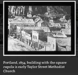
It appears the first church in Portland was not the Catholic Church,The map Also indicates that the church is mostly east of the port; which limits possibilities down to only one. 🥹👍🥳
I say that because the port in Portland is not west of the Catholic Church shown … in Old Portland, west of the river.
I suppose that with this story, that it very well may be another option not yet discussed. There is still maybe a steeple issue 😵💫
Idahodutch
Since the map/chart indicates the port is to the west of the church, I was looking for early churches of East Portland, the area east of the river (port).It appears the first church in Portland was not the Catholic Church,
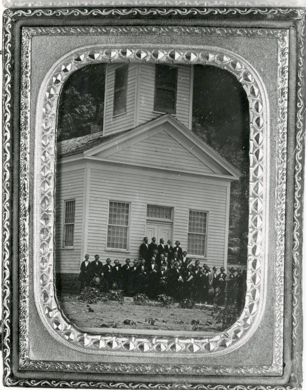
Here is a partial snip talking about it, and also the 75’ bell tower 😁
Ooops, it says the tower came along in 1957.
Another snag 😵💫😖
View attachment 2109102
It should be noted that this church was also in old Portland, west of the river.
The map indicates the church is east of the port (or Portland), which is not how either of these churches lay out.
Idahodutch

 chroniclingamerica.loc.gov
 leveereadycolumbia.org

 www.oregonlive.com
Crow,Macadamised road below.
View attachment 2110154
this road ended at the west back across from Milwaukie. you can see in the picture below.
View attachment 2110155
A bit about pike roads.
Pike roads
Perhaps the person who drew the map from Tennesse was told the location of the money from this dying Sims and wrote pike road on the map?
So the road might not actually related to plank roads at all.? And two miles west following Macadamised road on the west side of the river from the church at Milwaukie?
Crow
cw0909,have wondered where Sims got 6k,maybe he found a large sum of $$$ in the 1861 flood & hid it, then the 1894 flood took out the markers on the chart
Washington statesman. [volume], December 20, 1861, Image 2
Washington statesman. [volume] (Walla Walla, Wash. Terr.) 1861-1864, December 20, 1861, Image 2
Washington statesman. [volume] (Walla Walla, Wash. Terr.) 1861-1864, December 20, 1861, Image 2, brought to you by Washington State Library; Olympia, WA, and the National Digital Newspaper Program.
1894
map flooded area portland
Togel Singapore - Togel Hongkong - Togel Hari Ini - Data Keluaran HK SGP Prize
Lihat no result togel online hari ini pasaran togel hongkong & togel singapore yang berasal dari situs resmi toto sgp hk prize melalui tabel data keluaran hk sgp pools.
Portland’s catastrophic flood of 1894: Souvenir photo book from era showcases devastation
The Willamette River reached its highest recorded point in June 1894, thanks to persistent heavy rain and snow runoff.
Good morning Crow,Hello Idahodutch
Your theory is very close to where I thought it might be? I was slightly east more? But alas all theory unless it is some day found.?However thanks for contributing to make it an interesting thread. interesting stuff all the same.
I have theory that old man Sims had an orchard and looking at records there was two Sims Milwaukie from that joined the confederacy at Tennessee . I have theory the money came from 10 years with fruit boom supplying California with fresh fruit during the gold rush. When old Sims died his sons buried their money 3000 dollars each as they went off to civil war and one died in battle and the other died in hospital. Old man Sims died So perhaps the graves are connected to the family?
I could not find however anyone with that name owning land.
They maybe leased some land off the Llewellyn family? It should be noted the Llewellyn family was stanch union northern supporters.
What is interesting many people in Tennessee call toll roads pike roads. Perhaps that is connection are the two Sims from recorded from Milwaukie brothers? Perhaps that is why the money was buried in two lots of 3000?
Crow
 maps.app.goo.gl


 www.bettiedenny.com
 www.oregonencyclopedia.org

Crow,Hello Idahodutch
Your theory is very close to where I thought it might be? I was slightly east more? But alas all theory unless it is some day found.?However thanks for contributing to make it an interesting thread. interesting stuff all the same.
I have theory that old man Sims had an orchard and looking at records there was two Sims Milwaukie from that joined the confederacy at Tennessee .
I have theory the money came from 10 years with fruit boom supplying California with fresh fruit during the gold rush. When old Sims died his sons buried their money 3000 dollars each as they went off to civil war and one died in battle and the other died in hospital. Old man Sims died So perhaps the graves are connected to the family?
I could not find however anyone with that name owning land near Portland? The closest was independence Oregon upstream from Portland?
They maybe leased some land off the Llewellyn family? It should be noted the Llewellyn family was stanch union northern supporters.
What is interesting many people in Tennessee call toll roads pike roads. Perhaps that is connection are the two Sims from recorded from Milwaukie brothers? Perhaps that is why the money was buried in two lots of 3000?
* note the two confederates I found before i cannot find again? One thing on data bases I have access to Sims dying in 1864? None appears to died from Oregon?
Crow
For those interested, on our trip to Western Oregon, the weather was good on the drive over, bu too much snow on the ground to pursue photos of the potential grave markers at East Moreland golf course.Crow,
I haven’t forgot about this one, but have been waiting for the next time that I was going to be traveling to that part of Oregon, or at least in the area.
I’m hoping the snow that Portland, Or is currently getting, is not going to be still there in a couple of days.
It’s only about 2 hours out of the way to see what the 2 things, by the driving range, are.
I don’t think they are grave markers, but I would always wonder, most likely every time I go near enough to the area. 👀
If it’s actively accumulating snow as we go through, then I most likely will wait for a different trip to go look. 🤷🏼♂️
Hard to find stuff, unless we actually take time to look 🤓👍
Idahodutch