Cache Dowsing Please

Glasya

Jr. Member
Joined
Mar 6, 2012
Messages
44
Reaction score
2
Golden Thread
0
Primary Interest:
All Treasure Hunting

Attachments

  • PCSSB.webp
    PCSSB.webp
    126.3 KB · Views: 124
  • SL90.webp
    SL90.webp
    97.6 KB · Views: 131
  • LL90.webp
    LL90.webp
    120.9 KB · Views: 127
Yellow line area was picking up some raw gold. The red circles it seemed either old diggings or else cave/tunnels. Green for sites or archaeological signals.
 

Attachments

  • PCSSBGlasya.webp
    PCSSBGlasya.webp
    154.9 KB · Views: 137
Red_desert,

Thanks for taking the time to dowse my images, I guess the other two photos did not have any hits? What is the red box with the arrow pointing to it?

Glasya
 

The red arrow points to the first hit I got checking for any caves/tunnels or mine diggings. It was uncertain if this was just a natural cave, but at the red circles found more spots similar.
 

The other 2 maps, so far all I've got done on them is mark archaeological type signals. Must be a lot of Native American sites or stuff in there, especially the green circles.
 

Attachments

  • LL90-Glasya.webp
    LL90-Glasya.webp
    169.5 KB · Views: 114
  • SL90-Glasya.webp
    SL90-Glasya.webp
    153.9 KB · Views: 133
The red square at the end of the arrow, I checked it again, could be a cache or something hidden there. I'm getting signals like Native American in this map also....glad I didn't start marking them.
 

Yellow lines where I'm picking up some raw gold, blue lines with Xs must be a silver veins. All I could get so far, from the other map, is just a lot of Indian stuff.
 

Attachments

  • PCSSBGlasyacrop.webp
    PCSSBGlasyacrop.webp
    54.5 KB · Views: 116
  • SL90-Glasyacrop2.webp
    SL90-Glasyacrop2.webp
    30.4 KB · Views: 129
  • SL90-Glasyacrop1.webp
    SL90-Glasyacrop1.webp
    60.9 KB · Views: 110
Red_desert,

The two maps where you covered them with green X's and O's use to be a C.C.C. lumber mill back during the depression and is littered with broken bottles, rusted cans, nails, etc. Supposably there is a lost lumber jack payroll cache buried up there. I do not hunt for Native American stuff and have only seen them in museums. And for the record, I would just leave them where they lie even if I did find something.

As for the image with the red arrow on it, there are several Spanish symbols on trees in that area and rumors of a gold or silver cache. Never heard of Indians being up there, they were and are located about 100 miles south of that location. Thanks again for everything.

Glasya
 

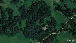
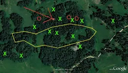
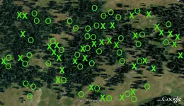
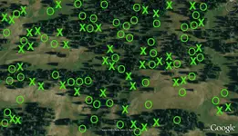
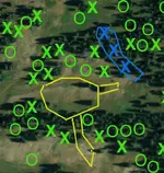
Indians moved around to relocate when food was scarce, then many villages died off in epidemics of diseases brought by the Europeans. Spanish symbols in the area, seemed like a cache site when I dowsed it.....hopefully the treasure never got recovered. Now as for the silver, there is very little difference between a silver vein with rich ore pockets and a cave/tunnel containing a silver cache. The reason why, the entire area of the cave/tunnel or connecting caves, gives off a signal because it contains a treasure. Any openings to a sealed room or entrances leading in, also produce a response when dowsed. The first 1-2 blue Xs I marked, did seem to be strong enough for to be either a cache or a pocket in a vein. That would mean a cache plus an opening marked, if this was a cave/tunnel. There was a little trace gold in spots of the map, reason for me thinking it must be a silver vein.
 

Hi Glasya,In all 3 pictures dowsing revealed an attraction to gold in the areas of the green circles.Thanks for posting your pictures,Jon
 

Attachments

  • PCSSBdowsed.webp
    PCSSBdowsed.webp
    129.1 KB · Views: 117
  • LL90dowsed.webp
    LL90dowsed.webp
    124 KB · Views: 107
  • SL90dowsed.webp
    SL90dowsed.webp
    99.6 KB · Views: 117
Jon,

Thanks for taking the time to dowse my images.

Glasya
 

Top Member Reactions

Users who are viewing this thread

Back
Top Bottom