Red_desert
Gold Member
- Joined
- Feb 21, 2008
- Messages
- 7,154
- Reaction score
- 3,790
- Golden Thread
- 0
- Location
- Midwest USA
- Detector(s) used
- Garrett Ace 250/GTA 1,000; Fisher Gold Bug-2; Gemini-3; Unique Design L-Rods
- Primary Interest:
- All Treasure Hunting
- #1
Thread Owner
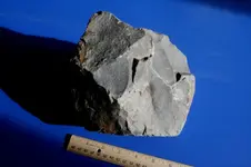
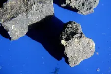
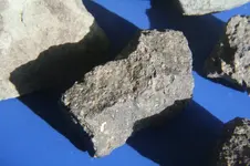
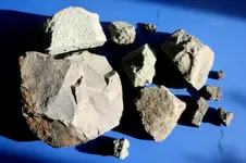
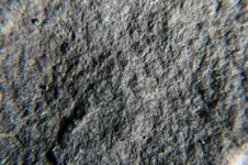
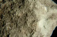
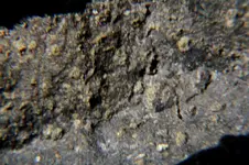
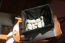
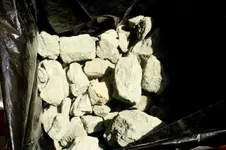
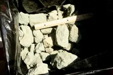
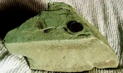
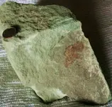
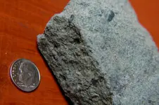
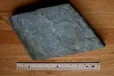
I just want to share some photos of Lamproite specimens, hard enough to slice, the type you see on the Internet cut & polished slices for $30-$36 which can fit into a 2x2" plastic holder. The Crater of Diamonds state park was packed out when I arrived Oct 19, they gave me an extra day, had booked for Oct 20-Nov 3.
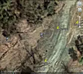
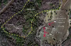
I went into the SW corner of the park mine field to get away from the people. Got out my GPS to check a dowsing hit done on GE maps before leaving for Arkansas. The spot was about 269 ft NW from me. My rods picked up a signal the same direction. Another GPAA member came by before moving toward the spot. We were chatting a while....he mentioned a wash out one time, leaving a vein exposed of this unknown type of rock. Later after locating the spot by GPS, that same guy ended up there too. He dug down, found the vein. It looked like the rock I'd taken in a couple small chunks to the geologists earlier that day called Lamproite, a volcanic rock that supplies the mine field with diamonds. Turned on my GPS, it started beeping. The vein was the exact spot as the dowsed coordinates, done by map dowsing at home. I picked up on the vein to follow it with the rods.
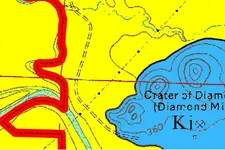
Later, the older lady geologist said, showed me a recent geological survey, they found 2 after eruptions where 2 extra diamond pipes were formed in the hill area. She showed me on a map, how the south diamond pipe has a reef, comes into the SW part of the diamond field.
I went into the SW corner of the park mine field to get away from the people. Got out my GPS to check a dowsing hit done on GE maps before leaving for Arkansas. The spot was about 269 ft NW from me. My rods picked up a signal the same direction. Another GPAA member came by before moving toward the spot. We were chatting a while....he mentioned a wash out one time, leaving a vein exposed of this unknown type of rock. Later after locating the spot by GPS, that same guy ended up there too. He dug down, found the vein. It looked like the rock I'd taken in a couple small chunks to the geologists earlier that day called Lamproite, a volcanic rock that supplies the mine field with diamonds. Turned on my GPS, it started beeping. The vein was the exact spot as the dowsed coordinates, done by map dowsing at home. I picked up on the vein to follow it with the rods.
Later, the older lady geologist said, showed me a recent geological survey, they found 2 after eruptions where 2 extra diamond pipes were formed in the hill area. She showed me on a map, how the south diamond pipe has a reef, comes into the SW part of the diamond field.


 Rats. I'd still do a little recon on the area, though.