What's new

Google Earth Anomalies for Dutch Hunters

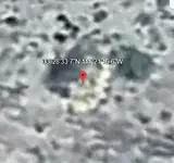
33°33'49.07"N, 111°17'44.91"W

Here is another interesting one. On horse mesa, i have not been to this location, but in the 2014 year of GE it could be natural with two old walls between a cliff edge and a drainage. Possibly an old campfire in the middle, with half a ring left.

in 2015 there is a new object in the area between what could be the two rock walls, red about 6.5'x6'. It casts a shadow so it has height.
in 2016 in is there but looks to have blown over and be stuck on the rock wall
It slowly disintegrates and turns to white over the following years.

Also a really unique rock to the south of it with such a long narrow rock that is straight but curved at the end.

Great location for a camp!

1772073631655.webp
 
These were for, i believe, airmail navigation.

I agree. My first thought was that the arrow was made for aerial mapping or navigation. I'm wondering if there are other such arrows in those mountains, and why this particular arrow was placed where it is.
 
I agree. My first thought was that the arrow was made for aerial mapping or navigation. I'm wondering if there are other such arrows in those mountains, and why this particular arrow was placed where it is.
Skyhawk1251,

I have been to the arrow in your photo. Here is my satellite image with La Barge Canyon and Music Canyons marked for reference:
Nov 20p 006.9a.webp

After examining the area where the 'arrow' is located, I believe it is a natural geographic feature and not man made. Here is a close-up of the area at the tip of the arrow:
Nov 20p 007.1.webp

It is a natural formation of exposed light colored bedrock. What's interesting though is a stone type structure nearby:
Nov 20p 009.0.webp

Steve Bowser
 
These were for, i believe, airmail navigation.

The vast majority of arrows in the early days of directed airmail were poured concrete, and there were absolutely no routes over the Superstitions because of the risk of crashing. Airmail routes followed flat desert as much as possible in case an emergency landing was required at any point.

I seem to remember someone suggesting that this arrow was an Eagle Scout project, for one reason or another.

There's another better-known scout project, same concept, on Usery Mountain, directing pre-GPS fliers to the Phoenix airport.
 
What do you make of this? 33°28'33.70"N 111°21'16.60"W
 
Google Earth shows this feature below Malapais Mountain and above La Barge Canyon. GPS coordinates are bottom right on the image. I see a lot of "smearing" in the image, so the feature might not be rectangular in shape. It could probably be observed from above using binoculars, but could not be seen from below in the canyon.

A.webp
 
Not sure all are anomaly's the first picture is a saguaro cactus. The second and third are just outcroppings Some of the other photos show mine dumps.

Why would you say these are anomaly's. If you are in a mining district, then outcroppings, mine shafts would be normal.
 
Google Earth shows this feature below Malapais Mountain and above La Barge Canyon. GPS coordinates are bottom right on the image. I see a lot of "smearing" in the image, so the feature might not be rectangular in shape. It could probably be observed from above using binoculars, but could not be seen from below in the canyon.

View attachment 2250719
Skyhawk

Using the latest date on GE - looks to be just large boulders


JUST BOULDERS.webp


SpartanOC
 
Google Earth shows this feature below Malapais Mountain and above La Barge Canyon. GPS coordinates are bottom right on the image. I see a lot of "smearing" in the image, so the feature might not be rectangular in shape. It could probably be observed from above using binoculars, but could not be seen from below in the canyon.

View attachment 2250719
My question is why are u looking at 2016 pic instead of the new pics?
 
My question is why are u looking at 2016 pic instead of the new pics?

On my screen the latest GE images look completely "washed-out" and have very poor resolution, plus the colors look very artificial. For me, images from 2/2016 look best. Any anomalies that I spot can be put in the DIY category, meaning fire-up GE and see what's there for yourself. I don't expect everyone to see what I see.
 
Not sure all are anomaly's the first picture is a saguaro cactus. The second and third are just outcroppings Some of the other photos show mine dumps.

Why would you say these are anomaly's. If you are in a mining district, then outcroppings, mine shafts would be normal.

When I describe something as an anomaly, I mean I see something that I can't positively identify. I've also learned through trial-and-error that it's best not to say something is an outcrop, mine shaft, etc. just by what is shown on Google Earth, because GE is far from 100% reliable. For me, it's just better to call something an anomaly. Then, other viewers can go to the coordinates and draw their own conclusions. Anyone who doesn't want to take the time to run GE on their own computer apparently lacks enough interest to be viewing posts of this kind.
 
When I describe something as an anomaly, I mean I see something that I can't positively identify. I've also learned through trial-and-error that it's best not to say something is an outcrop, mine shaft, etc. just by what is shown on Google Earth, because GE is far from 100% reliable. For me, it's just better to call something an anomaly. Then, other viewers can go to the coordinates and draw their own conclusions. Anyone who doesn't want to take the time to run GE on their own computer apparently lacks enough interest to be viewing posts of this kind.
If I see something of interest on Google earth, I check it out. When I was younger I would climb up to where I thought I saw something. Now that I am older and more prone to falling, I use a drone to check things out.
Unlike people on youtube, I quit going into mine shafts in my early 30's, encountering 1 snake was enough, a Mojave Rattlesnake does not back down.
 
I've found Google Earth to be reasonably accurate for showing surface features in the Cerbat Mountains here in Mohave County. I can say that because I've been to places I've viewed on Google Earth. GE is not as reliable for the Superstitions, maybe partly because there is more ground clutter -- rocky ground, too much vegetation.
 

Users who are viewing this thread

Back
Top Bottom