Lost Dutchman in the Superstitions? What is wrong with this picture?

Oroblanco

Gold Member
Jan 21, 2005
7,837
9,826
DAKOTA TERRITORY
Detector(s) used
Tesoro Lobo Supertraq, (95%) Garrett Scorpion (5%)
Lost Dutchman in the Superstitions? What is wrong with this 'picture'?

Lost Dutchman Mine in the Superstition Mountains? What is wrong with this picture?

Most Dutch-hunters know the story of the Lost Dutchman gold mine by heart. There are over 100 "clues" to help locate it, and at least several dozen people have claimed to have found it - but very VERY few ever had gold to show. The big question is where exactly is the mine?

Jacob Waltz told somewhat different stories to the two "main" parties we trace nearly all of our sources to, being Holmes versus Julia & Reiney. Their two versions have even been somewhat "homogenized" by Holmes going to Julia and comparing notes. There is a third version which is little known and is far less dramatic, but we will not address that here other than a couple of points, which I will get to in a moment.

Waltz told Holmes and his friends Julia and Reiney that the mine is in the Supers. He gave them a story (or we are told he did) that he got the mine from Peralta, about the massacre etc. We know that Waltz came to Phoenix about 1868. In his early days, he seems to have made Florence his "base" for prospecting expeditions into the Superstitions, which is a bit odd.

I posted a new thread with an 1876 map of Arizona, the link is

http://forum.treasurenet.com/index.php/topic,281261.new.html

Take a look at it, you may notice a few things. For one, the Superstitions are not even shown. The settlements of Phoenix, Macdowell, Florence and Adamsville seem to be the only "civilization" around the Superstitions, unless we count the Pima and Maricopa Indian villages which are on the river.

Now back to our story of Waltz and his gold mine. According to the stories, Waltz had a partner - his "nephew" according to Holmes, whom he murdered, or another "Dutchman" named Weisner, or Wiser, Weiser, Wisner, Wizer, Weisse etc by the other version. <I am going to skip some dramatic details which are not too important for our purposes here> Waltz took him to the mine and they had worked it only a short time before they had an incident in which one of their mules got into their supplies and destroyed most of it, so someone had to go for more and Waltz elected to go and leave Weisner to work at the mine. While he was gone, Weisner was attacked by Indians, Apaches as assumed by both partners. When Waltz got back to the mine, he found the evidence of the attack and his partner's bloody shirt, and concluded that he had been killed. What he was unaware of was that Weisner escaped, wounded desperately but managing to make it to friendly Pimas who took him to see their friend Doctor Walker. Doc Walker tried to help Weisner but his wounds were too much and he died in a few days, but not before drawing a map for Walker to find the mine. Weisner had assumed that the Apaches must have gotten Waltz and wanted someone to find the mine.

Now this is all well-known to Dutch hunters, whom could easily add much detail and corrections to what I just wrote. What seems to be skimmed over is a few landmarks. You see, Waltz went for more supplies - where did he go? Did he go to Phoenix? Did he go to MacDowell, which surely would be shorter? No - he went to Adams Mill. Adams Mill was pretty much where Adamsville is marked on the 1876 map. Weisner expected Waltz to be gone four days, allowing two days travel each way.

Back in this post I mentioned that Waltz had sort of made Florence his "base" - for several of the 'pioneers' (old timers) who knew him claimed he came into town fairly regularly, hired a Florence carpenter to build him a portable dry washer, and that his mine was "no big secret" in those days. Where is Florence? Very near Adamsville, check that 1876 map.

Weisner rode away from the marauding Apaches whom had ambushed him, hurt and bleeding, firing at them. They had jumped him early in the morning, and he rode the only horse they had not gotten, but only covered a few miles (as he estimated) before the Apaches arrows dropped the horse. He kept on, running and firing from behind rocks and eventually the Indians lost interest. He headed for the first water hole he knew of. He said he must have gone delirious, pulled out the arrow he had been hit by, and crossed the desert to the Gila river, where some Pima squaws found him. As far as we can tell this all took place in one day, for Doc Walker sat up with Weisner all that night. Where did the Pimas find Weisner? At the Pima villages on the river - now check that 1876 map again, you will see they are almost directly West of Adamsville. You may also notice an Indian trail is marked there, running North-Northeast and which would have run right through the Superstitions.

It seems logical that Weisner probably ran onto that Indian trail which led right to the river and is where the Pima villages were, where he was found.

When you put this together, you have to ask - if the Lost Dutchman mine is located somewhere up in the northern Superstitions, why would Waltz go to Florence to get his drywasher, or to Adams Mill to get flour, why would Weisner flee to the Pima villages, all of which are SOUTH of the Superstitions? According to Weisner, the mine ought to be two days travel from Adams Mill, and he himself made it, wounded, from the mine to the Pima villages in one day. So I am asking you, dear reader.

What is wrong with this picture? Thank you in advance for your replies. :icon_thumleft:
Oroblanco

. :coffee2: :coffee: :coffee2:
 

Springfield

Silver Member
Apr 19, 2003
2,850
1,383
New Mexico
Detector(s) used
BS
Re: Lost Dutchman in the Superstitions? What is wrong with this 'picture'?

Oroblanco said:
...So I am asking you, dear reader.

What is wrong with this picture? Thank you in advance for your replies. :icon_thumleft:
Oroblanco

1. Adams
2. Pima villages
3. Gold mine (placer too?)
4. Partner went for supplies
5. Apache killers
6. Dutchman

Hmmm.
 

cactusjumper

Gold Member
Dec 10, 2005
7,754
5,388
Arizona
Re: Lost Dutchman in the Superstitions? What is wrong with this 'picture'?

Roy,

That's a great map. Thanks for the link.

Something to keep in mind, is that maps in that day and age were often wonderfully accurate as well as woefully inaccurate in many instances. Mountains, forts, towns......etc., were often located in the wrong place on those early maps. I would asssume, perhaps wrongfully, that the Indian Trail that is depicted is the Apache Trail.

Take care,

Joe
 

OP
OP
Oroblanco

Oroblanco

Gold Member
Jan 21, 2005
7,837
9,826
DAKOTA TERRITORY
Detector(s) used
Tesoro Lobo Supertraq, (95%) Garrett Scorpion (5%)
Re: Lost Dutchman in the Superstitions? What is wrong with this 'picture'?

Thank you for your replies.

Springfield wrote
<Oroblanco wrote>What is wrong with this picture? Thank you in advance for your replies.
Oroblanco

1. Adams
2. Pima villages
3. Gold mine (placer too?)
4. Partner went for supplies
5. Apache killers
6. Dutchman

1.Well the "Adams" mentioned here was the owner of a grist mill who sold flour and other supplies, and a small settlement grew there - it is not one and the same with the Adams of the Lost Adams Diggin's.
2. The Pima villages are historically correct and fairly well documented.
3. The "placer" part is one which has been mystifying, as we find the Holmes version claims that Waltz was "losing some fine gold" for an explanation as to why he had brought in a drywasher. However according to at least one "old timer" who gave a 'Pioneer Interview' the drywasher was used to trace the gold to the vein, as water is scarce in the Supers it would be helpful in concentrating his samples. In locating a gold lode by this method, the "placer" gold need not be more than a single color to several shovels or even buckets of earth/gravel - the placer gold really isn't rich enough to mine it, just using it to trace back to the vein. There is a story given by Ely of a Mexican woman who remembered her husband "winnowing" the gold which was the size of wheat grains, and this is a dry placer mining method which is likely un-related to the Lost Dutchman at all.
4. What is unbelieveable about one of the two men going for supplies? It would have made sense for Waltz as the more "frontier" experienced of the two to be the one to go, and they must not have known of any hostile Indians or we can surmise their actions would have been quite different.
5. I am not so sure the Indians were Apaches at all, and suspect they were of a tribe which was SUPPOSEDLY at peace at this time. Both Waltz and Weisner believed they had been Apaches, but this is not proven.
6. I do not understand your finding the Dutchman to be one of the things wrong - may I ask you to explain this further? Thank you in advance.

Cactusjumper wrote
That's a great map. Thanks for the link.

Something to keep in mind, is that maps in that day and age were often wonderfully accurate as well as woefully inaccurate in many instances. Mountains, forts, towns......etc., were often located in the wrong place on those early maps. I would asssume, perhaps wrongfully, that the Indian Trail that is depicted is the Apache Trail.

I am very well aware of the errors and omissions we find in old maps, and have examined a fair number of different such maps. This example dates to a few years AFTER Waltz is thought to have discovered the mine (though some date it much earlier and much later) and has the latitudes and longitudes so it would be possible to cross-check the locations. The fact that the Superstitions do not appear other than a BLANK, and this "Indian trail" lead directly to the Pima villages are interesting to me. Other things we do not see include PINAL city, which appeared in 1878, and surely would have been MUCH closer for purposes of obtaining supplies, so this (indirectly) helps us to date Waltz's finding of the mine (before 1878, or why go to Florence and Adams Mill).

According to Kollenborn's version of Doc Walker & Weiser has the wounded Weiser walk over 20 miles, in two days, which is perhaps correct. I just have to wonder, why did Waltz and Weiser go SOUTH? Check out this 1867 map, which is "zoomable"

http://azmemory.lib.az.us/cdm4/item...DMTEXT=&DMTHUMB=1&REC=7&DMROTATE=0&x=97&y=236

You will note that Florence does not appear, but Ft. McDowell does, as do the Pima villages. Florence was founded in 1866, so may not have made it onto the 1867 map.So if the Florence old-timers are not lying, we can safely say that Waltz likely did not discover his mine before 1866, for there was no Florence to be hiring a carpenter.
<Also check out Johnson's 1864 map, no Phoenix or Florence>
http://azmemory.lib.az.us/cdm4/item...MTEXT=&DMTHUMB=1&REC=3&DMROTATE=0&x=244&y=389

This Military map (dates to 1860's) shows the "Salt River" mountains (Superstitions) and several different trails leading to the Pima villages, so I do not know if we can safely conclude the Apache Trail to be the same "Indian trail" of the 1876 map.
http://azmemory.lib.az.us/cdm4/item...TEXT=&DMTHUMB=1&REC=12&DMROTATE=0&x=153&y=372

Thank you again for your replies,
your friend in 'Dakota Territory'
Roy ~ Oroblanco
:coffee2: :coffee: :coffee2:
 

Springfield

Silver Member
Apr 19, 2003
2,850
1,383
New Mexico
Detector(s) used
BS
Re: Lost Dutchman in the Superstitions? What is wrong with this 'picture'?

Oroblanco said:
1. Adams
2. Pima villages
3. Gold mine (placer too?)
4. Partner went for supplies
5. Apache killers
6. Dutchman

... may I ask you to explain this further? Thank you in advance.

No great shakes Oro. It's just that the six points you've pinned to the LDM are also common points to another well-known, still lost AZ/NM 'lost mine' - the Lost Adams Diggings. Coincidences such as these always perk my attention.

By the way, I'm trying to locate an old email (1990's) from an aquaintence who was all over the LDM all his life and had info about Waltz being often reported at Florence Junction and points south. I can't remember much about his research, but as I recall, he didn't believe Waltz got his ore from the Superstitions. I was more interested in the Lost Adams at the time and his LDM theories went onto the back burner at that time.
 

OP
OP
Oroblanco

Oroblanco

Gold Member
Jan 21, 2005
7,837
9,826
DAKOTA TERRITORY
Detector(s) used
Tesoro Lobo Supertraq, (95%) Garrett Scorpion (5%)
Re: Lost Dutchman in the Superstitions? What is wrong with this 'picture'?

Thank you Springfield, I had not thought to compare the coincidences. (I thought you were saying there was something wrong on each point) It is interesting and curious, but the differences stand out to me, lode gold versus placer, general region, number of men in the mining party, mode of travel and route of travel, dates etc. I know we don't have a specific date when we can say Waltz found his mine, as he did not bother to mention that detail, but we can make educated guesses based on known incidents (such as the historical presence of Waltz in the Bradshaws during the Civil war period, his filing on a homestead in Phoenix 1868, and the stories of obtaining supplies etc as mentioned earlier.)

I take it that you do not think the Lost Adams ever existed? Thank you in advance,
your friend,
Roy ~ Oroblanco
 

Springfield

Silver Member
Apr 19, 2003
2,850
1,383
New Mexico
Detector(s) used
BS
Re: Lost Dutchman in the Superstitions? What is wrong with this 'picture'?

Oroblanco said:
.... I take it that you do not think the Lost Adams ever existed? Thank you in advance,
your friend,
Roy ~ Oroblanco

I'm still teetering on the fence and will continue to remain there, open to all ideas, new and old.

I know some rather brilliant folks from the alternative TH community and I've seen some extremely compelling evidence that would blow your socks off re the so-called 'KGC' phenomena on sites unrelated to both the LDM and the LAD. Therefore, by extension, I must strongly consider Brewer's claims regarding these two well-known 'lost mine' mysteries (i.e., they do not exist as described).

On the other hand, I've invested beaucoups time, research and Vibram rubber chasing the LAD since the 1970's. In fact, I've recently begun leaning towards the 'reality' of the story again. I've now found myself with much more available time and may decide to revisit the topic - I haven't done much with it for years. As I've said before, if this thing is real, then I feel it's located somewhere between the San Carlos Reservation and the Pinos Altos Range. Of course, if one is so inclined, he can stretch the search area all the way from the McCartys lava flow to the north to Juh's stronghold in Mexico, based on which version of the story you like. Quien sabe?
 

OP
OP
Oroblanco

Oroblanco

Gold Member
Jan 21, 2005
7,837
9,826
DAKOTA TERRITORY
Detector(s) used
Tesoro Lobo Supertraq, (95%) Garrett Scorpion (5%)
Re: Lost Dutchman in the Superstitions? What is wrong with this 'picture'?

Yo comprende! :icon_thumleft:
 

Ellie Baba

Hero Member
Mar 7, 2005
527
54
Laveen, AZ
Detector(s) used
Tesoro Lobo
Re: Lost Dutchman in the Superstitions? What is wrong with this 'picture'?

Hey Springfield,

Adams is located in/near Pinos Altos. A friend purchased 1,400 acres in Bear Creek and he owns property on both sides of the Zigzag Canyon. We have some great photos of falls with slide rock for burros as described by Snively.

Oroblanco,

You are beginning to see the light my friend. The Dutchman was not working the Soups. FYI, gold placers listed om some old maps relating to southern end of Soups.

Cactusjumper,

It is not the Apache Trail it is the back (early military) trail to Ft. McDowell. Check Sheriff Montgomery expedition to Bulldog Mine Masacre.

Gotta go...

EB
 

Springfield

Silver Member
Apr 19, 2003
2,850
1,383
New Mexico
Detector(s) used
BS
Re: Lost Dutchman in the Superstitions? What is wrong with this 'picture'?

Ellie Baba said:
Hey Springfield,

Adams is located in/near Pinos Altos. A friend purchased 1,400 acres in Bear Creek and he owns property on both sides of the Zigzag Canyon. We have some great photos of falls with slide rock for burros as described by Snively.
....EB

If that's so, then the W.W. Williams account of the legend would gain points because he places the LAD event in the late 1850's. Pinos Altos was founded by Snively and others and populated in 1860, but Snively rode back into town with his 500 ounces of placer in 1863. That Snively is quite a mercurial character in the history of TX, NM and AZ isn't he?

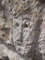
I believe that 1400 acres is slated to revert back to National Forest soon, thanks to our Stimulus Plan. It's all patented placer claims surrounded by the Gila NF. I guess I'm not sure which canyon you're calling 'Zigzag Canyon'. Went up to Twin Sisters today and finally found the face carving I've been looking for. There's lots of gooood stuff near Pinos Altos.
 

Attachments

  • face.jpg
    face.jpg
    108.9 KB · Views: 4,679
Nov 2, 2009
483
1
Re: Lost Dutchman in the Superstitions? What is wrong with this 'picture'?

Has anyone watched this on myspace videos?????????????? I so what are your thoughts????????
 

Nov 2, 2009
483
1
Re: Lost Dutchman in the Superstitions? What is wrong with this 'picture'?

"AMERICAS LOST GOLD" "GO TO MYSPACE VIDEOS TO WATCH IF ITS NOT WORKING HERE ON TREASURE NET."
 

Ellie Baba

Hero Member
Mar 7, 2005
527
54
Laveen, AZ
Detector(s) used
Tesoro Lobo
Re: Lost Dutchman in the Superstitions? What is wrong with this 'picture'?

Springfield wrote:

I believe that 1400 acres is slated to revert back to National Forest soon, thanks to our Stimulus Plan. It's all patented placer claims surrounded by the Gila NF. I guess I'm not sure which canyon you're calling 'Zigzag Canyon'. Went up to Twin Sisters today and finally found the face carving I've been looking for. There's lots of gooood stuff near Pinos Altos.

Hi Springfield,

This particular 1,400 acres was owned by a rancher for a number of generations. The Forestry Service does want to buy the property. Bear Creek runs right through the middle of the property and it has formed the zigzag canyon. The Twin Sisters can be seen off in the distance not to far away. We started a placer operation there late this summer and recovered a little gold (not enough rainfall this year) but, we plan to return in the spring if the water supply is sufficient. Bob S. found a sand bar that hasn't been worked in over 30 years and found three times the gold as in the previous benches. Tom is selling lots to my knowledge; Bob and myself have already picked our lots out. When this country takes its final bow I am heading for Pinos Altos to live out my last days. It will be there or Angel Fire as I have some good friends in AF, Eagles Nest, Taos and the Blackfire Ranch. You ever been up to Elizabeth Town? Its colder there in the winter though. There is a KGC site east of Farmington I want to check out some day. Maybe we can check it out together sometime in the future.

Take care mi amigo,

EB
 

Springfield

Silver Member
Apr 19, 2003
2,850
1,383
New Mexico
Detector(s) used
BS
Re: Lost Dutchman in the Superstitions? What is wrong with this 'picture'?

Ellie Baba said:
Springfield wrote:

I believe that 1400 acres is slated to revert back to National Forest soon, thanks to our Stimulus Plan. It's all patented placer claims surrounded by the Gila NF. I guess I'm not sure which canyon you're calling 'Zigzag Canyon'. Went up to Twin Sisters today and finally found the face carving I've been looking for. There's lots of gooood stuff near Pinos Altos.

Hi Springfield,

This particular 1,400 acres was owned by a rancher for a number of generations. The Forestry Service does want to buy the property. Bear Creek runs right through the middle of the property and it has formed the zigzag canyon. The Twin Sisters can be seen off in the distance not to far away. We started a placer operation there late this summer and recovered a little gold (not enough rainfall this year) but, we plan to return in the spring if the water supply is sufficient. Bob S. found a sand bar that hasn't been worked in over 30 years and found three times the gold as in the previous benches. Tom is selling lots to my knowledge; Bob and myself have already picked our lots out. When this country takes its final bow I am heading for Pinos Altos to live out my last days. It will be there or Angel Fire as I have some good friends in AF, Eagles Nest, Taos and the Blackfire Ranch. You ever been up to Elizabeth Town? Its colder there in the winter though. There is a KGC site east of Farmington I want to check out some day. Maybe we can check it out together sometime in the future.

Take care mi amigo,

EB

Are these guys brothers from Scottsdale, by chance? Those placer claims up and down Bear Creek have been worked off and on for many years with marginal success. My old partner and I got some worthwhile results out of upper Arroyo Rico (empties into Bear Creek just above Preachers Point) with a small dredge, a temporary dam and a Spanish rocker back in the '70s, but as you say, water is an issue, especially with the drought and much less spring runoff.

One of the reasons I chose SW New Mexico was the perfect climate - winters are too long in the San Juans and Sangre de Christos for my taste. If you land here, I'll show you some things that'll keep your KGC-aware heart thumping for the rest of your days.
 

Ellie Baba

Hero Member
Mar 7, 2005
527
54
Laveen, AZ
Detector(s) used
Tesoro Lobo
Re: Lost Dutchman in the Superstitions? What is wrong with this 'picture'?

Springfield wrote:

Are these guys brothers from Scottsdale, by chance? Those placer claims up and down Bear Creek have been worked off and on for many years with marginal success. My old partner and I got some worthwhile results out of upper Arroyo Rico (empties into Bear Creek just above Preachers Point) with a small dredge, a temporary dam and a Spanish rocker back in the '70s, but as you say, water is an issue, especially with the drought and much less spring runoff.

One of the reasons I chose SW New Mexico was the perfect climate - winters are too long in the San Juans and Sangre de Christos for my taste. If you land here, I'll show you some things that'll keep your KGC-aware heart thumping for the rest of your days.


They are brothers, one lives in Lodi (near Mesa) and one lives in California. They have owned the property for about three years. They had no idea of the historical value of the property, at least not until Bob Schoose took a trip up there to see our friends new property. I think I am in agreement with you as I am not a big winter country lover. I look forward to meeting you one of these days as I will be coming to Pinos Altos in the near future.

EB
 

Nov 2, 2009
483
1
Re: Lost Dutchman in the Superstitions? What is wrong with this 'picture'?

NEW MEXICO: Elizabethtown's post office was established in 1868, and was discontinued in 1931. Elizabethtown was the first incorporated city in New Mexico and even held the county seat. Charles Kennedy ran a boardinghouse here and when newcomers would come they would ((("soon disappear."))) Charles was killing them and taking their valuables and burning the bodies bit by bit. The town was so enraged after Charles' wife confessed they got him, tied a rope around his neck, and dragged him by horse up and down main street until long after he was dead. After the easy gold was picked, operations shut down and today there are only a few buildings left.
 

Nov 2, 2009
483
1
Re: Lost Dutchman in the Superstitions? What is wrong with this 'picture'?

In the fall of 1866, a lone Moache Ute showed up at Fort Union with a large chunk of copper ore. The federal government was shorting the Native Americans with food and such and he wanted to trade it for more winter supplies. Captain William Moore (retired), the owner of the suttler's store, recognized the rock for what it was and offered a deal to the Ute's liking. Part of the deal was that the Native American would lead the Captain to where he got the rock. That turned out to be on the west side of Baldy Mountain.

Moore sent three prospectors out to check out the ore deposit. While they were on the mountain, one of them decided to pan a bit of stream gravel and see what he might find. In the end, they dropped the copper ore project because they found flakes of gold in nearly every gully on the west side of the mountain. An early snowstorm forced them off the mountain and when they returned to Fort Union, the principals in this venture all swore each other to secrecy. However, it was a long winter and stories get told. By the spring of 1867, there were 300 men waiting at Fort Union to charge onto the mountain and stake their claims. Problem was, all this countryside was the private property of Lucien Maxwell as part of the Maxwell Land Grant.

Maxwell had dreamed of managed and controlled growth on his property but the gold rush that occured in 1867 put an end to that. He ended up establishing lease agreements with most of the miners and then built his own mining operation on the mountain.

Elizabethtown was founded that summer of 1867 by the miners. The town was surveyed and platted with wide streets and separate residential and commercial zones. That first summer five stores opened for business. However, winter can be pretty harsh at that elevation and the miners couldn't work their claims.

In the meantime, Maxwell built a toll road through Cimarron Canyon and leased land to Uncle Dick Wootton to build a toll road over Raton Pass to Trinidad. This was necessary to get the gold out of the Moreno Valley and deposit it in the banks in Trinidad. By the spring of 1868, there was a stage line offering daily service between Elizabethtown and Cimarron. This route was so successful that the owner soon instituted another stage line to Taos and Santa Fe.

By the end of summer in 1868, there were 3,000 men working the gold fields and 100 buildings built in Elizabethtown. In January, 1869, the state legislature created a new county and named it Colfax in honor of the Vice-President elect, Schuyler Colfax. As the largest town in the county, Elizabethtown was the first county seat. A year later, Elizabethtown became the first incorporated city in New Mexico. None of this meant that this gold camp was civilized: in one 24-hour period, there were 8 isolated confrontations that left men dead.

The outlaw problem was so bad, and the law so ineffectual, that vigilante justice became the norm. Lots of folks were killed simply because someone in a position of influence didn't like them. There were even instances when the vigilantes stormed the jail and hung whoever was inside. Too many times, the dead men turned out to be innocent.

One of the nastiest of the vigilantes was a former Confederate officer named Clay Allison. Allison had a ranch over towards Cimarron but every now and then he just had to go to town somewhere (he also regularly showed up in Trinidad because Trinidad had the best doctors: he'd picked up a nasty social disease and had to seek regular treatment). Allison's fame as a gunfighter, nasty drunk and vigilante activist stretched as far away as Dodge City. He was usually the leader of the groups that stormed the jail. He was also a squatter on Maxwell's property.

In 1870, Maxwell decided to sell the Land Grant and move to the abandoned Fort Sumner. A year later, the Grant was bought by a consortium of British and Dutch investors. These investors honored any property owner who had proof that he'd bought the land from Maxwell, but squatters were to be evicted. This led to the Colfax County War.

Within two years, the county seat was moved to Cimarron, close to the headquarters of the Maxwell Land Grant Company. By 1875, the boom days of gold mining were over and Elizabethtown was in swift decline. Then in 1887, the US Supreme Court finally ruled in favor of the Land Grant owners (that the Land Grant was valid private property) and things picked up again. Mind you, one of the local folks was Tom "Black Jack" Ketchum, a notorious train robber with his Hole-In-The-Wall Gang. They hung out in Elizabethtown a lot, spending hundred-dollar bills that no one could account for in all night poker games. Black Jack was finally shot during a botched train robbery and was caught, tried and hanged in Clayton in 1901.

But life in E-town was more sane and civil than it had been in the early years, until a fire broke out in 1903 that destroyed most of the town. It was after the fire that the Mutz Hotel was rebuilt in stone but the town didn't recover. The death knell really came when Charles and Frank Springer decided to build a dam near the entrance to Cimarron Canyon. That created Eagle Nest Lake. TD Neal bought land next to the lake and founded the town of Therma (later to be called Eagle Nest). Most of the remaining residents of E-town took their houses apart and moved everything down to Therma over the next couple of years.

Gold mining continued on Baldy Mountain up into the 1940's but it wasn't very profitable because there was a shortage of water for hydraulic placer mining, and the laws were also getting stricter in regards to water pollution. Most of the land on the east side of Baldy Mountain was purchased and donated to Philmont Scout Ranch in 1962 so all mining has ceased over there.

At this point, there are only 7 of the original buildings of E-town left "standing." And the town itself is in the hands of descendants of the Mutz family.
 

Nov 2, 2009
483
1
Re: Lost Dutchman in the Superstitions? What is wrong with this 'picture'?

I believe the adams diggings is very close to this area on a canyon that has black cats! Interestingly the locals say a male panther crossed over from south america and mated with some local female cats.
 

alaskabill

Jr. Member
Jan 5, 2009
81
13
Alaska
Detector(s) used
White's GMT
Re: Lost Dutchman in the Superstitions? What is wrong with this 'picture'?

I have a general question, probably for the monitor of this thread. The discussion here seems mostly about the Lost Adams Diggings. Have most recent researchers and managers of this Forum consider LDM and LAD one in the same?

Just wondering why is there not a LAD thread at the same level as LDM in the "Treasure Legends" topic?

Respectfully asked,

Bill
 

Homesteader

Jr. Member
Apr 18, 2003
39
5
Silver City, NM USA
Detector(s) used
Goldbug2
Primary Interest:
All Treasure Hunting
Re: Lost Dutchman in the Superstitions? What is wrong with this 'picture'?

As you head up Bear Creek, there is a cave up on the left hand side after you pass Horseshoe Bend. A survivalist had a cache in there and had it booby-trapped in the late 60's/early 70's? Forest Service finally went in and blew it shut, but rumor has it that he was searching for the Adams Diggings in that general vicinity.

I've messed around that area quite a bit, but never ran across anything much except for a few cliff dwellings lower down in that Cave Creek/Sycamore Canyon area. Little bit of gold among the old placers along Bear Creek and some of the feeder canyons.
 

Top Member Reactions

Users who are viewing this thread

Top