
Pebble mine a step closer to reality as EPA to withdraw restrictions
- Thread starter ratled
- Start date


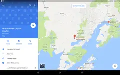
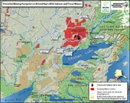

 It just happens to be the map I randomly selected to show a better picture of the watershed to contrast to Reed's map. I'm pretty sure Trout Unlimited (TU) did not draw a special map showing a fictitious river system just to support their cause. You can be skeptical of TU, but the post--it is just a map.


Similar threads


Users who are viewing this thread
Sponsored Vendors
View all →













Latest Discussions
-

-

-
-
 THE Random Chat Thread - AKA "The RCT" - No shirt or shoes required - Open 24 / 7
- Latest: ConceptualizedNetherlandr
-
