
You are using an out of date browser. It may not display this or other websites correctly.
You should upgrade or use an alternative browser.
You should upgrade or use an alternative browser.
SATELLITE IMAGES
- Thread starter Salvor6
- Start date
Au_Dreamers
Hero Member
- Joined
- Dec 15, 2010
- Messages
- 989
- Reaction score
- 671
- Golden Thread
- 0
- Location
- back on the 1715!!
- Primary Interest:
- All Treasure Hunting
and oddly as I've posted to this before.
Not once nor have they ever been willing to utilize the largest permitted treasure recovery operation in the USA (World?) of the 1715 fleet salvors.
It's this simple. The challenge;
The weather has broken for the good, there will be westerly winds for another week but still many days after that for a continued season.
With GPS coords there could be about a dozen boats or one digging up located treasure and you guys would have wealth enough to overcome your barriers to recover your own treasures or just license it out for millions and millions while you sit at home typing on your computer.
IF your system works...
But interesting a friend sent me a message about "Mysteries of the Deep" They are identifying shipwrecks on lake Nemi in Italy with satellites that side-scan sonar can't pick up.
But that is still far away from identifying treasure types on the ocean bottom or buried in the earth.
So...
I know Pete, I like Pete
Pete knows me, I think he likes me...
If not, I'm sure Bill or John will take him out!
-cheers
Not once nor have they ever been willing to utilize the largest permitted treasure recovery operation in the USA (World?) of the 1715 fleet salvors.
It's this simple. The challenge;
The weather has broken for the good, there will be westerly winds for another week but still many days after that for a continued season.
With GPS coords there could be about a dozen boats or one digging up located treasure and you guys would have wealth enough to overcome your barriers to recover your own treasures or just license it out for millions and millions while you sit at home typing on your computer.
IF your system works...
But interesting a friend sent me a message about "Mysteries of the Deep" They are identifying shipwrecks on lake Nemi in Italy with satellites that side-scan sonar can't pick up.
But that is still far away from identifying treasure types on the ocean bottom or buried in the earth.
So...
I know Pete, I like Pete
Pete knows me, I think he likes me...
If not, I'm sure Bill or John will take him out!
-cheers

Blak bart
Platinum Member
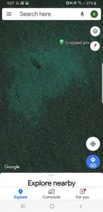
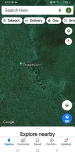
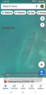
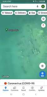
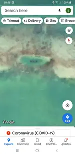
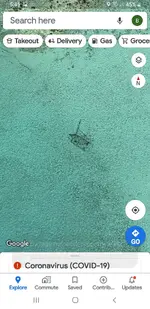
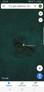
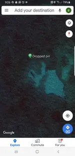
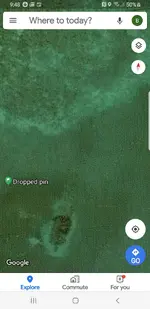
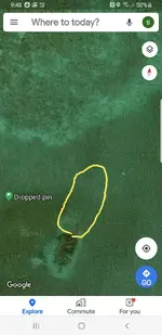
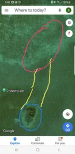

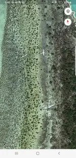 ....alright...alright I'll stop ! I got my own satellite guy.....me ! Plenty of stuff to go check and look at !! I stopped for a couple years because of the permit shenanigans with the state. But I'm back and going to film all my wreck finds....thinking of a snorkeling youtube video series on easy wrecks to reach for snorkeling. The one with the highlights I've been looking at.....its pretty cool. Mid to late 1800s large hogshead barrels have rotted and left the cargo solidified into barrel shaped conglomerates !! Lots of glass ballast and some wood.....Irma really peeled back some layers as this particular wreck was not showing before irma.....I know because I looked several times for it before the hurricane.....there it was in plain sight after the storm !! It's a simple process......find it on sat....mark it.....drive to it and check......in ten minutes it's a yes or no. I also use the sat to check bottom conditions at my known beach spots....if the sand has shifted I go hunt.
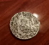 so far careful observation of the ultra shallow spots on the flat has paid off this spring !! What I'm saying is I have plenty good luck finding stuff from the sats it's been pretty quick and easy to do and a heck of a lot of fun for me and a few other t-net guys to explore !!
Attachments
D
Deleted member 102095
Guest
Coin
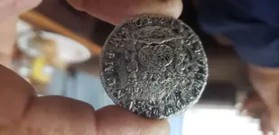
What is the detail on the back of the coin like?
What is the detail on the back of the coin like?

Red_desert
Gold Member
- Joined
- Feb 21, 2008
- Messages
- 7,500
- Reaction score
- 4,367
- Golden Thread
- 0
- Location
- Midwest USA
- Detector(s) used
- Garrett Ace 250/GTA 1,000; Fisher Gold Bug-2; Gemini-3; Unique Design L-Rods
- Primary Interest:
- All Treasure Hunting
According to the scientist I'd had contact with...
"uperior to the Landsat series, for most mineral mapping, because its sensors have a much smaller bandwidth.
Band No. Spectral Range (μm)
1 0.52-0.60 visible range
2 0.63-0.69
3N 0.78-0.86
3B 0.78-0.86
4 1.60-1.70 Near IR range (reflected light)
5 2.145-2.185
6 2.185-2.225
7 2.235-2.285
8 2.295-2.365
9 2.360-2.430
10 8.125-8.475 Extended IR range (from self emission - absorbed heat)
11 8.475-8.825
12 8.925-9.275
13 10.25-10.95
14 10.95-11.65
While the Landsat satellite system also has IR sensor they don't go as far into the IR as do the Aster series satellites. But the Landsat system has higher resolution than the Aster series does but the images are over a gigabyte in size. The 3B sensor is a back looking sensor used to provide 3D views in the visible spectrum.
You can find more about these sensors at this link: http://asterweb.jpl.nasa.gov/content...r_guide_v2.pdf
It takes several hours to find a suitable image that doesn't have any clouds in it and then translate and combine the package into a multi-layered image. Then after all this is finished the algorithm can be run in a few minutes (if you have a very fast multi-processor computer).
As far as gold emission goes there are very detailed wavelength tables for gold in the "Handbook of Chemistry and Physics". When you build your algorithm you need to take into consideration the fact that gold laying on the ground does not have a highly polished surface (which exhibits highly directional reflection) but instead the surface is pitted and generally coated with a clear varnish (from being exposed to the elements for years - this coating is so bad when I drop a gold placer into a fresh batch of aqua-rega nothing happened because the acid couldn't get to the gold surface). This pitting usually makes the gold placers/flakes reflect light in a unidirectional directional (failry evenly with angle). Generally a placer will exhibit less than 20% reflection and one that has a thin dust coating under 5%.
An algorithm to find such materials looks for similar emissions/reflections withing 2% between the various bands down to 1 um where the reflection starts to drop (refer to the Handbook of Chemistry and Physics). The reflection of gold continues to drop somewhat evenly across the visible spectrum so the algorithm also looks for the drop ratio between bands 4, 3N, 2, and 1. Such an algorithm is very comples and requires many steps and resulting images.
Another way to build your algorithm is to select four bands and produce maps from the rations of the three products. For this type of algorithm you would divide three IR bands by the lowest visible band (which would be band 1). For this type of algorithm you would use the Landsat satellite system as the Aster series does not have a blue sensor like the Lamdsat does. The ration of the reflectivity for gold between blue light and any of the IR bands is very high. So if you used the Landsat series you would produce an image from the division of band 7 and band 1 (ie: 7/1). Then produce a second image from bands 5 and 1, and a third image from bands 4 and 1. Then assemble these three layers into a single image and assign the 7/1 band as the Red layer, the 5/1 as the Green layer, and the 4/1 image as the Blue layer of the new image. Then the resulting false color image, which will be devoid of most of the topological information, will show surface gold as white dots.
You need to be careful when you analyze these images for you can get white dots over habitated areas (mostly from the trash and junk in peoples yards) but this is generally not a problem in open areas where people don't live or trash.
These images are quite large, generally 300 megs per layer. The division usually requires 30 billion division calculations per layer or over 100 billion calculations to produce a false color image.
If you want to a simple introduction to false color satellite mineral maps start with this link: Satellite Mineral Images
The gold reflectance algorithm is an extremely simple one that doesn't require and research or testing. Algorithms to find mineral fields are far more difficult to develop.
Another word of caution these satellites can't see anything smaller than 30' so you are looking for an outcropping of a thick vein lode gold deposit they will never see it however they will see the alteration zone where the deposit was formed, so in this case you would not look for gold at all but rather an alteration zone. For micron gold you use yet another different algorithm.
I hope this answered your question."
"uperior to the Landsat series, for most mineral mapping, because its sensors have a much smaller bandwidth.
Band No. Spectral Range (μm)
1 0.52-0.60 visible range
2 0.63-0.69
3N 0.78-0.86
3B 0.78-0.86
4 1.60-1.70 Near IR range (reflected light)
5 2.145-2.185
6 2.185-2.225
7 2.235-2.285
8 2.295-2.365
9 2.360-2.430
10 8.125-8.475 Extended IR range (from self emission - absorbed heat)
11 8.475-8.825
12 8.925-9.275
13 10.25-10.95
14 10.95-11.65
While the Landsat satellite system also has IR sensor they don't go as far into the IR as do the Aster series satellites. But the Landsat system has higher resolution than the Aster series does but the images are over a gigabyte in size. The 3B sensor is a back looking sensor used to provide 3D views in the visible spectrum.
You can find more about these sensors at this link: http://asterweb.jpl.nasa.gov/content...r_guide_v2.pdf
It takes several hours to find a suitable image that doesn't have any clouds in it and then translate and combine the package into a multi-layered image. Then after all this is finished the algorithm can be run in a few minutes (if you have a very fast multi-processor computer).
As far as gold emission goes there are very detailed wavelength tables for gold in the "Handbook of Chemistry and Physics". When you build your algorithm you need to take into consideration the fact that gold laying on the ground does not have a highly polished surface (which exhibits highly directional reflection) but instead the surface is pitted and generally coated with a clear varnish (from being exposed to the elements for years - this coating is so bad when I drop a gold placer into a fresh batch of aqua-rega nothing happened because the acid couldn't get to the gold surface). This pitting usually makes the gold placers/flakes reflect light in a unidirectional directional (failry evenly with angle). Generally a placer will exhibit less than 20% reflection and one that has a thin dust coating under 5%.
An algorithm to find such materials looks for similar emissions/reflections withing 2% between the various bands down to 1 um where the reflection starts to drop (refer to the Handbook of Chemistry and Physics). The reflection of gold continues to drop somewhat evenly across the visible spectrum so the algorithm also looks for the drop ratio between bands 4, 3N, 2, and 1. Such an algorithm is very comples and requires many steps and resulting images.
Another way to build your algorithm is to select four bands and produce maps from the rations of the three products. For this type of algorithm you would divide three IR bands by the lowest visible band (which would be band 1). For this type of algorithm you would use the Landsat satellite system as the Aster series does not have a blue sensor like the Lamdsat does. The ration of the reflectivity for gold between blue light and any of the IR bands is very high. So if you used the Landsat series you would produce an image from the division of band 7 and band 1 (ie: 7/1). Then produce a second image from bands 5 and 1, and a third image from bands 4 and 1. Then assemble these three layers into a single image and assign the 7/1 band as the Red layer, the 5/1 as the Green layer, and the 4/1 image as the Blue layer of the new image. Then the resulting false color image, which will be devoid of most of the topological information, will show surface gold as white dots.
You need to be careful when you analyze these images for you can get white dots over habitated areas (mostly from the trash and junk in peoples yards) but this is generally not a problem in open areas where people don't live or trash.
These images are quite large, generally 300 megs per layer. The division usually requires 30 billion division calculations per layer or over 100 billion calculations to produce a false color image.
If you want to a simple introduction to false color satellite mineral maps start with this link: Satellite Mineral Images
The gold reflectance algorithm is an extremely simple one that doesn't require and research or testing. Algorithms to find mineral fields are far more difficult to develop.
Another word of caution these satellites can't see anything smaller than 30' so you are looking for an outcropping of a thick vein lode gold deposit they will never see it however they will see the alteration zone where the deposit was formed, so in this case you would not look for gold at all but rather an alteration zone. For micron gold you use yet another different algorithm.
I hope this answered your question."
Last edited:
Red_desert
Gold Member
- Joined
- Feb 21, 2008
- Messages
- 7,500
- Reaction score
- 4,367
- Golden Thread
- 0
- Location
- Midwest USA
- Detector(s) used
- Garrett Ace 250/GTA 1,000; Fisher Gold Bug-2; Gemini-3; Unique Design L-Rods
- Primary Interest:
- All Treasure Hunting
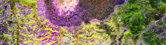
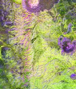
This is what you could expect to see. The darker especially purple colors show areas of erosion. At top center is a northwest flowing canyon which sits on top of a 15 mile long ridge of mineralized alteration zone, a place you might look for gold veins.
Last edited:
Red_desert
Gold Member
- Joined
- Feb 21, 2008
- Messages
- 7,500
- Reaction score
- 4,367
- Golden Thread
- 0
- Location
- Midwest USA
- Detector(s) used
- Garrett Ace 250/GTA 1,000; Fisher Gold Bug-2; Gemini-3; Unique Design L-Rods
- Primary Interest:
- All Treasure Hunting
See if I can load whole image.

ScubaFinder
Bronze Member
Good work as usual Red Desert! Gold prospecting has come a long way, your method would only show gold as white dots if the gold was on the surface, correct?
Jason
Jason

Red_desert
Gold Member
- Joined
- Feb 21, 2008
- Messages
- 7,500
- Reaction score
- 4,367
- Golden Thread
- 0
- Location
- Midwest USA
- Detector(s) used
- Garrett Ace 250/GTA 1,000; Fisher Gold Bug-2; Gemini-3; Unique Design L-Rods
- Primary Interest:
- All Treasure Hunting
There is a lot of input a scientist can give you, from my very limited understanding of it, quartz rock and veins will show up as white with these settings.Good work as usual Red Desert! Gold prospecting has come a long way, your method would only show gold as white dots if the gold was on the surface, correct?
Jason
Red_desert
Gold Member
- Joined
- Feb 21, 2008
- Messages
- 7,500
- Reaction score
- 4,367
- Golden Thread
- 0
- Location
- Midwest USA
- Detector(s) used
- Garrett Ace 250/GTA 1,000; Fisher Gold Bug-2; Gemini-3; Unique Design L-Rods
- Primary Interest:
- All Treasure Hunting
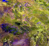
Jason, this IR satellite image from the Superstition mountains in Arizona, should answer your question. In the bottom left corner are some very bright spots. These probably come from aluminum junk in peoples yards. Needles canyon area, is off the top left comes into view above bright spots on bottom left. Very bright diamond shape above and right, is the only known alteration zone in Superstition Mts which has produced very thick quartz veins.

Salvor6
Silver Member
- Joined
- Feb 5, 2005
- Messages
- 3,793
- Reaction score
- 2,189
- Golden Thread
- 0
- Location
- Port Richey, Florida
- Detector(s) used
- Aquapulse, J.W. Fisher Proton 3, Pulse Star II, Detector Pro Headhunter, AK-47
- Primary Interest:
- Shipwrecks
- #33
Thread Owner
Red Desert what is that black spot left of center? Is it a lake?
Blak bart
Platinum Member
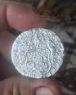
..... I keep my eye trained on the same spots for years on end. In this shot you can see where the sand has been swept away to hard scrubby bottom.....hunting in the deep sand is not productive.....mother nature is my mailbox blower.....just have to look where mother nature is already moving sand. If you hunt the rocky pot hole bottom you will obviously see alot more than swimming over bottom that's covered in many feet of sand. So watch your spots and check them when you see a change. This spot has been getting swept cleaner and cleaner since Irma. And now as we scan the bottom closer many things that were buried for many years are exposed in these areas....the key is to get on them and check immediately before the sand shifts again.....it might be another 100 years before the sand shifts again...or it might shift tomorrow ?? Who knows ?? Now take a closer look !!!! 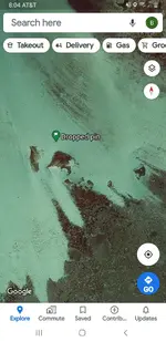
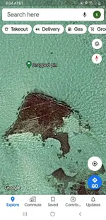 is it a wreck ?? Is it modern rubble ?? Is it lobster habitat ?? Who knows but after years of looking the red circled area looks alot like what I've learned is ballast.
 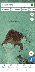 One thing is certain.....well soon know exactly what it is. Someone may go and check it today...because there excited to go look....or I'll go and look this weekend. I have more fun doing these missions and have been quite successful at finding wrecks of all ages and types. Even when they dont pan out as wrecks they usually are something that holds fish or lobster or both. I'll be driving around with another t-netter on sunday checking some of these anomalies !! Wooo hooo. Man it's a lot of fun !! Water is off the chain beautiful right now too !!
is it a wreck ?? Is it modern rubble ?? Is it lobster habitat ?? Who knows but after years of looking the red circled area looks alot like what I've learned is ballast. One thing is certain.....well soon know exactly what it is. Someone may go and check it today...because there excited to go look....or I'll go and look this weekend. I have more fun doing these missions and have been quite successful at finding wrecks of all ages and types. Even when they dont pan out as wrecks they usually are something that holds fish or lobster or both. I'll be driving around with another t-netter on sunday checking some of these anomalies !! Wooo hooo. Man it's a lot of fun !! Water is off the chain beautiful right now too !!
Last edited:

Kray Gelder
Gold Member
- Joined
- Feb 24, 2017
- Messages
- 7,064
- Reaction score
- 12,562
- Golden Thread
- 0
- Location
- Georgetown, SC
- Detector(s) used
- Fisher F75
- Primary Interest:
- Metal Detecting
Call me skeptical. Does this person in the Philippines have a personal satellite? You say real time. Tasking a satellite for personal use would cost a small fortune. What is the technology? Spotting coins and Jems from space? Can't do it. What's with the color image, and what does it mean? I can't believe this claim without a much better explanation. Not that it matters if I believe it.
Kray Gelder
Gold Member
- Joined
- Feb 24, 2017
- Messages
- 7,064
- Reaction score
- 12,562
- Golden Thread
- 0
- Location
- Georgetown, SC
- Detector(s) used
- Fisher F75
- Primary Interest:
- Metal Detecting
I have heard and read where current tech, bare earth DEMS ( where avaliable ), LIDAR, sonars, towed magnetometers, and sat images have been a real help, as Blak Bart attests to. I don't think we're down to inches of resolution, plus IDing the target mineral content at the same time. I welcome being corrected.
Salvor6
Silver Member
- Joined
- Feb 5, 2005
- Messages
- 3,793
- Reaction score
- 2,189
- Golden Thread
- 0
- Location
- Port Richey, Florida
- Detector(s) used
- Aquapulse, J.W. Fisher Proton 3, Pulse Star II, Detector Pro Headhunter, AK-47
- Primary Interest:
- Shipwrecks
- #37
Thread Owner
In 1962 President John F. Kennedy boasted that we have satellites that can read a license plate on a car in Moscow. That was almost 60 years ago. What do you think they have now? I have a buddy whos neighbor works for Homeland Security. He has access to a satellite that can see individual coins buried in the sand. I think he said it is SIR-C synthetic aperature radar. You have no idea what the gov. has top secret satellites now. I don't know what technology the satellite guy uses and I don't ask so it doesn't look like I am trying to go behind his back. He doesn't charge anything. He just asks that you send 10% of whatever you find. That is good for me.

ARC
Emerald Member
- Joined
- Aug 19, 2014
- Messages
- 40,567
- Reaction score
- 151,010
- Golden Thread
- 0
- Location
- Tarpon Springs
- Detector(s) used
- JW 8X-ML X2-VP 585
- Primary Interest:
- All Treasure Hunting
Lidar is revolutionizing discovery as we speak.
Satellite images are great... and getting better all the while.
Lidar just stepped over satellite tech and took imaging to a whole new level.
Satellite images have been instrumental in a new era of exploration... leading to countless new discoveries...
But... Lidar is... and has been uncovering discoveries a satellite could never... and will never... see to begin with.
So...As for a tech for "uncovering" or "seeing" what the naked eye cannot... Lidar blows doors.
Just thought I would throw that in there... and is solely based on... My opinion :P
Satellite images are great... and getting better all the while.
Lidar just stepped over satellite tech and took imaging to a whole new level.
Satellite images have been instrumental in a new era of exploration... leading to countless new discoveries...
But... Lidar is... and has been uncovering discoveries a satellite could never... and will never... see to begin with.
So...As for a tech for "uncovering" or "seeing" what the naked eye cannot... Lidar blows doors.
Just thought I would throw that in there... and is solely based on... My opinion :P
Last edited:
Red_desert
Gold Member
- Joined
- Feb 21, 2008
- Messages
- 7,500
- Reaction score
- 4,367
- Golden Thread
- 0
- Location
- Midwest USA
- Detector(s) used
- Garrett Ace 250/GTA 1,000; Fisher Gold Bug-2; Gemini-3; Unique Design L-Rods
- Primary Interest:
- All Treasure Hunting
I looked at that area in Google Earth. I saw a lot of holes and caves with steep cliff sides. The spot is just on the edge of alteration zone. The quartz vein forming zone has 4 ends which oddly enough form the 4 cardinal points of the compass. The black spot is between the west and south ends.Red Desert what is that black spot left of center? Is it a lake?
Red_desert
Gold Member
- Joined
- Feb 21, 2008
- Messages
- 7,500
- Reaction score
- 4,367
- Golden Thread
- 0
- Location
- Midwest USA
- Detector(s) used
- Garrett Ace 250/GTA 1,000; Fisher Gold Bug-2; Gemini-3; Unique Design L-Rods
- Primary Interest:
- All Treasure Hunting
I typed in the scientist's name, he lived in Phoenix at the time. His name is Roger Brown Ph D who did these satellite images. Found another scientist with same last name in Arizona, both look like they could be brothers.
Robert Brown
Professor Emeritus
Dr. Brown's research interests center on observational, theoretical, and laboratory studies of planetary surfaces and surface processes.
His recent work has focused on: models of processes acting on icy surfaces in the outer solar system, the surface composition and geology of Saturn's Titan, the design and construction of advanced spacecraft instrumentation, determination of the chemical and isotopic composition of icy surfaces, laboratory/theoretical studies of evaporative isotopic fractionation on comets and icy satellites and spacecraft studies of the outer solar system.
Of particular interest in his research are Titan and the rest of Saturn's icy moons.
Ph.D., 1982, University of Hawaii
Years with LPL: 1996 to present
https://www.lpl.arizona.edu/faculty/brown
Robert Brown
Professor Emeritus
Dr. Brown's research interests center on observational, theoretical, and laboratory studies of planetary surfaces and surface processes.
His recent work has focused on: models of processes acting on icy surfaces in the outer solar system, the surface composition and geology of Saturn's Titan, the design and construction of advanced spacecraft instrumentation, determination of the chemical and isotopic composition of icy surfaces, laboratory/theoretical studies of evaporative isotopic fractionation on comets and icy satellites and spacecraft studies of the outer solar system.
Of particular interest in his research are Titan and the rest of Saturn's icy moons.
Ph.D., 1982, University of Hawaii
Years with LPL: 1996 to present
https://www.lpl.arizona.edu/faculty/brown
Last edited:


Featured Treasure Finds
Featured Treasure Finds
Similar threads
- Replies
- 0
- Views
- 214
Users who are viewing this thread
Total: 1 (members: 0, guests: 1)













Latest Discussions
-
-
Gold Coin Discovery Using Specialized Geochemical Formulas
- Latest: MR.MHMD(MOHAMMAD)
-

-
-

-