What's new

Survey project planning going on....

ropesfish

Bronze Member
🥇 Charter Member
Joined
Jun 3, 2007
Messages
1,304
Reaction score
2,307
Golden Thread
0
Location
Sebastian, Florida
Detector(s) used
A sharp eye, an AquaPulse and a finely tuned shrimp fork.
Primary Interest:
Shipwrecks
I am contemplating a project at the moment with magnetometer(s), sidescan or multibeam and sub-bottom profiler to map a series of known shipwrecks that have been surveyed piecemeal by different operators using different equipment with different parameters in different decades...actually, different centuries. The results range from useless to quite valuable, but since the information is held closely by the owners for decades, who really know what is out there? I have heard for years about mag surveys done here and there and everywhere, but it is hard to know the who/what/when/where/how of it all.
There is no centalized archive or one vendor that a contractor/subcontractor can contract with to make use of the results so it seems like one big project is in order with the end result being a definitive geophysical survey of the area.
Phase 1 of the project will be +/- 44 sq nautical miles in 2 -10 sq nm bites.
Phase 2 will be in the neighborhood of 100 square miles.
For the 2 mags, MB sonar and a sub-bottom profiler we are looking at $200K in equipment, 4 small, cheap autonomous surface vessels, Sampson for a mobile operations center as well as Showdown for a chase boat and a couple of aerial drones. That is about a 200,000ish dollar survey of the area using a half million in assets. (This stuff ain't cheap).
What is the possible payoff? $500,000,000, we think.
How do we make the best use of the results? (You can't dig em all yourself) Partner with other salvors on a cash or (more likely) percentage-of-finds arrangement.
What are the odds of making the investment money back? IMHO, 70%.
What are the odds of making a Major Find ($10 million or more)? IMHO 60-70%.
What are the odds of finding the 20-40 tons of silver that is believed to be still missing? I think 40-50%.
Why would a 70 year old guy want to start a project that might not pay off while he's still mobile? I started this quest late in life. I've been at this, pretty much 24.7.365 for 12 or 13 years. Just because I can't be standing on the boat when the pile comes up doesn't mean it's any less important to me.
What do YOU think?
>> I do have to add that I had originally written this as a reply to another thread "MB and SS Bathymetry, AIS, VIIRS, visible satellite, IR satellite to find undocumented and potentially valuable shipwrecks." , but realized that I still have little idea what that thread was about so I just posted it as a standalone.

<reason for edit -my late night ramblings often need grammar check, spelcheck, accuracy check and either deletion or expansion>
 
Last edited:
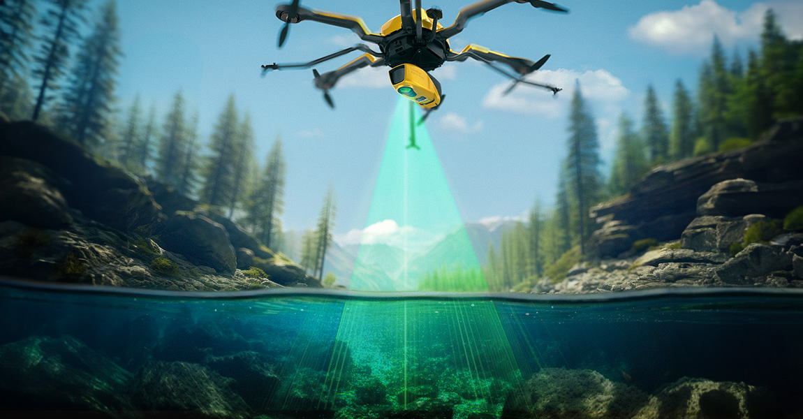
I am not sure where 3RDLIFE found all the fancy names that maybe he thinks they are applicable to searching for shipwrecks but he is going down the wrong path. I see that he is a new member. There are tried and true technology that is used to detect shipwrecks which Ropefish has mentioned.
I think he might have read about some university that is using lidar or IR to detect Inca ruins in a jungle but not underwater.
 
LIDAR would be a great tool for clear waters, but I've gone months in our area without good viz. Waiting around for that ONE day would be a budget killer:
 
Regular land lidar "camera" for a drone starts around $30K, 532 nm lidar "camera" for bottom scanning starts around $200K. There's a great lidar map of the ocean off of Ft Lauderdale/Dania area showing all kinds of detail--but you need clear water. I think some will do 2X Sechi disk. (it's a round disk about a foot in diameter, divided into four black/white quadrants, used to measure visibility).
 
Last edited:

Regular land lidar "camera" for a drone starts around $30K, 532 nm lidar "camera" for bottom scanning starts around $200K. There's a great lidar map of the ocean off of Ft Lauderdale/Dania area showing all kinds of detail--but you need clear water. I think some will do 2X Sechi disk. (it's a round disk about a foot in diameter, divided into four black/white quadrants, used to measure visibility).
Heyyyy Denniss! I was just thinking about you earlier.
We were discussing building some DIY weather buoys to keep track of local conditions on the wreck sites instead of have to figure out what our old favorite NOAA Buoy 41114's readings actually mean in Sebastian! Come by Sampson sometime and visit if I am there, just look around if I'm not!!
 
My question is what would you hope to see using Lidar? Reef area? Ballast pile? Cannon laying on a flat bottom? Anchor? I assume you are looking for a wooden 1500 to 1800 shipwreck.
 
My question is what would you hope to see using Lidar? Reef area? Ballast pile? Cannon laying on a flat bottom? Anchor? I assume you are looking for a wooden 1500 to 1800 shipwreck.
That is sort of why I want to take a complete approach to this survey which, of course, will be on the 1715 Fleet to start with. If we have survey results for all these instruments (magnetometer, sidescan and/or multibeam sonar, LIDAR, hi def optical camera, IR camera or some other sensing tech that I have not heard of yet and put them on our present maps as layers I think that we can learn more than it we just had a paper map. If you are not familiar with layers in Autocad or DigFindR - "In AutoCAD, layers are used to organize and manage drawing objects, similar to transparent sheets stacked on top of each other. Each layer can have unique properties like color, linetype, and visibility, allowing for efficient control over how objects are displayed and plotted. " So if I happen to see some bottom feature that correlates to another feature that in other places has indicated coins...maybe I should go look there.
 
I fully understand your layered approach. I am not sure what the depth of sand is in the area of your search, I am surprised that more people don't mention the use of sub bottom profiler in shallower sand areas. The resolution gets down to cm's. Small footprint but once you have established an artifact trail it seems to me that it would be extremely efficient at detecting smaller objects. I will use sub bottom to detect 5 tons of golden in 3 feet of sand.

The sub-bottom profiler​

The classic instrument for detecting bottom layers and sub-bottom objects is the sub-bottom profiler (SBP), or shallow seismic system. We distinguish the pinger, boomer and sparker type instrument, based on their acoustic source.

The pinger (e.g. General Acoustics, Tritech) is effectively a very low frequency echosounder that offers good resolution at the cost of less penetration. Modern versions use CHIRP (Compressed High Intensity Radar Pulse) signals, which offer an extended range and even higher resolution. This type of SBP is often used to detect relatively shallow objects, for example in the form of a pipetracker for pipeline and cable detection. The CHIRP pinger SBP is sometimes combined with a side-scan sonar (SSS) in a single tow fish, allowing surface and sub-bottom data to be collected simultaneously (see separate article for SSS). A very special form of pinger type SBP is the parametric echosounder (e.g. Innomar, Kongsberg). This instrument combines the bottom detection accuracy of a single beam echosounder at high frequency with the penetration of a low-frequency pinger SBP. The main downside is that the amount of low frequency energy is generally less than in a traditional pinger or CHIRP SBP.
 
Heyyyy Denniss! I was just thinking about you earlier.
We were discussing building some DIY weather buoys to keep track of local conditions on the wreck sites instead of have to figure out what our old favorite NOAA Buoy 41114's readings actually mean in Sebastian! Come by Sampson sometime and visit if I am there, just look around if I'm not!!
Where's the Sampson located, I'd like to see it
 
Bill-

Again, you show what a REAL, PROFESSIONAL, TECH SAVVY operator is in a field of "work harder, not smarter" profession. ( Not directed at ANYONE, just a general observation of the world in general)...

I think you are on to a real winner with this plan. As always, I'm so broke I can't pay attention, but if I can be of help in any way, just pick up the phone.

Kurt
 
I am contemplating a project at the moment with magnetometer(s), sidescan or multibeam and sub-bottom profiler to map a series of known shipwrecks that have been surveyed piecemeal by different operators using different equipment with different parameters in different decades...actually, different centuries. The results range from useless to quite valuable, but since the information is held closely by the owners for decades, who really know what is out there? I have heard for years about mag surveys done here and there and everywhere, but it is hard to know the who/what/when/where/how of it all.
There is no centalized archive or one vendor that a contractor/subcontractor can contract with to make use of the results so it seems like one big project is in order with the end result being a definitive geophysical survey of the area.
Phase 1 of the project will be +/- 44 sq nautical miles in 2 -10 sq nm bites.
Phase 2 will be in the neighborhood of 100 square miles.
For the 2 mags, MB sonar and a sub-bottom profiler we are looking at $200K in equipment, 4 small, cheap autonomous surface vessels, Sampson for a mobile operations center as well as Showdown for a chase boat and a couple of aerial drones. That is about a 200,000ish dollar survey of the area using a half million in assets. (This stuff ain't cheap).
What is the possible payoff? $500,000,000, we think.
How do we make the best use of the results? (You can't dig em all yourself) Partner with other salvors on a cash or (more likely) percentage-of-finds arrangement.
What are the odds of making the investment money back? IMHO, 70%.
What are the odds of making a Major Find ($10 million or more)? IMHO 60-70%.
What are the odds of finding the 20-40 tons of silver that is believed to be still missing? I think 40-50%.
Why would a 70 year old guy want to start a project that might not pay off while he's still mobile? I started this quest late in life. I've been at this, pretty much 24.7.365 for 12 or 13 years. Just because I can't be standing on the boat when the pile comes up doesn't mean it's any less important to me.
What do YOU think?
>> I do have to add that I had originally written this as a reply to another thread "MB and SS Bathymetry, AIS, VIIRS, visible satellite, IR satellite to find undocumented and potentially valuable shipwrecks." , but realized that I still have little idea what that thread was about so I just posted it as a standalone.

<reason for edit -my late night ramblings often need grammar check, spelcheck, accuracy check and either deletion or expansion>
I was taking care of a wise elderly man. Before he passed, he made sure he gave me some interesting stuff. One is the gps mapping and different books that coordinate where he has been with his yacht. I have pictures of coins being washed on a riverbank he dredged out with a shop vac. I even got the old shop vac. This stuff I have contains valuable knowledge. I hate water so I doubt I'm going hunting for it anytime soon...
 
I was taking care of a wise elderly man. Before he passed, he made sure he gave me some interesting stuff. One is the gps mapping and different books that coordinate where he has been with his yacht. I have pictures of coins being washed on a riverbank he dredged out with a shop vac. I even got the old shop vac. This stuff I have contains valuable knowledge. I hate water so I doubt I'm going hunting for it anytime soon...
I have used a wet vac for many things, but never (yet) a dredge!
 

Users who are viewing this thread

Back
Top Bottom