The Pearl Ship

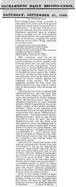
In an article from the Los Angeles Herald, 1 October 1892 (Volume 38, Number 173), referenced by Old Bookaroo in the “Peg Leg Smith Chronicles” in the Peg Leg Smith” thread, the last sentence says “Mr. Converse having passed through the locality in a boat during the overflow into Salton sea.” Since there doesn’t seem to be any unusual stress or commentary on this statement, it indicates to me that the overflow was not a very unusual occurrence, and would reinforce the feeling that overflows did occur, and may not have been all that uncommon.. Also, note in the directions to Hank Brandt’s mine “ A petrified ship will be found in this canyon. At present, all that remains is curving line of ship's beam and petrified pieces of wood.” Could this be the lost Viking (or Phoenician) ship? The description seems close to what Myrtle Botts describes. PLL did mention the Hank Brandt connection in passing, but I thought I would add it here to emphasize the possibility.

Hey Shortfinger,

Hank Brandt's Mine is another Anza-Borrego Story I spent a long time chasing. I followed the trail described in most versions of the story. I started where the railroad used to end in Plaster City and headed North. Found oyster shells and petrified palms. The dry lake with two trees could be a couple of places, but the multicolored canyon that led into the mountains is on Fish Creek Mt not Superstition. Most of the known stories place it in the Superstition Hills (just East of Fish Creek Mt). I never spent a lot of time on the South side (too many people for too many years have been all over the South Side). The North side (in the Carrizo Impact Area) was virtually untouched. I spent a lot of time exploring there. No Hank Brandt Mine. There is a 1960s article in Desert Magazine that describes how someone found Hank Brandt's Mine on top of Fish Creek Mt. I found the spot they showed in the pics, but that wasn't it. Looked like a made up story for magazine sales.

Mike
 

Gollum, I found this on the net about a mine in the Fish Creek mountains. It looks like this may have been what the people in Desert Magazine found… if they found anything and the story wasn’t just made up. No gold, just Manganese. Hanks Lost Mine prospect, Fish Creek Mts, Imperial Co., California, USA I spent some time up in the Fish Creek wash area, through Split Mountain, but never really did a lot of looking in those mountains. There is a lot of petrified wood in that area, but, of course, it’s all state park, so you can’t collect it.
 

Hey Shortfinger,

Hank Brandt's Mine is another Anza-Borrego Story I spent a long time chasing. I followed the trail described in most versions of the story. I started where the railroad used to end in Plaster City and headed North. Found oyster shells and petrified palms. The dry lake with two trees could be a couple of places, but the multicolored canyon that led into the mountains is on Fish Creek Mt not Superstition. Most of the known stories place it in the Superstition Hills (just East of Fish Creek Mt). I never spent a lot of time on the South side (too many people for too many years have been all over the South Side). The North side (in the Carrizo Impact Area) was virtually untouched. I spent a lot of time exploring there. No Hank Brandt Mine. There is a 1960s article in Desert Magazine that describes how someone found Hank Brandt's Mine on top of Fish Creek Mt. I found the spot they showed in the pics, but that wasn't it. Looked like a made up story for magazine sales.

Mike

Mike...are you planning any trips to the desert, I assume in the fall or winter. I am
working on a TI method for finding surface gold, but I would never go there alone. If you want company, I would be interested.
Bob
 

I thought I would share... I am reading a book right now about the island myth of California and in it the author remarks that during the second half of the 16th century there were many private pearling operations in the gulf of california but that there's little to no record of their details because they weren't govt. sponsored. Apparently one Baltasar De ObregĂłn, who sailed to the gulf of CA with his father on several occasions, describes the head of the gulf as being tidal. He claimed that at high tide the gulf extended past the mouth of the Colorado in a chronicle he wrote in 1583. I believe this "high tide" may actually be the flooding of the salton sink during the periodic shifts in the Colorado rivers course as was once the case. In this same book another Spaniard, whose name I forget, claimed to have reached 34 degrees N latitude in the gulf. The author dismisses both these accounts and the book is about a broader topic but I imagine if such a ship or ships exist that they likely originate from these earlier private enterprises and not the Cardone/Iturbe venture. From what I recall Iturbe & his ship were all accounted for and Cardone (is that his name?) does not mention a lost ship in his book "Hydrographical Description.." According to my research at least, the only place Iturbe's lost ship is mentioned is in "The Journey of the Flame" which is a work of fiction. I have committed much time & study to this story and am a bit of amateur expert, if I may say so, on 16th & early 17th century history. I'd love to participate if anyone mounts an expedition.
 

Hi surreal pillow welcome to the forum
it was not a high tide but a high tidal bore. it was dangerous enough to sink ships. I forget the name of the passenger carrying steam ship it sank in the 1800's. On average it was a 6ft bore that traveled over 40 miles up river. but when the weather conditions were right it could get higher than thirty feet. before the American's began keeping the lower colorado in what is now considered its main channel. the river would in flood times dam itself and change channels so that sometimes it would flow down the east side of the delta, sometimes the west, sometimes into laguna salada and sometimes into the salton sink. although the sink is below sea level the level of the lake when it was full with the river flowing in, was above sea level. Nicholas De Cardona never made it to the head of the gulf. I do not remember its been so long since i read it. But did he even mention the ship he lost to Joris Von Speilbergen in his book? It is after Speilbergen gets back to Europe with his captured spanish maps that California started appearing as an Island in european maps.

btw according to bancroft's history of the northwest coast vol.1 pg 102 chapter on california an Island. Bancroft says that Nicolas de Cardona promoted the idea that California was an Island
 

Last edited:
Hi folks, it been a while but I'm back wondering about this ship, you would think by now I should have tried to check on the location I mentioned in this thread previously.

Last time I attempted to post pictures of my satallite findings but failed. Here I go again. I tried Makin a u tube video jus to show the pictures .
Watch "Lost ship in mojave desert" on YouTube
Lost ship in mojave desert:
 

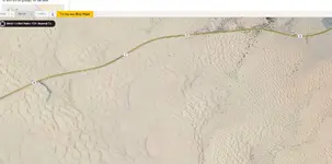
Does this look familiar to anyone? I will say this, this object 8s located on the west side of the salty sea. I'm excited to find out what this truly is. To me it reminds me of that old photograph, that shows a ship mast no one could ever relocate. I believe I've at least found that.
 

Last edited:
Does this look familiar to anyone? I will say this, this object 8s located on the west side of the salty sea. I'm excited to find out what this truly is. To me it reminds me of that old photograph, that shows a ship mast no one could ever relocate. I believe I've at least found that.


Hi, devotedwun. I do see the shadow. The only way you will be able to tell is to go there. There are several places you can see similar shadows in that area on Google Earth, most are easily explainable. At 33 11 33.95N; 115 58 42.01W, there is a road with several power poles. It is possible that you have an abandoned power pole or telephone pole here. At 33 11 33.95N; 115 50 24.97W there is a similar shadow on an abandoned WWII military post near the Salton Sea. Although I haven’t been there, I suspect this may be a dead palm tree, which is another possibility for your shadow. There is a similar shadow from a living palm tree just west of this one, except you can see the shadow of the fronds. Let us know what you find out when you get there. I would be interested.

JB
 

http://terraserver.microsoft.com/image.aspx?T=1&S=19&Z=11&X=5&Y=35&W=1

The above link is to Terraserver's image of the Salton Sea, California, and this concerns the story of the Pearl Ship, which was supposedly a galleon that got trapped in a rare flooding of the area from the Gulf of California about 1615. Some stories state it went aground about 30 west of Dos Palmas; that it involved a "Captain Iturbe"; it had onboard a king's ransom in pearls.

So, short of going into the Spanish Archives, here's the other option. Look at these satellite photos of the northern Salton Sea area for the ship. If it exists, it should show up somewhere along the edge of the mountains where maximum flooding took place.

check out this article here is the link address

Pearls, petroglyphs, and desert shipwrecks | San Diego Reader
 

Hey Shortfinger,

Hank Brandt's Mine is another Anza-Borrego Story I spent a long time chasing. I followed the trail described in most versions of the story. I started where the railroad used to end in Plaster City and headed North. Found oyster shells and petrified palms. The dry lake with two trees could be a couple of places, but the multicolored canyon that led into the mountains is on Fish Creek Mt not Superstition. Most of the known stories place it in the Superstition Hills (just East of Fish Creek Mt). I never spent a lot of time on the South side (too many people for too many years have been all over the South Side). The North side (in the Carrizo Impact Area) was virtually untouched. I spent a lot of time exploring there. No Hank Brandt Mine. There is a 1960s article in Desert Magazine that describes how someone found Hank Brandt's Mine on top of Fish Creek Mt. I found the spot they showed in the pics, but that wasn't it. Looked like a made up story for magazine sales.

Mike

Ya know something. Looking closer at my map. I see that railroad near plaster city on the map, dude you were so close to the ship, I just know it.
 

Ya know something. Looking closer at my map. I see that railroad near plaster city on the map, dude you were so close to the ship, I just know it.

At least one of the stories puts it on the south east side of Superstition Mountain. Gollum says he has the exact location , but hasn't checked it out yet.

JB
 

At least one of the stories puts it on the south east side of Superstition Mountain. Gollum says he has the exact location , but hasn't checked it out yet.

JB

Hey Buddy,

Its not on the SE side of Superstition Mt. It is SE of the Salton Sea just South of highway 78 not far past Osborn Park Rd. (that was my landmark for remembering where it was). The original finder was back in the 1950s-1960s. He was the Brawley/El Centro Distributor for a popular sweetened carbonated soda manufacturer. He drew a picture of what it originally looked like. It was a Caravelle. He used most of the wood from the aft end of the ship to build his guest house addition. He said he only used the wood from the aft end because it was the only straight wood left. Everything on the fore end was all curved he said. He also dispelled the treasure part of the story as well. Nothing but wood and iron left. It is also usually covered by sand. I just looked at Google Maps and it isn't visible in the current pics. The guy that told me about the finder had a screenshot from another mapping agency that was older, and you could actually see some of the exposed timber. I will see if I can find it.

Those dunes have radically changed since the older satellite shots. It is somewhere in this pic:

DesertShip.jpeg

Mike
 

Last edited:
Thanks, Mike. I suspect that there may be (or may have been) more than one ship out there. Shifting sands are a problem is all areas of the Imperial Valley, but especially so in that area. I would be interested in any and all info you may have, including photos/drawings/etc. Even with no treasure, it would be interesting to find. There might be artifacts that don't count as treasure. I did see a reference somewhere that indicated that there was a ship SE of Superstition Mountain somewhere. I'll see if I can dig that up. Still driving that old white land Cruiser from Don Jose?

JB

I believe you are thinking NorthEast of Superstition Mt. One of the best Desert Ship Stories is about an old prospector in about 1908 heading towards Borrego Springs through Coyote Canyon got caught in a bad sandstorm and took shelter under this Ironwood Tree. The next morning, his horse was dead, but he was supposed to have been right near an uncovered ship with baskets of pearls. Sounds fishy. I have been all through there and nothing remotely resembling big sand dunes from the story. Closer sounding to Glamis and the Algodones Dunes.

Mike

You are right, that one sounds fishy, for several reasons. No sand dunes, and the pearls would have most likely have deteriorated over the many years. However, this one is more recent, from the " San Diego Reader" story from last year. It may not have been the "Pearl Ship", however.

Pearls, petroglyphs, and desert shipwrecks | San Diego Reader

On page 2 of the story, there is a quote from an Imperial Valley resident indicating it is located 300' SE of the easternmost ridge of Superstition Mountains. I haven't been there to look, for obvious reasons (in the impact area). I'm not scared of the munitions, I ran the Chocolates for years, but I can't afford the fines.

JB
 

Shortfinger my friend, you posted ===I'm not scared of the munitions,


I was in bomb disposal work for a bit. I am. Defective rounds are unpredictable. Play it safe and stick around to swap stories and coffee.
 

Shortfinger my friend, you posted ===I'm not scared of the munitions,


I was in bomb disposal work for a bit. I am. Defective rounds are unpredictable. Play it safe and stick around to swap stories and coffee.

Well, my point was, if you watch where you are going, and don't pull on them, drive on them, hit them with a hammer or a shovel, and generally stay well clear of the unexploded munitions, you are okay. Do something stupid, and they might go boom. I saw several from a distance in the Chocolates, but never went close to them. As a matter of a fact, I made it a point to detour around (far around) anything that might go boom.

JB
 

Top Member Reactions

Users who are viewing this thread

Latest Discussions

Back
Top