The Peralta Stone Maps, Real Maps to Lost Gold Mines or Cruel Hoax?

Do you think the Peralta stone maps are genuine, or fake?


  • Total voters
    121
Orblanco............Twisted? per say........ Twisted Fork 2012-05-25_2107.jpg
 

Last edited:
That is a beautiful heart, good luck and be careful.in my area there are many, many man made hearts. Most all of them are man made. You must evaluate each one and never act hastley.always remember that if you can't figure out if its real or where the entry is, don't touch it.you could spend years or the rest of your life digging in the wrong place.good luck to you all.
 

Hello:
Can anyone answer, why on google earth, by bluff spring mt. there is a spot called the conclusion of the peralta stones?

Thank

Scott
 

Scott:

Seems like Google got caught napping,and let some foundit post a place marker and a series of photos with links to his claims of having solved the stones AND the LDM mystery. Just another "all in one" single trip solution which,as far as I can tell,yielded the sum total of one dvd to sell to the gullible.
:BangHead:.....Sales must be slow.

Regards:SH.
 

Last edited:
That is a beautiful heart, good luck and be careful.in my area there are many, many man made hearts. Most all of them are man made. You must evaluate each one and never act hastley.always remember that if you can't figure out if its real or where the entry is, don't touch it.you could spend years or the rest of your life digging in the wrong place.good luck to you all.

Scott,

An interesting side note to that, is the fact that Tom Kollenborn placed a notation on his, 35-years in the making, map stating, "Stone Map Artist.....here" at a peak on the northeast end of.......Bluff Spring Mountain.


Take care,

Joe
 

Joe:

I hope that one day I can read Tom's "Kollenborn Chronicle" story about the "Stone Map Artist" on Bluff Spring Mountain.

Regards:Wayne
 

Wayne,

Here is Tom's story:

The spot was pointed out to Tom by Charles Kenworthy in an attempt to convince him that the Stone Maps were authentic. Kenworthy stated that one of his researchers had found the mark of "El Gato" on a high point on the east side of Blluff Springs Mountain overlooking the Charlebois Canyon and Black Mountain area. He took Tom and Arkie Johnston to the spot. He stated that was the exact spot where the Stone Map artist did his work from.

That was around 1978 or 1979, but he could be wrong about the date. Someone used the name of "El Gato" for a few posts on TNet about "ISOGONIC DRIFT", and to slam my theories on the Stone Maps. I am pretty sure who "El Gato" was, but some of you may have heard him talking about Isogonic drift over on DUSA or in person, as I believe he had friends there.

Much of what I have just written is a direct quote from Tom that I received this morning. He also stated that he had often considered writing a story about the incident, but never got around to it.

That's, pretty much, the exact story you would hear from Tom at the Rendezvous or anywhere else.

Take care,

Joe
 

Joe:

Thanks for putting that together and posting it.
I hadn't thought of Kenworthy as the source,but it does make some sense that he would be one who would imagine the stones to have been visualized from that peak.
I also considered "El Gato" to be just another "sock puppet" of some regular poster. I don't really care who it was, because it's all too common for some reason....especially where the stones are the topic. It's a tactic I have never agreed with nor used, so I usually ignore them unless it adds something new to the subject.
Same goes for the new "pop-ups" who lately seem more numerous. Some weeks it seems like we're playing "whack a mole" on here and DUSA.

As far as having your theories "slammed", you gotta realize by now that any theory,even yours, should be open to debate by anyone but the bobble heads.

Regards:Wayne
 

Last edited:
Joe:

Thanks for putting that together and posting it.
I hadn't thought of Kenworthy as the source,but it does make some sense that he would be one who would imagine the stones to have been visualized from that peak.
I also considered "El Gato" to be just another "sock puppet" of some regular poster. I don't really care who it was, because it's all too common for some reason....especially where the stones are the topic. It's a tactic I have never agreed with nor used, so I usually ignore them unless it adds something new to the subject.
Same goes for the new "pop-ups" who lately seem more numerous. Some weeks it seems like we're playing "whack a mole" on here and DUSA.

As far as having your theories "slammed", you gotta realize by now that any theory,even yours, should be open to debate by anyone but the bobble heads.

Regards:Wayne

Wayne,

I believe I have had my share of "incoming" and feel I have, for the most part, handled it pretty well......over the last ten years. I have always been willing to "debate" my theories. Where the debate deteriorates is when the talk consists of denigrating me or my family......personally.

IMHO, I am the only one who has ever posted conclusions to the Stone Maps that really fit them. Each and every year, I have been willing to trace the Stone Maps on to a topographical map.......for anyone. If someone doesn't think they fit, they can show me why not.

Someone always has a picture of a rock, the line of a ridge or ravine that matches some part of the Stone Maps. It's always a stand alone feature, without the rest of the map. You can't imagine how many folks have sent me their pictures and conclusions. The match is almost always......subtle.:wink:

Actually, I always thought it was Kenworthy, because that's exactly where he made his "discoveries". No doubt you have heard the stories......

Take care,

Joe
 

Hello my friends, i am reading your messages of and I take my hat off to all of you. There hasn't been any real discussions about the stone maps.i have always respected charles kenworthy since the day i met him.he wasn't a quiter on searching.and he never showed me any disrespect on my searching.i know that there are many searching but are not giving this site any information. I can't blame them are because I myself tried to give as much as I could and that person went behind me on his own.if some talk of it being in different places that is ok and others shouldn't pick on their views.
I hope people will again start discussing their hunts for different treasures thats part of what this site is all about. And let the non believers wait till a large treasure is found then watch them start looking at themselves..if you could only beleive rangler you could start your own search.the only advice i can give is never underestimate. The jesuits.they put giant markings and there difficult to see. You can be next to some and not see them.good luck
 

Hello:

OK, here I go again on google. I don't know anything about the stones and probably never will. But, I have come up with a ending, using the clues, left behind, Kenworthy's book, and just some google looking. If you go to 33 27 14.21 N and 111.21 58.50 W, there is a large rock,with what looks like FIN, on it, which means final or finish, in some languages. Now go to 33 27 12.78 N and 111 22 00.06 W elv 3653, eye alt. 3653. You will see a heart, within 4 boulders, and a almost perfect circle right below.I still think the LDM is on Bluff Spring Mt. Now if I'm right, please remember me.I hope to get out there later this year. I think it's under the heart and that's why the heart comes out of the stone. Now like I stated earlier, I don't know if the stones point to area or not, but you guys are right you can see anything you want, specially on GE, and there are a lot of hearts out there. And again you're right sometimes it's not about the gold as much as the hunting.

Thanks for reading

Scott
 

The Peralta Family

Eusebio Francesco Chino is a link to click on down the page. (click The Peralta Family) One could safely say he was knowledgeable on the subject and probably the real mystery man here. The Peraltas very simply made the tablets from notes taken in the field and were done with cutting edge machinery of the day.

What? Did you think that men of stature were a bunch of rock kicking tards back in the day? Tracing machines have been around for centuries and so have drills and mills and their tooling to go with them. Headstones were in demand for a while back then right? Child's play my dear sirs. The most basic of surveyor's triangulation, often done upside down and backwards with some at face value mixed in.

Scale separation is the key to reading the carved segments before one can put together the sequence of the chains. The shape of a ridge, may become the shape of a tributary at 1/8th the scale if the sequence is correct and so fourth as nature repeats itself over and over again, closing in on the lode.
 

Last edited:
Hello:

OK, here I go again on google. I don't know anything about the stones and probably never will. But, I have come up with a ending, using the clues, left behind, Kenworthy's book, and just some google looking. If you go to 33 27 14.21 N and 111.21 58.50 W, there is a large rock,with what looks like FIN, on it, which means final or finish, in some languages. Now go to 33 27 12.78 N and 111 22 00.06 W elv 3653, eye alt. 3653. You will see a heart, within 4 boulders, and a almost perfect circle right below.I still think the LDM is on Bluff Spring Mt. Now if I'm right, please remember me.I hope to get out there later this year. I think it's under the heart and that's why the heart comes out of the stone. Now like I stated earlier, I don't know if the stones point to area or not, but you guys are right you can see anything you want, specially on GE, and there are a lot of hearts out there. And again you're right sometimes it's not about the gold as much as the hunting.

Thanks for reading

Scott

Twisted F.,

I believe there is a "rock kicking tard(s)" involved in the Stone Map debate, but it's a modern-day problem, having nothing to do with the Peralta's or Father Kino.

Good luck,

Joe Ribaudo
 

View attachment 649197View attachment 649198

Miguel's Mine #3 of 3....

That's two of three under my belt at this time. Now where is mine #2? Still at hand.

Probably a reference to the Ace of Spades and or a trap. Some mines are regular killers.

Turn it sideways to see what appears to be date numbers or quads landscaped into the foliage. Designed to be viewed through a glass whilst on horseback and standing next to a monument on a far mountain.

Looks like the real thing! I can see bright green foliage of some kind that's clearly been planted exactly into the shape of an arrow and there is a very distinct absolutely straight narrow stream with bright blue water running N/S. I'm not sure of the significance of it, but I'd say there's a good chance there are gold bricks piled together in the center of the green foliage arrow in the shape of a capital E and P (P being for Peralta of course).

Grats - what are you going to do with your riches?
 

Joe:

Are u calling me a rock kicking tard?


Scott

Not off hand. One cannot tell. We would have to go back in time to 1847 and have a few drinks before I could answer that one myself.


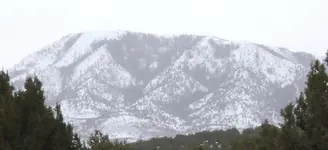
Here are a few more examples of markers that take up entire slopes along the Peralta trail.


Sheeprock.jpgSheeprock.a.jpgSheeprock.b.jpgDancingMatilda.jpg

The white dog head profile in one photo, has Linetta carved into the tree line. A little humour to pass the time as we cut timbers for the mines nearby.

Possibly their mascot's name or that of a favoured dancing girl, madam or such. Markers so outward are usually viewed as the sheets of a set of paper overlays, that are layed down in view over an unmarked neighbouring slope; one that is reflective in some shape forms and where the real mine(s) can be found. Good luck seeing these after the snow melts.
 

Last edited:
Looks like the real thing! I can see bright green foliage of some kind that's clearly been planted exactly into the shape of an arrow and there is a very distinct absolutely straight narrow stream with bright blue water running N/S. I'm not sure of the significance of it, but I'd say there's a good chance there are gold bricks piled together in the center of the green foliage arrow in the shape of a capital E and P (P being for Peralta of course).

Grats - what are you going to do with your riches?

It's really more like what are they doing with me. Very preoccupied with other works at this time and so time will have to tell. Hoping to get back in late winter. Much to hot for my liking this time of year. One summer, the thermometer on the travel home blew up right in front of us at around 130 degrees. That was only mid June.
 

The Peralta Family

Eusebio Francesco Chino is a link to click on down the page. (click The Peralta Family) One could safely say he was knowledgeable on the subject and probably the real mystery man here. The Peraltas very simply made the tablets from notes taken in the field and were done with cutting edge machinery of the day.

What? Did you think that men of stature were a bunch of rock kicking tards back in the day? Tracing machines have been around for centuries and so have drills and mills and their tooling to go with them. Headstones were in demand for a while back then right? Child's play my dear sirs. The most basic of surveyor's triangulation, often done upside down and backwards with some at face value mixed in.

Scale separation is the key to reading the carved segments before one can put together the sequence of the chains. The shape of a ridge, may become the shape of a tributary at 1/8th the scale if the sequence is correct and so fourth as nature repeats itself over and over again, closing in on the lode.

Sorry Scott,

I hit the "Reply With Quote" at the top of the post I was quoting instead of the bottom.:-[

Take care,

Joe
 

Same Tablet Code, different traveller in time; one of Anarchy. This is a master map that functions at any mine site using the code. A lone Knight, disbanded and forgotten.


Simple are the tablets; like a child's mind..........1777

1777Site.jpg...M56twistedfork.jpg ...2ndBuriedEntryintoMountain-1.jpg... Only the rabbit knows.

Ice cold air is blowing out through the burrow.
 

Last edited:

Top Member Reactions

Users who are viewing this thread

Latest Discussions

Back
Top