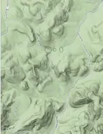
Topography around creeks and streams.

EngiNerd

Jr. Member
Joined
Jul 7, 2013
Messages
27
Reaction score
3
Golden Thread
0
Location
Holly Springs, NC
Primary Interest:
Prospecting
Hello! First time poster, and new to panning (couple of pay-to-play trips and had a lot of fun).

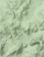
I have been doing a lot of reading on streams, how gold moves through them, and where to look in them. However, I do not see much about the topography around the creek and streams, and how it relates to where gold is in a creek/stream. For example, in the screen shot below, would the creek at the bottom (Dutch John Creek) be a better prospect due to the steep drops into the creek, compared to the creek at the upper right that has much shallower drops into the creek?

. . . or am I am just getting too detailed?? :dontknow:

Thanks for any info you can pass along!
creeks.webp
 
Upvote 0
Hello! First time poster, and new to panning (couple of pay-to-play trips and had a lot of fun).

I have been doing a lot of reading on streams, how gold moves through them, and where to look in them. However, I do not see much about the topography around the creek and streams, and how it relates to where gold is in a creek/stream. For example, in the screen shot below, would the creek at the bottom (Dutch John Creek) be a better prospect due to the steep drops into the creek, compared to the creek at the upper right that has much shallower drops into the creek?

Howdy, and welcome to the site...:hello:

I think much of what you ask depends on where that stream is crossing the source of the
gold, and also the type of gold you are finding. If it is more of the glacier type (very, very flat,
small flakes and fines), I might try working my way up the flatter creek, and hitting all the flood
gold bearing bars on the way upriver.

Saved your screen capture, and added three black circles to the spots I would go first. That
great big hook in John Dutch Creek would definitely hold color if any was coming down from
above, and at the juncture where the creek at the top right used to flow into John Dutch
would be another place to check out. If the upper flat creek ever flowed into John Dutch then
there will be an ancient riverbed there. It might be covered over by soil, but if the two connected,
and the flat creek carried good gold, then that old riverbed is definitely worth the effort needed
the check it out.

(Pic is blurry until expanded to full size, then it is sharp)
creeks.webp

Now, that's just my thoughts after looking it over. Odds are though that others might suggest a
completely different approach based on their greater experience. Ultimately, it's your
decision where you'll stick that shovel in first..:occasion14:

. . . or am I am just getting too detailed?? :dontknow:

Not at all for an engineer...8-)
 
Last edited:
Well done DD! Then again one must estimate (guess is another word for it) where the gold is coming from, up high or down low and when was the last hard rain and what obstructions were present to the water flow. Eddy currents, holes in the bedrock all make a difference as to where the gold settles. As Lanny would say "lazy gold wants to drop out as soon as it can". Walk the streams during high water and see where the water stalls, boils and goes back up river.

Welcome to Tnet EngiNerd and the best of success with your hunting...............63bkpkr
 
I just had a look at the area in Google Maps/Satellite and Google Earth. The
creek on the upper right is Moccasin Creek, and there was definitely some
interaction of Moccasin and John Dutch in the past. Also, there is a great
looking wash that runs north of where the confluence would have been.

As Bkpkr said, there's a million other influences to consider that
would have had an effect on the golds path, but that's also what makes
finding some so worthwhile..:occasion14:
 
Hello DD!

Thanks for your thoughts and suggestions! I am pretty sure there is gold in the area. And as you have found, this is in the Uwharrie National Forest in NC, and gold was mined here in the past. I am planning a trip to the NF next Saturday, and have several spots to check out. I will keep your spots in mind, if I get to that area. It might be quite a hike upstream from the road. I have no idea how hard it is to hike these streams until I get boots on the ground and check it out first hand. You can only see so much from the satellite photos on Goggle maps! :)

BTW, I have family in your neck of the wood. One sister lives on Whidbey Island, and another lives in Longview. My aunt left us a house in Cathlamet, so we get together there every other 4th of July. Next time I visit, I will have to see about any panning in the area.

EngiNerd.
 
Hello 63bkpkr!

Then again one must estimate (guess is another word for it) where the gold is coming from, up high or down low

Yea, that is another way of asking my question! If the gold is coming from erosion in the hill sides (lode gold??), then perhaps the steeper slopes into a creek would yield better panning. Or if from an ancient river bed, as DD suggest, then you would look else where (the spots DD marked on the map).

Thanks for the welcome!!

EngiNerd
 
Hello 63bkpkr!


Yea, that is another way of asking my question! If the gold is coming from erosion in the hill sides (lode gold??), then perhaps the steeper slopes into a creek would yield better panning. Or if from an ancient river bed, as DD suggest, then you would look else where (the spots DD marked on the map).

Thanks for the welcome!!

EngiNerd


EngiNerd,

My experience has been that water rushing through a steep gorge tends to carry the gold off with it. Look to the stretches just below the gorges; this is where the water slows down and the gold settles out.
 
EngiNerd,

My experience has been that water rushing through a steep gorge tends to carry the gold off with it. Look to the stretches just below the gorges; this is where the water slows down and the gold settles out.

Hello nuggeteer!

Thanks for the suggestion! I will check it out if I get that far down Dutch John Creek.

Good news is that after studying a trail map of the area, there are trails that go right to that area that DD pointed out. You can also see them on Google Maps. It is also the bad news, as it means gold prospectors may have already hit the area. I will keep an eye out for prior activity.

EngiNerd
 

Users who are viewing this thread

Back
Top Bottom