What's new

Tributary Gold.

Mine Shaft

Bronze Member
🥇 Charter Member
Joined
Apr 11, 2017
Messages
1,297
Reaction score
1,967
Golden Thread
0
Location
Fontana, California
Detector(s) used
NA
Primary Interest:
Prospecting
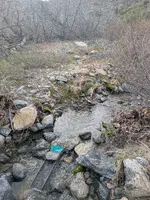
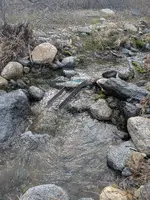
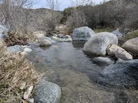
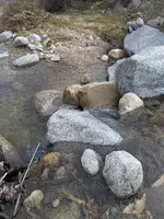
Hi members, thought I would post my outing to my Claim yesterday. I have found Gold on one of the tributary's before but just a little so I tried a new spot and did one test pan only 6-8 inch deep and 3 colors popped up and happy with that lol so I ran about 4, 1/2 buckets and came away with 26 colors just fine Gold but happy with the results. I will put some time into that area in the future. Anyway good luck in the field take care.
 

Attachments

  • PXL_20260205_174705358.MP.webp
    PXL_20260205_174705358.MP.webp
    4.3 MB · Views: 237
  • PXL_20260205_174635948.MP.webp
    PXL_20260205_174635948.MP.webp
    3.9 MB · Views: 119
  • PXL_20260205_183144286.MP.webp
    PXL_20260205_183144286.MP.webp
    3.7 MB · Views: 109
  • PXL_20260205_183414140.MP.webp
    PXL_20260205_183414140.MP.webp
    4.1 MB · Views: 111
  • PXL_20260206_170800022.PORTRAIT.ORIGINAL.webp
    PXL_20260206_170800022.PORTRAIT.ORIGINAL.webp
    1.5 MB · Views: 114
  • PXL_20260206_171649769.PORTRAIT.ORIGINAL.webp
    PXL_20260206_171649769.PORTRAIT.ORIGINAL.webp
    834.1 KB · Views: 120
  • PXL_20260206_171956331.MACRO_FOCUS (1).webp
    PXL_20260206_171956331.MACRO_FOCUS (1).webp
    332 KB · Views: 127
TY russau, as I mentioned my first test pan showed 3 colors at just 6-8 inch but I did dig down to 12-18 inch only to run into a large Boulder that covered 2 ft diameter of the hole. I will work that area next time i go. If you look close at the first photo you can see the yellow handle of my shovel that's where I was digging lol.
 
Last edited:
TY russau, as I mentioned my first test pan showed 3 colors at just 6-8 inch but I did dig down to 12-18 inch only to run into a large Boulder that covered 2 ft diameter of the hole. I will work that area next time i go. If you look close at the first photo you can see the yellow handle of my shovel that's where I was digging lol.
Too bad the boulder is not sitting right on top of bed rock. Any idea how far down to bedrock?
 
Too bad the boulder is not sitting right on top of bed rock. Any idea how far down to bedrock?
I have no idea lol. I might dig around it and try to take it out and see what's under it.
 
I have no idea lol. I might dig around it and try to take it out and see what's under it.
That is part of the fun. Let us know if you are getting close to bedrock and what your pans / sluice box is showing at that point. Thanks.
 
That is part of the fun. Let us know if you are getting close to bedrock and what your pans / sluice box is showing at that point. Thanks.

You present an interesting concept. Do tell...how does one know they are close to bedrock without actually reaching it?
 
You present an interesting concept. Do tell...how does one know they are close to bedrock without actually reaching it?
Probe, drill, and general angle of slope of the bedrock to start with.

It will help first to have an idea what the bedrock flow is in that particular area to make a decision when one reaches it. Many times, estimating the angle of a given flow will get one near to bedrock and the colors will likely increase as well. This is just a general description as each area will be different. If there is no change in both the loose rock and bedrock this will make a decision more difficult as an example.
 
Last edited:
Probe, drill, and general angle of slope of the bedrock to start with.

You miss the point entirely dear aide-de-camp.

The general does not speak of those things.

The controversy currently at play is about how one knows the location of the bedrock without first having determined it. You do recall yourself "Let us know if you are getting close to bedrock" do you not?

Please try again :P
 
You miss the point entirely dear aide-de-camp.

The general does not speak of those things.

The controversy currently at play is about how one knows the location of the bedrock without first having determined it. You do recall yourself "Let us know if you are getting close to bedrock" do you not?

Please try again :P
One can hit bedrock if enough is exposed to help make a decision of reaching that flow of rock is the general guideline of mining a surface deposit. The estimated angle of a flow of rock can also be decided upon as a guideline to help one determine if one is close. The pickup of a mineral deposit colors can also be an indicator if one is close to bedrock before the deposit ends. The miner has to determine what 'Close to bedrock' is in each given area.

There is no need for one to try again as the deposit stops with the solid rock is the general rule depending on the conditions present.
 
You present an interesting concept. Do tell...how does one know they are close to bedrock without actually reaching it?
SIMPLE ! Look at your state's Geological reports on the general depths of that area's bedrock ! Or look at a survey of the area !
 
TY guys for all the info i will make notes of it. Do you think bedrock would be closer in a Creek or River then off those areas ? @russau I will definitely check your info ty.
 
TY guys for all the info i will make notes of it. Do you think bedrock would be closer in a Creek or River then off those areas ? @russau I will definitely check your info ty.
Bedrock in places could be closer to 100 feet or even more. In other places could be a foot or even inches. It is up to the miner to decide how close one is mining at most times next to bedrock.

An example I posted on a different thread topic about a 'Boulder / dam' is if nature quickly moves the boulder / dam very quickly this will have a big impact on the depth of over burden sitting on top of bedrock in that given area regardless of what general mapping will tend to show. Another example is how much ash is nature depositing in that general area is a big factor of the depth of overburden on top of bedrock. One can go on and on with examples depending on what nature has done and is doing as a general rule.
 
Last edited:
Thats what I was just reading on the USGS site ty.
 
Drilling lots of test holes will tend to be the best mapping in a given area. Just saying....... :cat: :hello:
 
Electric drill only lol and I don't know how long I could drill test holes + every where I dig there are a lot of big rocks to contend with.
 
Electric drill only lol and I don't know how long I could drill test holes + every where I dig there are a lot of big rocks to contend with.
Well, it sure is better than hand digging even if you can go down 1 - 2 feet to test for colors. Perhaps you can drill down further if the colors look good.
It will be better if you can drill in smaller cobble stones compared to larger boulders to test for colors.
 
Last edited:
Well, it sure is better than hand digging even if you can go down 1 - 2 feet to test for colors. Perhaps you can drill down further if the colors look good.
It will be better if you can drill in smaller cobble stones compared to larger boulders to test for colors.
Right but in order to do some serious drilling I would think a person would need a 2" bore minimum and go up from there and again your talking some drill motor with a lot of power and that ain't going to happen unless I hire a professional with that kind of tool. My best bet is pick/shovel and elbow grease lol.
 

Users who are viewing this thread

Back
Top Bottom