Weiser's Gravesite

OP
OP
Idahodutch

Idahodutch

Bronze Member
Sep 25, 2019
1,850
4,786
Idaho
Detector(s) used
Whites MXT
Gold Legend
Primary Interest:
Other
Skyhawk,
The person that did the “hike Arizona” article with built in photo links, did a nice job.
The photo links are a very nice feature.

I have never hiked/climbed Palomino mountain. Wouldn’t mind it, just haven’t.
It looks to be a interesting hike.

A group of us use to go to echo canyon on camelback mountain and climb.
The superstitions are much more interesting (IMO), just not as convenient :)
Thanks for fixing the lit arch pic :icon_thumright:

I think I have seen the last remaining photos from my son’s phone .... there are photos of us milling around camp, hiking out, some scenic video shots .... a few of the great shade boulder, above and a little left of the bluff of faces. That shaded spot below the boulder, was really nice and cool. Had almost continuous breeze. A mattress would have made it more comfortable, but was still glad for the spot, just as is :coffee2:

One of the scenic videos has a few frames where the outcrop mine can be seen.
I’ll work on getting what I can over to my computer, and post.

Hopefully they post correctly :)
 

OP
OP
Idahodutch

Idahodutch

Bronze Member
Sep 25, 2019
1,850
4,786
Idaho
Detector(s) used
Whites MXT
Gold Legend
Primary Interest:
Other
OK - The trip in the superstitions this time was backpacking in a week ago today, and coming back out last Thursday.
We went in at First Water Trailhead and followed the Dutchman trail to Boulder Canyon trail, and went north down Boulder Canyon.
We found shade directly across where Needle Canyon joins Boulder Canyon, and tried to recuperate from the hike in, for a few hours.
Later in the afternoon, 3 of us went down boulder canyon but just as we were setting off, we crossed over to the other side of boulder creek, and found a decent campsite .... flat, room for tents and cooking, close to potential water source ..... but right on boulder trail.
We went for it and set it up as soon as we got back from the short hike.

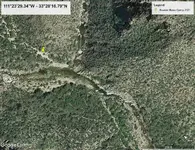
Below is a GE zoom in of the campsite we used as a base while we were in there.

Camp 2021.jpg


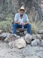
I got this one off of my wifes phone, my son had sent it to her.
I'm sitting about 10' south of the pin marker of the camp.

Idahodutch.jpg


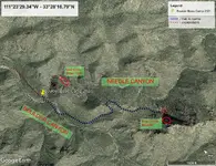
Here is a crude GE image, showing the treks we made while in there, from our base in boulder canyon.

Camp Treks 2021.jpg

pictures look straight, so i'll submit reply.
 

Last edited:

rlw48

Newbie
Apr 18, 2012
4
0
pennsylvania
Primary Interest:
Other
In Sims Ely's book, Waltz tells Julia that he and Weiser mistakenly killed two Mexicans thinking they were Apaches.
 

rlw48

Newbie
Apr 18, 2012
4
0
pennsylvania
Primary Interest:
Other
Where did Bicknell get his information for the story? Bicknell was a newspaper writer and storyteller - that was his job. You don't think perhaps he may have "embellished" a bit? Why would you believe Bicknell's story but not the Holme's story other than the fact it fits with your theories?

I believe Bicknell interviewed Julia himself. And there's a very good chance he embellished to make a good story even better.
 

OP
OP
Idahodutch

Idahodutch

Bronze Member
Sep 25, 2019
1,850
4,786
Idaho
Detector(s) used
Whites MXT
Gold Legend
Primary Interest:
Other
Hello rlw48,
Welcome to tnet.
Yeah ... it is hard to know. Did Bick add, or Sims leave out?
Or did maybe Julia tell it differently .... perhaps not exactly the same batch of information was remembered, or conveyed between interviews. :dontknow:

If you have not already done so, maybe test the clues given in Bicknell’s 1895 article, and then decide if they are embellished or not?

Be careful not to throw out the baby, with the bath water :laughing7:
 

Aug 28, 2021
17
28
Detector(s) used
Garrett Sea Hunter Mark 2
Primary Interest:
All Treasure Hunting
Hi Idaho, you didn't go farther up the canyon?? There is something interesting up there....
 

OP
OP
Idahodutch

Idahodutch

Bronze Member
Sep 25, 2019
1,850
4,786
Idaho
Detector(s) used
Whites MXT
Gold Legend
Primary Interest:
Other
Hi Idaho, you didn't go farther up the canyon?? There is something interesting up there....

Hello Steve,
There are no shortages of interesting things to investigate. :)
We did what we could do, and was I was especially glad to have been able to go at all :icon_thumleft:

If you end up going, just be safe. Don?t go it alone if you don?t have to.
A person can get hurt, just slipping on a trail.
Other than being safe, those mountains are a great place to go.
There really is so much to see :)
 

Last edited:
Aug 28, 2021
17
28
Detector(s) used
Garrett Sea Hunter Mark 2
Primary Interest:
All Treasure Hunting
Thanks for the advice, it looks like rough country.....closest I have been was on the west side going up to the lake, and didn't really know where I was. I have been through some pretty rough country in Hawaii and other states alone, but your point is well taken, and I am not as young as I was. I do hope to get there before i am too busted up to get where i want to; I am moving back to Oregon soon if my land deal comes through.
Have a look on the north side at the base of Battleship Mountain and tell me if you see what i do. I found that site by heading straight north on GE past WN until that showed up.
 

skyhawk1251

Sr. Member
Nov 9, 2018
312
669
Kingman, AZ
Detector(s) used
Fisher Gold Bug Pro
Primary Interest:
Prospecting
Have a look on the north side at the base of Battleship Mountain and tell me if you see what I do. I found that site by heading straight north on GE past WN until that showed up. -- Stevethepirate62

This is what you might be referring to. It's the Indian Paint Mine, north of Battleship Mountain. The foundation of an old cabin is visible in this GE image.

001.png
 

skyhawk1251

Sr. Member
Nov 9, 2018
312
669
Kingman, AZ
Detector(s) used
Fisher Gold Bug Pro
Primary Interest:
Prospecting
Go to first water, then to second water, then take the old government trail to San Carlos. Where the trail turns south you will see over the point of a ridge a rock standing in the brush that looks like a man. This is where I always leave the trail. Go to the left of the trail and follow up the long ridge and you will come to a saddle. In this saddle is a round Indian ruin of rocks. Go through this saddle and on up a low ridge, and when you get to the highest point of the ridge you can look north and the four peaks are lined up to look as one peak. In the other direction you will see a high needle. In the canyon under you is my hidden camp. You can't get down there because it's too steep, go to the mouth of the canyon and then back. You can find the rock house with very little difficulty. You won't be able to see it until you are right up on it. After you find the camp then come back out of the canyon. (Here Waltz gave a direction to the mine that Holmes and Roberts kept secret.) You will never be able to find the mine until you first find the rock house as the opening is completely hidden. A prospector won't find it because there is no ledge in view. In the mine you will find about $75,000 dollars in gold ore already dug out. I dug the outcropping away and covered all signs of my digging. -- Holmes Manuscript


We did not get to everything we wanted to get to. Too short of a trip. I didn't look for indications of Weiser's grave. I spent most of my time investigating the LDM. My youngest, the workout guy, headed up to check out the shaft mine ... after several hours, he was not able to get to the spot, due to very heavy shrubbery and super thick scrub oak. My other son, and my old childhood buddy, looked for one of the caches ... but it appears to have been emptied. It's location was a shallow impression ... about 4x4. That cache was not buried according to info.

The hidden camp is that spot talked about. I spent time in it. It has suffered severe damage ... perhaps during all the activity with the tunnel adits, as a large amount of dirt/mud/rocks came down and buried about 2/3 of the two-room rock house. The room I could see was about 3-1/2 wide, and went back 4 to 5 feet, until the inflow of material that absorbed most of the shallow cave. The retaining wall of boulders that were used to level that area out are still intact. Some of that grassy flat, in front of the shallow cave, has some erosion, but still mostly there.

Bicknell's 1895 article is spot on! The descriptions waltz told to Julia are accurate. Only Weiser is still in question. I really don't think Waltz could have moved ALL the boulders and large rocks that were used to cover the LDM ... by himself. The rest of the article tells how to find the LDM, if you know where the hidden camp is.

I really don't see anybody being able to do any more than what we did ... which is look in awe at the precise stacking of boulders to replicate the shape of what the natural landscape was originally. It would be statistically impossible for boulders to randomly stack themselves, just in that spot ... on an outcropping ... after some 140 years, and that the shrubbery has still not reclaimed that area. I checked out the outcrop, and where the brush stops, the original outcrop was taken down, ... dug down, and the rocks filled back. That is my assessment ... done by man.

Traversing that outcropping of boulders and rocks ... a small slip of footing, where a leg slides just enough between boulders ... and broken leg time. It's a rough place. -- Idahodutch (edited)

My congratulations once again on your successful exploratory trip, and my appreciation for your taking the time to share it with us. I think you've done your research on the LDM as good as it can be done. You've convinced me that your chosen spot is worthy of more scrutiny.

Your description of the hidden camp is of particular interest to me. Matching its location with the Holmes Manuscript indicates to me that no direct pathway from the hidden camp to the mine was ever constructed. The manuscript reads, "After you find the camp then come back out of the canyon." So, it seems that the way from the hidden camp to the mine was by going around the mountain and then by approaching the mine from the other end/opposite direction. You don't make mention of seeing any evidence of pathways leading away from the hidden camp.

The hidden camp is that spot talked about. I spent time in it. It has suffered severe damage ... perhaps during all the activity with the tunnel adits, as a large amount of dirt/mud/rocks came down and buried about 2/3 of the two-room rock house. The room I could see was about 3-1/2 wide, and went back 4 to 5 feet, until the inflow of material that absorbed most of the shallow cave. The retaining wall of boulders that were used to level that area out are still intact. Some of that grassy flat, in front of the shallow cave, has some erosion, but still mostly there. -- Idahodutch (edited)

With reference to the terraced ground that the rock house was built on, how large an area does the terraced ground cover? How large are the boulders that were used to build the retaining wall? How high is the entrance to the shallow cave, and do you have a guess as to how deep it could have been before sediment partially filled it? Is there clear evidence of human habitation, such as a fire ring? How high are the walls of the rock house as they now stand?

It's my guess that the first prospectors (Mexicans) panned the gravels on the canyon bottom, and finding colors in their pans, they traced the source to a rich vein, or perhaps the vein/ledge was visible near the canyon bottom, now covered over by Waltz. Diggings would not have been done without there being indications that gold was present.

003.png

002.png
 

Last edited:
Aug 28, 2021
17
28
Detector(s) used
Garrett Sea Hunter Mark 2
Primary Interest:
All Treasure Hunting
Yes Skyhawk, that is the place, Thank You! for the mine name, know much about it? I did find some articles online, I do not put much credence in the Mine Bureau stating no minerals were present, the mineralization can be seen from the air! Maybe no gold though.
 

Last edited:
OP
OP
Idahodutch

Idahodutch

Bronze Member
Sep 25, 2019
1,850
4,786
Idaho
Detector(s) used
Whites MXT
Gold Legend
Primary Interest:
Other
My congratulations once again on your successful exploratory trip, and my appreciation for your taking the time to share it with us. I think you've done your research on the LDM as good as it can be done. You've convinced me that your chosen spot is worthy of more scrutiny.

Your description of the hidden camp is of particular interest to me. Matching its location with the Holmes Manuscript indicates to me that no direct pathway from the hidden camp to the mine was ever constructed. The manuscript reads, "After you find the camp then come back out of the canyon." So, it seems that the way from the hidden camp to the mine was by going around the mountain and then by approaching the mine from the other end/opposite direction. You don't make mention of seeing any evidence of pathways leading away from the hidden camp.


With reference to the terraced ground that the rock house was built on, how large an area does the terraced ground cover? How large are the boulders that were used to build the retaining wall? How high is the entrance to the shallow cave, and do you have a guess as to how deep it could have been before sediment partially filled it? Is there clear evidence of human habitation, such as a fire ring? How high are the walls of the rock house as they now stand?

It's my guess that the first prospectors (Mexicans) panned the gravels on the canyon bottom, and finding colors in their pans, they traced the source to a rich vein, or perhaps the vein/ledge was visible near the canyon bottom, now covered over by Waltz. Diggings would not have been done without there being indications that gold was present.

View attachment 1945220

View attachment 1945221

Skyhawk,
Thank you for the kind words. It means a lot, and as you say ... I too believe the area merits more exploration. :)

On the way back and forth, from the Boulder pile, to the possible hidden camp location, and back again; there was no clear trail. I didn?t go the same path there and back. Not really a good way, just some a little less treacherous lol.
The Peralta worked the upper shaft mine, so they didn?t really have motive to go across at that lower elevation imo. But going to that upper shaft mine, seems easier to get to ; if starting at the Possible hidden camp location, go further up the canyon/ravine above that spot While heading west towards the part of the low ridge where the shelf begins, then drop down in.

I also don?t know how much time Waltz and any company actually spent at the mine location.
- Initial Waltz workings, also tell of starting the outcrop mine.
- Possible separate trip when mule spilled the grub steak.
- Then Waltz return with supplies.
Then at least 2 more times for cache retrieval.

Not really seeing where Waltz and any company did anything, other than use whatever shelter was found.
The signs of retaining wall remnants, could have been made prior .... 1840?s perhaps?
When the Peralta still planned on many more trips?
 

OP
OP
Idahodutch

Idahodutch

Bronze Member
Sep 25, 2019
1,850
4,786
Idaho
Detector(s) used
Whites MXT
Gold Legend
Primary Interest:
Other
Skyhawk,
I plan to make another trip, this time we will have supplies packed in. Probably at least 10 days in there, maybe 2 weeks.
The goal of this trip is to document whatever evidence can be found. The area of the possible hidden camp really looked like mostly buried ruins, with what is left of what was maybe a nice Camp area to relax, cook etc.
It would be interesting to excavate it out and see :)
Maybe one day...

We want to locate the upper shaft mine, see what might be on top of the outcrop mine (hopefully a large cache), then if time permits, do more exploring..... maybe see if Weiser is there?
Have to get there first :)

Been racking my brain as to where to have base camp .... suggestions would be welcome !!! :)
 

skyhawk1251

Sr. Member
Nov 9, 2018
312
669
Kingman, AZ
Detector(s) used
Fisher Gold Bug Pro
Primary Interest:
Prospecting
Skyhawk -- Thank you for the kind words. It means a lot, and as you say ... I too believe the area merits more exploration.

On the way back and forth, from the boulder pile, to the possible hidden camp location, and back again; there was no clear trail. I didn't go the same path there and back. Not really a good way, just some a little less treacherous lol. The Peraltas worked the upper shaft mine, so they didn't really have motive to go across at that lower elevation imo. But going to that upper shaft mine seems easier to get to; if starting at the possible hidden camp location, go further up the canyon/ravine above that spot while heading west towards the part of the low ridge where the shelf begins, then drop down in.

I also don't know how much time Waltz and any company actually spent at the mine location.

- Initial Waltz workings, also tell of starting the outcrop mine.
- Possible separate trip when mule spilled the grub steak.
- Then Waltz returns with supplies.
- Then at least 2 more times for cache retrieval.

Not really seeing where Waltz and any company did anything, other than use whatever shelter was found. The signs of retaining wall remnants could have been made prior ... 1840's perhaps? When the Peralta still planned on many more trips? -- Idahodutch

Skyhawk -- I plan to make another trip, this time we will have supplies packed in. Probably at least 10 days in there, maybe 2 weeks. The goal of this trip is to document whatever evidence can be found. The area of the possible hidden camp really looked like mostly buried ruins, with what is left of what was maybe a nice camp area to relax, cook, etc. It would be interesting to excavate it out and see. Maybe one day ...

We want to locate the upper shaft mine, see what might be on top of the outcrop mine (hopefully a large cache), then if time permits, do more exploring ... maybe see if Weiser is there? Have to get there first. Been racking my brain as to where to have base camp ... suggestions would be welcome!!! -- Idahodutch

The old-time prospectors/miners didn't practice LNT (leave no trace), so I was hoping to hear that some artifacts were left behind at the hidden camp, even something as mundane as tin cans. A garbage pit could provide clues as to when the hidden camp was active. Also, signs that trees had been cut down to clear the area or for firewood could indicate if the hidden camp was active for an extended period. Small details can provide big clues!

I remain very impressed with your explorations on those slippery slopes. Bushwacking and loose talus are not for me anymore! I'll ponder on possibilities for your next base camp. The preferences of the outfitter who packs in your supplies could take priority.
 

OP
OP
Idahodutch

Idahodutch

Bronze Member
Sep 25, 2019
1,850
4,786
Idaho
Detector(s) used
Whites MXT
Gold Legend
Primary Interest:
Other
The old-time prospectors/miners didn't practice LNT (leave no trace), so I was hoping to hear that some artifacts were left behind at the hidden camp, even something as mundane as tin cans. A garbage pit could provide clues as to when the hidden camp was active. Also, signs that trees had been cut down to clear the area or for firewood could indicate if the hidden camp was active for an extended period. Small details can provide big clues!

I remain very impressed with your explorations on those slippery slopes. Bushwacking and loose talus are not for me anymore! I'll ponder on possibilities for your next base camp. The preferences of the outfitter who packs in your supplies could take priority.

The area was void of any obvious signs like old cans, but Waltz said he erased all trace of them being there..... or something to that point.

Earlier on a different thread, Matthew gave us some insight as to previous activity, before the Wilderness restrictions were imposed. According to what was said in that other thread, it sounded like Harnish looked all around the upper part of the canyon/ravine up that drainage wash.
There are still visible adits up in there .... courtesy of Harnish operations.
Anyway, maybe any garbage left from the last parts of activity associated with Harnish, might be down by the mouth of the canyon below. Matthew said Harnish guys camped down by the creek, near where the wash dumps into the creek.

We didn?t get down to the creek, near that spot where Harnish guys camped, so I don?t know if there is trash down there.

I did see a juniper tree. It was not real big, maybe 15? or so tall, but looked to be pretty old. It was mostly dead, but there were thorn branches growing all through where I was wanting to get passed, to head back to the outcrop.
It was not that far from the possible hidden camp, maybe 40?-50? from it.
There were still low branches, but not on the side nearest the possible hidden camp.
Not much of a flat spot under the juniper, but enough to tie up an animal ... not sure about 2 animals though.
Just thought it coincidental, .... I kind of doubt the grub steak tree would still be there, after 140-150 years or there bouts, but who knows.
The reason I remember about the tree, is because the one time I took a tumble, I ended up 4? from the tree. I was there a couple of moments, collecting myself, and taking better note of my surroundings. Luckily, I only ended up with a bruised hip.

I took notice of the terrain in Boulder Canyon, just north of the junction with Needle Canyon.
It did not look much easier to get around on, than what we experienced bushwhacking over to our spot of interest. Both slippery, and thorny .... but ropes not required.
My advice ..... be safe, but find a way to get to the spots you see.
I would not go solo, especially off trail. It is hazardous, and much slower than trail hiking.
I?m sure you know that, but it really is very easy to have a rock roll out, and lose footing.

If a slip up happens, and the only thing to break the fall is some cactus, it would be hard to be thankful for it breaking the fall lol.

I drastically underestimated how much slower things go, when bushwhacking some of those areas in there. Got to give yourself plenty of time :)

I can?t think of anything else, other than I really do hope you have a great trip.
Look forward to hearing about it :)
 

skyhawk1251

Sr. Member
Nov 9, 2018
312
669
Kingman, AZ
Detector(s) used
Fisher Gold Bug Pro
Primary Interest:
Prospecting
For Idahodutch --

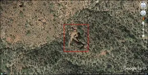
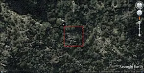
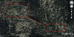
Here are two GE screenshots that you might want to examine closely. The area that I find interesting (first image, left red box) is above the "hidden camp" (right red box, left side). I see many depressions/excavations there and stacked stones. You might need a magnifying glass to see the stacked stones. The depressions are significant, with enough depth to easily contain the height of the vegetation growing inside them. The red line connects this area to the "hidden camp" by running along a razor-thin ridge of rocks. I'm not sure if this ridge could have been walked to gain access down to the "hidden camp." It looks dangerous. There is an unusual rock formation with linear features to the right of the "hidden camp."

The second image is a more overhead view of the area above the "hidden camp." I don't think you got to this area during your recent trip, but if you did your comments would be appreciated.

For your next trip, you might want to consider posting a man equipped with a monopod, a monocular, and a two-way radio across the canyon, high up on the opposite slope. He could scan your ravine and point the team to areas to explore.

014.png

015.png
 

OP
OP
Idahodutch

Idahodutch

Bronze Member
Sep 25, 2019
1,850
4,786
Idaho
Detector(s) used
Whites MXT
Gold Legend
Primary Interest:
Other
For Idahodutch --

Here are two GE screenshots that you might want to examine closely. The area that I find interesting (first image, left red box) is above the "hidden camp" (right red box, left side). I see many depressions/excavations there and stacked stones. You might need a magnifying glass to see the stacked stones. The depressions are significant, with enough depth to easily contain the height of the vegetation growing inside them. The red line connects this area to the "hidden camp" by running along a razor-thin ridge of rocks. I'm not sure if this ridge could have been walked to gain access down to the "hidden camp." It looks dangerous. There is an unusual rock formation with linear features to the right of the "hidden camp."

The second image is a more overhead view of the area above the "hidden camp." I don't think you got to this area during your recent trip, but if you did your comments would be appreciated.

For your next trip, you might want to consider posting a man equipped with a monopod, a monocular, and a two-way radio across the canyon, high up on the opposite slope. He could scan your ravine and point the team to areas to explore.

View attachment 1945505

View attachment 1945506

Skyhawk,
That ridge of sorts that looks to connect the 2 red boxes, would be mostly climbing, not hiking. Also any brush encounters along the route, is either plunge through, or go around.
The image with just the one red box, definitely looks to have had considerable past activity in and around that red box.
Going about a 45 angle up and left from the upper left corner of the red box ... about 1/2 way to top of saddle, looks like might be the claim marker I saw 12 years ago. It?s about 3? high pyramid of stacked rocks.

The Waltz Map reflects the contours of that area, but looks like the representations drawn on the map, happened prior to all the alterations that occurred from activity, but isn’t reflecting the changes that looked to have happened ... lots of indications of activity there.

We did not go to that area, this past trip.
A guy could stay busy for quite some time, checking things out in there.

If another trip results in much increased interest, then we?ll cross that bridge :)
I liked your point about a base camp location. Partially up to how close outfitters can get.
 

Last edited:

skyhawk1251

Sr. Member
Nov 9, 2018
312
669
Kingman, AZ
Detector(s) used
Fisher Gold Bug Pro
Primary Interest:
Prospecting
For Idahodutch --

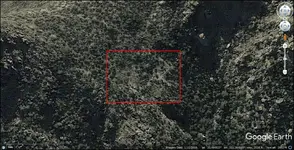
"The image with just the one red box, definitely looks to have had considerable past activity in and around that red box. Going about a 45 angle up and left from the upper left corner of the red box ... about 1/2 way to top of saddle, looks like might be the claim marker I saw 12 years ago. It's about 3 (feet) high pyramid of stacked rocks." -- Idahodutch

I saw that pile of rocks before you posted your reply. I couldn't decide if it is man-made or natural geology, but you've confirmed that it is man-made. It could be a claim marker, but I'm leaning more toward the idea that it could be just a cairn marking the route up and down the slope. I'd guess that a permanently anchored rope would have been used to assist getting up and down. The area inside the single red box looks like it was used as a camp site. Not much vegetation is there, so I suspect that trees must have been cut down to make the clearing. If so, there might be some sawed stumps to be found there, as well as on the route up and down the slope. Those rectangular, "walled" anomalies I see could have been used as crude shelters that were tarped over. They look too large and elaborate to have been fire beds. The existence of the cairn alone suggests this location had some importance to someone.

015.png
 

OP
OP
Idahodutch

Idahodutch

Bronze Member
Sep 25, 2019
1,850
4,786
Idaho
Detector(s) used
Whites MXT
Gold Legend
Primary Interest:
Other
For Idahodutch --


I saw that pile of rocks before you posted your reply. I couldn't decide if it is man-made or natural geology, but you've confirmed that it is man-made. It could be a claim marker, but I'm leaning more toward the idea that it could be just a cairn marking the route up and down the slope. I'd guess that a permanently anchored rope would have been used to assist getting up and down. The area inside the single red box looks like it was used as a camp site. Not much vegetation is there, so I suspect that trees must have been cut down to make the clearing. If so, there might be some sawed stumps to be found there, as well as on the route up and down the slope. Those rectangular, "walled" anomalies I see could have been used as crude shelters that were tarped over. They look too large and elaborate to have been fire beds. The existence of the cairn alone suggests this location had some importance to someone.

View attachment 1945631

Skyhawk,
I looked at that area inside of the box, and it is sloped .... fairly steep.
If this is one of the areas where Peralta activity was happening, it is conceivable that area was used like you imagine.
Much much later after the 1840?s, the area was part of Harnish?s operations.

I don?t know how much more beyond the large adits would have been done by Harnish, but Matthew talked about quite the activity .... he spoke of probes being drilled. (Maybe your ?hole? you saw is one of them)

It does not look like Harnish spent much time outside that part of region.
Sort of from the possible hidden camp ... on up southward, ... and also maybe eastward.
I don?t know how many Harnish guys might have been working there at a time, but perhaps over time, they used that area in the way you mention. Areas to rest, eat, maybe sleep.

It seems like a suitable camp site should be there, but enough to just have outfitters drop gear .... across the canyon where we hiked in from, is still sloped but less sloped. But it was pretty windy over there. There is also an area to drop down to needle creek west of the ravine, where the creek starts heading down, to the north again. That looks like a hike, not a climb.... but if there is a lot of rain, then down at needle creek may not be a good spot to camp, if it?s full of water.
Even if camp just up out of creek bed a bit, of rain comes, can trap you in your camp, if the creek was the camp access.
I like the idea of easy access to water though.
I need to visit with some outfitters, see what they suggest. :)
 

Top Member Reactions

Users who are viewing this thread

Top