downindixie
Hero Member
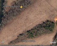
This is located right next to a major creek here in Alabama,there have been several mounds located next to this creek.I just started with google earth and learning.
P.S.,I am not a person who would violate the law and trespass on private property.I did 50 years ago when I was a kid,but things were different then as compared to now.I have a friend who works for the State of Alabama and his job is to investigate any reports of Indian settlements,who I would pass this information.I would however try to gain permission from owner to look for surface finds around the mound.
If I have offended anyone by this post please contact me by private e-mail so we can discuss this in proper fashion instead of trying to have my thread stricken from this site,I am an agreeable guy!