kiddrock33
Hero Member
i stated my map from three seperate drill holes . which are my triangle points. one east one west one south. each drill hole was on top of three large boulders. 66 yards in between east and west holes.
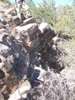
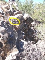
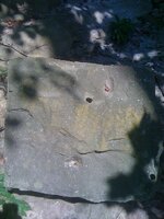
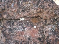
I rule out SELF-SUPPORTING tripod, given the seemingly near vertical angle of the face. I would not rule a hand held tripod device with the same function at the sight wire found on the lid of a lensatic compass. If it were designed for THAT purpose, then hopefully there is enough information to lead you to the next place where you could find another tripod template and even more information.Clay Lindsey said:Ok! Back on track. I'm posting this next photo for two reasons: for one, it better shows the "corner" on the boulder. And for two, it shows how much detail can be lost by taking a photo of your proposed S/S in a certain way. In summary, because I took the first photo head on at the corner, it made the rock look flat. By losing the third dimension, I may have lost some important information. So be careful when you take pictures out in the field. Note: the third hole (upper left) is behind my shoulder by my chin.
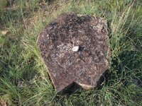
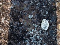
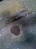
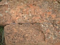
Yes the V is interesting.....no I did not make the drill hole...(ouch, I would never make a mark myself and then try to pass it off on someone! ) all I did was remove the "pebble" and gently brush out a little dirt. Found a few more about the same depth on other rocks that were shaped different. (they also had a pebble in the hole) As of yet I have not flipped any of them, so as not to lose any precise angles?dsty said:The mouth on the head or the V is interesting and did you make the drill hole, have you looked on the bottom