Old Dog
Gold Member
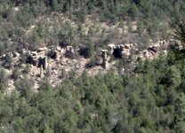
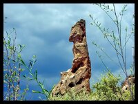
This is for the most part what is called a "range marker"
it shows the trail entrance to the main trails going into the mountains.
The rest of the story will show up on the trail head marker some miles away.
The seven is probably the only marker visible lower on the cliff
meant to be seen from a distance, indicated that a safe gathering/camping place was located where they could wait for a rain to fill the water sources for the journey in.
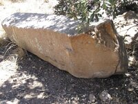
Maps and trails were not measured in days or distance so much as they were gauged in available water.
Water was and is the most valuable resource. The Spanish always marked the Water Source.
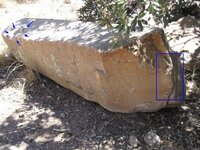
it shows the trail entrance to the main trails going into the mountains.
The rest of the story will show up on the trail head marker some miles away.
The seven is probably the only marker visible lower on the cliff
meant to be seen from a distance, indicated that a safe gathering/camping place was located where they could wait for a rain to fill the water sources for the journey in.
Maps and trails were not measured in days or distance so much as they were gauged in available water.
Water was and is the most valuable resource. The Spanish always marked the Water Source.


.png")