Geoffnotjeff
Jr. Member
- Nov 30, 2019
- 36
- 106
- Primary Interest:
- All Treasure Hunting
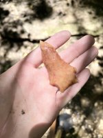
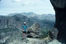
Hi all, new to *posting* on the forums, and wanted to say hello. The last time I was able to hike in the superstitions was 30 years ago, as a fresh teenager having the time of my life with my dad, who was raised in the area. Ive been reading and researching the LDM for fun for more than 30 years now, with no delusions to actually finding anything. Picture from '93 LOL!
However, myself and a friend will be in the area building a new facility for 4-5 weeks mid october - november and i was curious if any of the active members who have spent untold hours in the mountains have any recommended 1-2 day hikes. We can spend a night out, and will have at least 2 weekends we can get into the mountains. We move fast, are fit, experienced hikers, climbers, im a rigger, friend is a wilderness EMT and are both acclimated to higher elevations than we will find there. I would love to take him to some cool locations, and wanted to inquire about what would be your ideal spots to see with limited time but the ability to move quickly off or on trail for a long time.
My main idea would be seeing the pit mine area, with some time to explore around briefly, with an understanding it may be hard to locate on the ground, and moving through the brush is a challenge.
For a second trip, either peters mesa via peters canyon or the fun way up Geronimo's head. I understand that would be a overnighter or a very long day without anytime to explore.
Any ideas? I know the gathering is also happening while we are in town, and something i will try to attend for a night if work schedules permit.
Thank you all for the entertaining reads over the years, across multiple forums, reading many books, posts, i have deluded myself that there is a story out there of hat happened, but it will never be public knowledge. Im eager to learn more, as always.


")