Ragnor
Sr. Member
- Joined
- Dec 7, 2015
- Messages
- 445
- Reaction score
- 423
- Golden Thread
- 0
- Primary Interest:
- All Treasure Hunting
Well after countless hours of web searching and studying about using landsat systems for remote mineral sensing my brother and I have succesfully created a working mineralization map. It was allot of mental effort to figure out how it works. However my brother is a college acredited programmer and a professional graphics designer. So once I was able to figure out how it all works he was able to tell me what to do to make it work for me. I'm pretty proud of our accomplishment.
I present a few choice screen shots from our project for your enjoyment and inspiration.
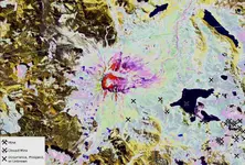
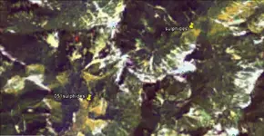
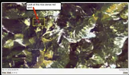
In these images pure red indicates iron, pure green is clay minerals and pure blue is silicates.
The blue tends to get over exposed as a baby blue/white. Interestingly enough sulphur tends towards a nice yellow.
All other shades are combinations of the RGB spectrum.
The first area is Mt St Helens (for those who don't recognize it)
The second is a random strong Iron hit that I find interesting.


We do need to work more on resampling and contrast, but it is a working set.
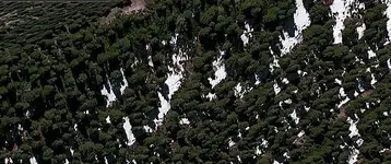
We overlayed it onto google earth and the results are pretty darn cool if you ask me.
Once we do a little ground work to sample some of these anomalous areas we should really be able to cut down on time spent sampling barren ground significantly. It's a Hi-Tech Redneck treasure map
I present a few choice screen shots from our project for your enjoyment and inspiration.
In these images pure red indicates iron, pure green is clay minerals and pure blue is silicates.
The blue tends to get over exposed as a baby blue/white. Interestingly enough sulphur tends towards a nice yellow.
All other shades are combinations of the RGB spectrum.
The first area is Mt St Helens (for those who don't recognize it)
The second is a random strong Iron hit that I find interesting.


We do need to work more on resampling and contrast, but it is a working set.
We overlayed it onto google earth and the results are pretty darn cool if you ask me.
Once we do a little ground work to sample some of these anomalous areas we should really be able to cut down on time spent sampling barren ground significantly. It's a Hi-Tech Redneck treasure map

Upvote
0


