What's new

Any Hits Along This Corridor

Zincoln Miner

Hero Member
Joined
Nov 14, 2003
Messages
571
Reaction score
362
Golden Thread
0
Location
New York State
Detector(s) used
Minelab Vanquish 340, Tesoro Silver uMax, Compadre, and BH Tracker IV.

Ex: White's Spectrum XLT, Tesoro Cutlass II Umax, and that circa late 70's red handled junk from RadioShack that started it.
Any info will be of interest.
 

Attachments

  • 20200420_043217.webp
    20200420_043217.webp
    55.4 KB · Views: 146
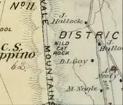
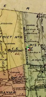
Does this section mean anything to you?

20200420_043217-this-corridor-A1.webp
 
White is probably a natural cave or tunnel. Gold color for treasure with a black dot to pinpoint. Red and green as old site indicators. This area seems to draw hits for some reason.

20200420_043217-this-corridor-A1-LG.webp
 
Last edited:
Yes...I had a variety of mixed signals.
 
Wild Cat Rock has a treasure legend of "Claudius Smith" a Tory during the Revoluntionary War. The formation does have a shallow cave/rock shelter at the base. Also reports of 19th century moonshiners supposedly worked the area.

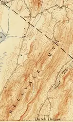
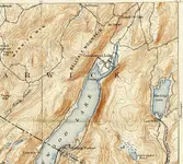
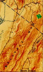
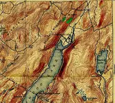
Here's early 20th century topos of the same area.
 

Attachments

  • 20200423_035552.webp
    20200423_035552.webp
    47.6 KB · Views: 119
  • 20200423_035656.webp
    20200423_035656.webp
    310.4 KB · Views: 134
Last edited:
Wild Cat Rock has a treasure legend of "Claudius Smith" a Tory during the Revoluntionary War. The formation does have a shallow cave/rock shelter at the base. Also reports of 19th century moonshiners supposedly worked the area.

Here's early 20th century topos of the same area.
All sounds very interesting, I'll check these topos also, soon as get a moment.
 
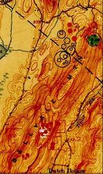
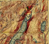
The red boxes are possible gold cachevdetections
 
Turning out different this time around, some type of archaeological site signals, marked in green.

20200423_035552;solx nys.webp

20200423_035656;solx nys.webp
 
Turning out different this time around, some type of archaeological site signals, marked in green.

The top pic in the general area of the green are two cellar holes.

The bottom pic does have cellar holes, and farming activity in the general area of the right green. Not sure of the left green, but it should have though modern residences are around there now.
 
The green is hard to see, so put a dark green line around plus dark green rounds to help pinpoint. Generally use white to mark possible caves or tunnels, but those hits can sometimes be old wells or burial chambers in rock. Rarely happens, already have marked in white very deep holes treasure hunters dug looking for a tunnel. Gold colored round with black dot to pinpoint, for a possible treasure, Dark red rounds are possible sites, red line boxes large areas of mabe nothing but scattered signals or areas of interest. Red lined circles for places of possible metal detecting finds. Black lined circles, usually how I've marked outlaw sites in the past or pirate, then sometimes for weapons, ammunition, explosive devices, or even death traps in Spanish mines.

20200423_035552-Sites.webp

20200423_035656-5ites.webp
 
Wild Cat Rock isn't marked on there, at least anywhere I can see. I thought it might be around the large red rectangle line boxes, checked for signals throughout there, if nothing important just ignore them.
 
Thanks guys. I do not believe in map dowsing, but it has been fun seeing what you guys clue in on.
 
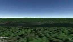
Tried Google Earth, this is how it looks from side view.

Belivale Mt.webp
 

Users who are viewing this thread

Back
Top Bottom