Pala Y Pico
Full Member
- Joined
- Jan 18, 2011
- Messages
- 216
- Reaction score
- 15
- Golden Thread
- 0
- Location
- Colorado and New Mexico
- Detector(s) used
- Tesoro Vaquero.
- Primary Interest:
- All Treasure Hunting
- #1
Thread Owner
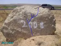
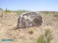
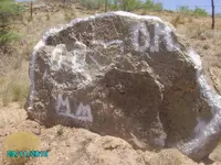
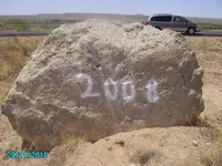
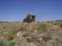
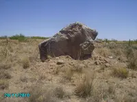
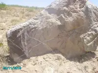
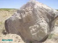
I have been driving by this rocks for years and I finally decided to stop.
These are pictures of two rocks, front and back.
I think they are on the Santa Fe Trail, not far from the Canadian River By Logan NM.
Someone took a spray can to one of them.
Because they are close to the rode, I am thinking Trail markers?
These are pictures of two rocks, front and back.
I think they are on the Santa Fe Trail, not far from the Canadian River By Logan NM.
Someone took a spray can to one of them.
Because they are close to the rode, I am thinking Trail markers?


Attachments
-
 Canadian river 2011 032.webp113.4 KB · Views: 392
 -
 Canadian river 2011 033.webp141.2 KB · Views: 348
 -
 Canadian river 2011 035.webp127.5 KB · Views: 356
 -
 Canadian river 2011 037.webp89.1 KB · Views: 348
 -
 Canadian river 2011 038.webp101.6 KB · Views: 340
 -
 Canadian river 2011 039.webp107.1 KB · Views: 348
 -
 Canadian river 2011 040.webp97.4 KB · Views: 349