Pala Y Pico
Full Member
- Jan 18, 2011
- 216
- 15
- Detector(s) used
- Tesoro Vaquero.
- Primary Interest:
- All Treasure Hunting
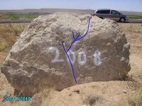
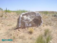
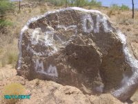
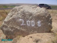
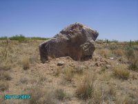
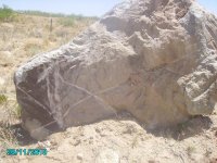
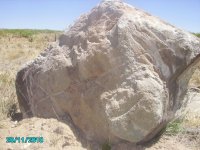
I have been driving by this rocks for years and I finally decided to stop.
These are pictures of two rocks, front and back.
I think they are on the Santa Fe Trail, not far from the Canadian River By Logan NM.
Someone took a spray can to one of them.
Because they are close to the rode, I am thinking Trail markers?
These are pictures of two rocks, front and back.
I think they are on the Santa Fe Trail, not far from the Canadian River By Logan NM.
Someone took a spray can to one of them.
Because they are close to the rode, I am thinking Trail markers?


Attachments
-
 Canadian river 2011 032.jpg148.7 KB · Views: 375
 -
 Canadian river 2011 033.jpg170.5 KB · Views: 331
 -
 Canadian river 2011 035.jpg160.4 KB · Views: 339
 -
 Canadian river 2011 037.jpg129 KB · Views: 332
 -
 Canadian river 2011 038.jpg140.8 KB · Views: 323
 -
 Canadian river 2011 039.jpg143.9 KB · Views: 331
 -
 Canadian river 2011 040.jpg135.8 KB · Views: 332