What's new

Copper Spike

Roln99

Jr. Member
Joined
Jan 1, 2009
Messages
40
Reaction score
3
Golden Thread
0
Location
Garland, NC
Detector(s) used
Bounty Hunter Pioneer 505
I was hunting in Garland Park in Garland North Carolina and I found this copper spike on the edge of one of the small baseball diamonds. A railroad used to run through Garland in the early 1900s. It's location was marked on my gps and perhaps there'll be additional finds on future hunts!

CopperSpike.jpg
 
Upvote 0
It does kinda look like brass. However when I used electrolysis to clean it up there was no mistake, "IT'S COPPER"!!! Here's my GPS map of where I found it!

GarlandParkTreasureMapII.jpg
 
Looks like a ground stake of some kind. Was there a wire pole near the area or wire lines run along side the tract? Great find.
 

Attachments

  • tn_27_jpg.webp
    tn_27_jpg.webp
    520 bytes · Views: 671

  • tn_27_jpg.webp
    tn_27_jpg.webp
    520 bytes · Views: 668
According to the GPS you dug a clad dime in the middle of the road!
Upon hitting the pothole that YOU dug I sustained some serious damage (my insurance adjuster will contact you shortly).
I almost managed to get my disabled vehicle off the road, but not before I was rear ended!!!
In the process losing a cherished possession!

Enjoy that dime while you can...
Soon it will be mine! All mine!!!

Nice finds and great technology.
Just stay out of the road!
 
Thank you all for you compliments! The GPS mapping technique was an experiment. Seeing as how I've gotten such positive remarks about it, I will now plan a detailed video hunt including instructions on how to use a gps to map all of your own hunts for future references! This will include how to use the mapping software that comes with the gps to look for promising sites to hunt (recon), as well as how to download the information to and from the gps to the software so that your custom pre/post hunt treasure maps are always current and up to date!!! :thumbsup:

P.S. By the way that road featured on the map doesn't exist through there anymore. They moved it about 1/8th of a mile to the east!!! LOL
 
Very Cool! Never heard of one of those being made out of that metal. If you find anymore information on it, please share it with us. ;D
 
It's very possible that it was used as an electrical ground rod!
 
BY THE WAY, I ALSO LOG ALL OF MY FINDS, THUE DIGITAL PICS OF THE SITE, LATS AND LONGS, MAGELLAN GPS CORDS, AND A LOCAL HISTORICAL ASSC., AND FIELD NOTEBOOK
THAT I KEEP CLOSE WITH MY LIFE, MOST OF " CW " HUNTERS KEEP A RUNNING LOG OF THE STUFF WE FIND JUST TO SHOW OFF

GOOD JOB ON THE DATA - LOL- :thumbsup:

KEEPA DIGGIN

MLHUDSON
 
Roln99 said:
Thank you all for you compliments! The GPS mapping technique was an experiment. Seeing as how I've gotten such positive remarks about it, I will now plan a detailed video hunt including instructions on how to use a gps to map all of your own hunts for future references! This will include how to use the mapping software that comes with the gps to look for promising sites to hunt (recon), as well as how to download the information to and from the gps to the software so that your custom pre/post hunt.

That's much of what I've been thinking of doing but haven't dug into GPS's enough yet to know the best (and most cost-efficient) route to do so. If you're starting a list of people to msg when you've posted it, please add me! :)
 
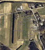
I always mark the location of my key finds with my GPSr (Garmin GPSMap 60CSx). Been Geocaching for about 4 years and it was second nature to bring it with me. I like to plot out my finds on Google Earth and interpret patterns. Old stuff over in one area, trash in another, and so on. Here is a map of a farm I worked this Spring.
 

Attachments

  • Farm_Key_finds.webp
    Farm_Key_finds.webp
    109.4 KB · Views: 190
Now that's what I'm talking about. This is treasure hunting on steroids!!! Keep up the good work!!!!
 

Users who are viewing this thread

Latest Discussions

Back
Top Bottom