Hitndahed
Hero Member
- Joined
- Dec 4, 2014
- Messages
- 866
- Reaction score
- 876
- Golden Thread
- 0
- Detector(s) used
- Fisher CZ7 Pro
- Primary Interest:
- All Treasure Hunting
=================================================================
Simply beautiful pictures Hal, Gods country for sure.
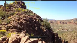
But I would like to ask a question concerning the "last" image in the series of 6 you shared.
Is it just me or do I see a HUGE human skull on the top of that ridge?
When I saw that I had the hair on my neck rise.
Even though I will probably never have the chance to venture into this part of the country, I really like reading and hearing everyone's opinions and interpretations on this legendary place.
There are just so many "clues" and hidden meanings involved it is sometimes hard for me to wrap myhead around it all.
But , I do wonder this.
Has anyone taken all the proven authentic data and laid it all out? In this section of the boards there is tons of data, some is viable and some is mere fantasy.
But to methodically assemble and digest what all those who knew are really saying.
Who knows, it may just be a lot simpler than anyone thinks.
Take the "maps" at face value, for what they show and are.
The well informed may just be overthinking it all.
I dunno,,, but it seems way too much time, money and life has been invested.


")

