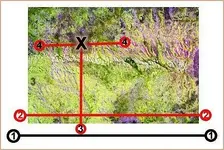
... Print out your satellite map or photo which is to be used for locating targets. Then tape the corners of it to a spot on the wood door, pin on bulletin board, etc. (keeping it at a comfortable height). Have a marker or pen ready within reach.-------follow these steps-----1. First move your pendulum slowly across the bottom, but below the edge off your image. 2. If still no response, try again from left/right over lower part of the map or photo. 3. Any forward swinging movement should be observed. Lift pendulum higher, but vertically in line with the spot where the response started on the bottom edge area. 4. Mark intersecting point of any change of pendulum (from swinging a forward motion on vertical to a horizontal or a non-rotating left/right swing).
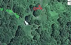
 looking for a cache or silver or gold coins