What's new

Dowsing My Maps

Tcar

Jr. Member
Joined
Apr 25, 2024
Messages
46
Reaction score
35
Golden Thread
0
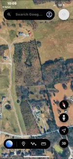
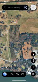
Wow this is amazing ! I have a couple maps , and I’m digging I have 4-5 targets . If you could / would douce my map I would love to have an opinion if I’m even on target ! Thanks any hello would be greatly appreciated !!!
 

Attachments

  • IMG_4588.webp
    IMG_4588.webp
    112.8 KB · Views: 101
  • IMG_4585.webp
    IMG_4585.webp
    97.9 KB · Views: 80
  • IMG_4587.webp
    IMG_4587.webp
    65.9 KB · Views: 70
Wow this is amazing ! I have a couple maps , and I’m digging I have 4-5 targets . If you could / would douce my map I would love to have an opinion if I’m even on target ! Thanks any hello would be greatly appreciated !!!
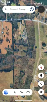
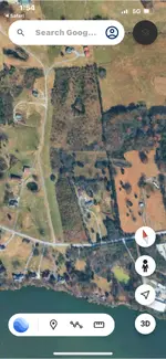
I need you to take the Google earth pictures as 3D please 2D is more difficult to scan
 
I need you to take the Google earth pictures as 3D please 2D is more difficult to scan
Take a picture of your dig site and I can check if gold or silver is present
 
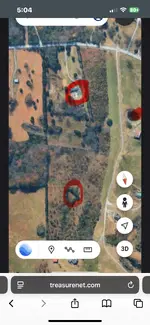
Ok ! This is great! The first pic is dig site under the trees , I’m so excited ! I physically went doucing and a couple by places pulled the brass rods to the ground . ? For what it’s worth .
 

Attachments

  • IMG_4593.webp
    IMG_4593.webp
    170.4 KB · Views: 55
  • IMG_4592.webp
    IMG_4592.webp
    116.7 KB · Views: 58
  • IMG_4590.webp
    IMG_4590.webp
    122.6 KB · Views: 58
Another
 

Attachments

  • IMG_4594.webp
    IMG_4594.webp
    135 KB · Views: 60
Ok ! This is great! The first pic is dig site under the trees , I’m so excited ! I physically went doucing and a couple by places pulled the brass rods to the ground . ? For what it’s worth .
And what did you find dowsing?
 
Posts moved, please start new thread....
 
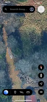
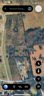
Oh my goodness !!! lol your red target is dead on with my doucing ! I’m amazed ! I’m digging 20’ north . But I’m in an air vent I think at 7-8’ I’m still in a 10” hole it goes north and south wow I want to leave work and go dig ! I may !!! 😂
As far as the white as a gold target what does that mean ?
Sorry I’m new to this and 1-1/2 yr in ! But so many symbols I’m confused ! lol thank you thank thank you !!!
 
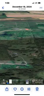
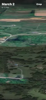
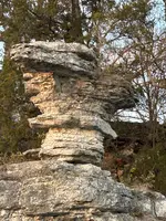
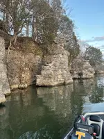
Joska, on the other 3d maps did you see anything ? I think / know there are tunnels and a few caves closed off with stacked rock and a stream coming from one . the triangle in the upper part of the pic is a 130’x130’130’ laid out in stacked rock . And there are 6 water dams built in low lying areas coming off the hill from that triangle ????? I’m thinking hydro mining ???
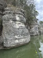
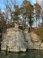
This site is in the foothills of the Appalachian Mountains, on a river system in a huge bend in the river it also has huge 30 foot tall what I had to believe to be monuments for something, I think this is the main marker on the river, even though there are three or four of them. And where I’m digging is close to the 357 -360 around 1200’ with a shaft 200’ + deep also in this line .
Thank you for your input !!! I’m always looking for advice . I just feel there’s to much here to ignore . Thank you again !
 

Attachments

  • IMG_7716.webp
    IMG_7716.webp
    5.1 MB · Views: 69
  • IMG_7567.webp
    IMG_7567.webp
    6.1 MB · Views: 66
  • IMG_7568.webp
    IMG_7568.webp
    2.4 MB · Views: 60
  • IMG_7569.webp
    IMG_7569.webp
    5 MB · Views: 65
Joska, on the other 3d maps did you see anything ? I think / know there are tunnels and a few caves closed off with stacked rock and a stream coming from one . the triangle in the upper part of the pic is a 130’x130’130’ laid out in stacked rock . And there are 6 water dams built in low lying areas coming off the hill from that triangle ????? I’m thinking hydro mining ???
This site is in the foothills of the Appalachian Mountains, on a river system in a huge bend in the river it also has huge 30 foot tall what I had to believe to be monuments for something, I think this is the main marker on the river, even though there are three or four of them. And where I’m digging is close to the 357 -360 around 1200’ with a shaft 200’ + deep also in this line .
Thank you for your input !!! I’m always looking for advice . I just feel there’s to much here to ignore . Thank you again !
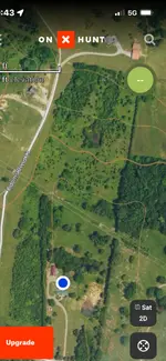
 
There is much information I can share with you but if you could take pictures on the ground of where you’re digging than I could make sure you’re on target.About the white bright spots they are Farris and non-Farris material in the ground that the satellite captures when taking over passphotos. The satellite picture you send they’re not really that clear. Can you send clear ones.
 
Oh yea ! Do I dig the red or white I’m close and think there’s a tunnel

 
Oh yea ! Do I dig the red or white I’m close and think there’s a tunnel

Send me a picture about 30 ft back from where you want to dig I hate for you to dig the wrong spot.
 
Send me a picture about 30 ft back from where you want to dig I hate for you to dig the wrong spot.
Do you have any detectors when you dig down?
 
Ok I’ll get pics this afternoon . The red is the exact area the doucing rods went crazy .i had hits but they were crazy at this area .
I started digging 20’ away I noticed a rodent hole under a rock and started digging there using and endoscope I see Timbers , tunnels . Maybe tool handles , and other stuff I’ve never seen before but shouldn’t be in a tunnel 14’ feet deep . They shouldn’t be in a hole in the ground anyway!
I can’t just dig anywhere this is in solid rock to the point the land has rock quarry’s near and is zoned Ag/quarry use .
Did the other maps show anything ? Thanks
 
And no detector beyond 10’ down in current dig hole . Nothing 10’ down there . Lots of rock hand tools though in the dig so far . Ancient looking rock tools /rocks ground to nothing almost like they were grinding rocks and smashing them ?
 
Ok I’ll get pics this afternoon . The red is the exact area the doucing rods went crazy .i had hits but they were crazy at this area .
I started digging 20’ away I noticed a rodent hole under a rock and started digging there using and endoscope I see Timbers , tunnels . Maybe tool handles , and other stuff I’ve never seen before but shouldn’t be in a tunnel 14’ feet deep . They shouldn’t be in a hole in the ground anyway!
I can’t just dig anywhere this is in solid rock to the point the land has rock quarry’s near and is zoned Ag/quarry use .
Did the other maps show anything ? Thanks
I will check tonight but it would have been helpful to only have the elevation on Google earth around 400 ft .would be better picture quality.
 
New google pic
 

Attachments

  • IMG_4597.webp
    IMG_4597.webp
    120.8 KB · Views: 57
  • IMG_4596.webp
    IMG_4596.webp
    124.8 KB · Views: 60

Attachments

  • IMG_7382.webp
    IMG_7382.webp
    274.5 KB · Views: 63

Users who are viewing this thread

Back
Top Bottom