How Does A Person Get Thier Leads To New Hunting Grounds?

Eric Willoughby

Sr. Member
Jun 4, 2009
474
18
Detector(s) used
Currently Pilfered!
I know these may seem like some stupid questions, but how does everyone on here come up with the spots they find through research? How do you come across the stories, or go out and find the stories of historical places, and then be able to track down thier exact locations where there is no longer any signs of the old buildings being here? How can I go about generating leads on places long out of existence and forgotten about? What are the procedures and resources a person has to use to track these places down?

I would really love to hear any and all answers.

I can research pretty well, but I seriously lack the skill when it comes to tracking down certain historical places, and who owns the current land, in order to ask for permission to hunt it.
 

HI crunch.I used to get a lot of infomation from my local libary..until someone stole all the the books.. i dont know how it works in the states...but if you can get hold of any old maps that should give you a starting point.
Hope this helps.
Regards Ron.
 

The county tax collector will tell you who owns the land (or ,at least, pays the property taxes).
Give us an example of a historical place you seek and someone here will, no doubt, tell you where it is (was) and how they found it.
Don.....
 

When I first started in Illinois years ago, I'd just go along country roads and look for the small wooded plots in the cornfields, generally these are where old houses or barns were, and farmers just didn't seem to till them, maybe because they didn't want to break plows? I don't know. Also it helped that I worked on detassling crews up there and knew many of the local farmers and that made getting permission, and tips a bit easier.

Never pass up an opportunity to chat with older people, my grandfather and his pals were and endless source of info. Many sites you'd never expect are just sitting there unnoticed and the old timers remember them and can point you in the right direction.
 

I find old county maps at the libary. They will have the road listed on them then you just go and found out who owns it now and tell them a little about myself and ask if it would be ok to hunt.......Matt
 

I like to go to the local historical societies and go through their pictures on file. I found several mill sites on a small creek near where I grew up. Never knew there were any mills there till I saw the pictures of these long gone places. After I studied the pictures for landmarks such as tree lines, bends in the creek and rocks it was just a question of getting permission to hunt and making a harvest.
 

All of you have posted excellent advice. Thank you! :notworthy::thumbsup:
 

Cap, Recheck my post on treasure stories. Most of the orginal post was missing.
 

NOLA_Ken said:
When I first started in Illinois years ago, I'd just go along country roads and look for the small wooded plots in the cornfields, generally these are where old houses or barns were, and farmers just didn't seem to till them, maybe because they didn't want to break plows? I don't know. Also it helped that I worked on detassling crews up there and knew many of the local farmers and that made getting permission, and tips a bit easier.

Never pass up an opportunity to chat with older people, my grandfather and his pals were and endless source of info. Many sites you'd never expect are just sitting there unnoticed and the old timers remember them and can point you in the right direction.

As this gentleman says talk to older people. They are a endless means of information. I have gotten many leads from talking to elderly folks . Some worked out and some didn't, but it was always a interesting conversation and a place to start looking.

Many years ago my grandmother told me about a school that was located on here fathers property in southern Illinois. She felt that because of all the activities that went on there it might be a good place to metal detect.

I took a drive down to the county seat and since I had my great grandfathers name, the dates he owned the property, and the approximate location. I was able to use the old Platte maps to locate his property and it even showed a school being located there. By using up to date Platte maps I was able to find out who owned the property now.

I wasn't able to get a address or a phone number of that person so I drove out to the area my grand mother lived in. I started talking to people in the area and even found a lady who remembered the school as she went to school there as a child. She said the person who owned the property didn't live in the area but was leasing the property to a local farmer and she gave me his phone number. I contacted him and explained what I wanted to do and that my great grandfather had once owned the land. He gave me permission to hunt the property.

It was quite a bit of leg work but it payed off. I hope this helps you with locating people and properties to hunt. Rick
 

Cap Crunch get a hold of a copy of the WPA guide to your state. Its the federal writers project guide written back in the 1930s. Every state has one.
 

And if you want to see their photos they are in the Library Of Congress pictures section which can be accessed on line. Just search Library of Congress.
 

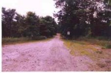
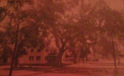
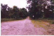
Old postcards from your area are a good reference as well. Around here there are a few postcard sellers at the local flea market and at a couple of antique group shops as well. They will often show a great visual picture of what an area near you used to look like. Here is an example from Hill, NH which is now completely gone due to being moved uphill from it's original location when they put in a dam in the 40s. The first pic is a post card from the 1930s. The second pic is what the same street looks like today.
 

Attachments

  • Hill NH today.jpg
    Hill NH today.jpg
    6.1 KB · Views: 287
  • Hill NH 1930s postcard.JPG
    Hill NH 1930s postcard.JPG
    39.2 KB · Views: 318
  • Hill NH today.jpg
    Hill NH today.jpg
    6.1 KB · Views: 289
I use 3 methods
First and mostly I knock doors
Second I use old maps, make calls to land owners
Third I use craigslist ads
 

Rockin Chairs Gold, where are you in Illinois? I grew up in Pekin, and may be able to tip you to a few spots around there. Haven't been there in years so I'm not sure what's changed.....
 

I research ownership at the county tax collector's. I get leads pretty much everywhere. One of my favorite places is old newspapers, either microfilm or (preferably) bound copies if possible.

I specifically like the time frame 1920-1940 for early jewelry, which often shows up in the lost classified advertisements, which often were free.

I like the 1940-1964 time frame to search for silver coinage, and sometimes research into 1970.

I keep a treasure cross-reference index. Just got finished with Oregon: 1400 leads. Not bad, considering Oregon only recently surpassed 3 million people. Since treasure is hidden in direct proportion to the number of people in the state, most other states will have many more leads. I'd hate to guess how many are in California, Texas, New York and Florida. But I've got over 120,000 leads right now.

Some people like to keep their leads in loose-leaf notebooks. Wouldn't work for me. Until I transferred my files to digital medium, had them stored on 4x6 cards. Haven't added much since 1980, so I'd expect a few thousand more entries to bring it up-to-date.

One of the important things to reference are treasures that have already been found. Just because a treasure has been found doesn't mean everything has been found.
 

ironron said:
HI crunch.I used to get a lot of infomation from my local libary..until someone stole all the the books.. i dont know how it works in the states...but if you can get hold of any old maps that should give you a starting point.
Hope this helps.
Regards Ron.
Allso i forgot to mention, old picnic areas..these can be some of the most lucrative area's for finding coins ..allso area's where courting couples frequent..
 

Research,
Talking to anyone who is Curious
that approaches me while Detecting,

Research,
Reading local history Books,
Research,
Ebay Picture Postcards,
Research,
Tnet,
Research,
Other detectorists,
Research
Local Newspapers,
research,
Friends & Family
research,

Key word Searches on Google web & Images


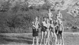
example keywords : pennsylvania swimming

http://www.google.com/images?um=1&h...vania+swimming&btnG=Search&aq=f&aqi=&aql=&oq=

Swimming at "the quarry" in Tyrone, Blair Co., PA.Swimming%20at%20the%20Quarry,%20Tyrone,%20PA.jpg


& Whatever you do
don't forget to Research


also search Beers County Atlas
for 1800's Street , Township & County Maps
with Landowner names

http://www.google.com/images?um=1&h...s+county+atlas&btnG=Search&aq=f&aqi=&aql=&oq=
 

Old Maps.
I’ve been working with old maps from my collection and overlaying the oldest aerial photos I can find.

This example shows a project I did to identify the locations of “Praying Villages” (camps where the Native Americans in eastern Massachusetts in the 1600s were isolated.)

One cool feature is the ability to compare 1930s aerial photos with today’s aerial photos.
The land has changed a lot faster in the past 80 years. The 1930s photos reflect what things looked like for hundreds of years.

http://menotomymaps.com/praying_villages.asp


-Vin
 

Hay, learn something new every day! Really like that map program!
Here's one for you, fantastic topos but hard to get use to. The size and movement controlls are hidden on the left side of the map until the courser covers them. http://explorer.arcgis.com/. to open,click on the upperleft tool bar gray box with 4dots in a square move down to topo maps and click. Enlargement is touchy. Resolution is fantastic on some enlargements. I used it to find an old stage coach route in Wind River WY. Good luck
 

I step out my back door and start detecting in an ever widening circle until I cover the entire planet ;D
 

Top Member Reactions

Users who are viewing this thread

Back
Top