Old Bookaroo
Silver Member
- Dec 4, 2008
- 4,371
- 3,577
for FEBRUARY 15, 1924.
"In the Direction of the Sun"
By KIRBY THOMAS, Mining Engineer.
The story of the lost mine of Tubac
"En la direccion del Sol a las quatro de la tarde en el dia viente uno de Junio." ["In the direction of the Sun at four o'clock in the afternoon on the twenty-first day of June."] These are the explicit directions transcribed into my notes from the ancient church records. After nearly a week's search for the "mine of Tubac", we are again in the straggling Indian village of the same name as the old mine, a Spanish "antigua", the location of which has been entirely lost through the mutations of time during the two or more centuries since its operation.
At Tubac is a "mission", a block-like affair of mud walls, once white, with a characteristic arch of unequal arms for a bell and a crumbled portico facing to the north. On this portico we had stood a few days since and looked "in the direction of the sun at four o'clock on the 21st day of June", as the old record had prescribed, to lay our course for a trip to locate the "lost mine of Tubac".

Tubac - J. Ross Browne - 1869
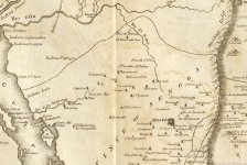
The story of our adventure is not an exciting one, but now, after our high expectations have ended in doubt, to say the least, it seems worthy of being recorded. While I was in Mexico City several years ago I received a letter from an old time mining friend in Arizona, in which he asked me to make a search of the archives in the Mexican libraries for the purpose of finding some information which might enable him to locate a famous "lost" mine of which traditions were still extant in his locality. The mine was called Tubac after a pueblo, or village, of that name in which there was a church mission not un¬ like half a hundred others in the south¬ west. The name Tubac was reported to mean, in the Indian language, "the place of water". This information was my clue, and I was expected to find from the scanty records of the days of the early Spanish occupancy data which would lead to the rediscovery of this early day "bonanza" mine. In the "Biblioteca [sic] Nacional" I found the archives of the Catholic Church from the very earliest days all in fairly good order and certainly very interesting as human documents.
In a dusty and yellowed volume, bound in pigskin, hardened by age to the stiffness of iron, I found quiantly [sic] scribed the records of the numerous "missions" which the tireless and zealous Catholic "Padres" had founded and sustained in the then far borderland of Spanish domain, now a part of the state of Arizona. These told of the founding of the missions, of Indian massacres and of matters of trivial but timely import, of the conversion of the Indians and of the discovery and operation of the rich silver mines. The church's liberal toll of the products of these mines was enumerated orderly and occasionally some notes of comment on the mines and their great richness were included. There was a description of the mine known as "Plancha de Plata" (Plank of Silver) and the "Salero" (Salt Cellar). The "plank of silver" found in the mine so designated was described as being as big as the "top of the table", which is not very definite to one of engineering habits or measurements. However, it was considered that the "find" was so important that it was sent intact to the king of Spain, either through gratitude or in hope of due regal reward. This contribution to the king was of course in addition to the liberal tithe exacted for the royal exchequer.
It is not told in these church records, but in later secular writings, that the king was so interested in the donation that he ordered the mine confiscated to the crown. Finally reference to the mine of Tubac was found. It was described as "muy requisma" (very rich) and the record set forth its location with reference to the mission as was customary at the time in terms of the sun and the almanac. Further, the scribe told of some sturdy and fruitful pear trees, transplanted from far off Spain, which were growing near the mission. No further data or description was to be found.
Some years later, finding myself in the region referred to in this old record, and having some time to spare, I decided to visit my friend and to inquire of him concerning the mine of Tubac. It seems that he had not followed up the ancient clue, partly because, as is the wont with miners and desert habitats, he did not have the time, but chiefly because the locality indicated by the directions was one not considered promising for mines or mineral deposits of any kind. However, he was still interested in the matter and he was very willing to venture with me in the quest, and he promptly offered to provide horses and ample and suitable equipment for a several days' desert trip.
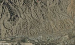
Tubac, today, is a cluster of a half score or so of "adobe" huts, looking like demounted freight cars straggled on the gray edges of patches and squares of alfalfa and other products, vivid green in contrast with the general color schemes of the desert region, and resulting from the rare perennial springs at this "place of the water". There was also the mission, very old and similar in architectural design to the other and better known missions of the southwest, many of which can trace a direct historical record back a couple of hundred years or more to the days when the padres and the intrepid Spanish miners first came into the country on their respective quests.

Tubac - The Presidio - 1908
I soon felt very sure that this was the mission referred to in the old records and that from its portico the mine of Tubac had been visible as described. Taking the course from the portico by compass and nautical almanac, we laid out our plans for the search. A long rocky slope stretched ahead, a day's travel or more to the crest, and beyond that another blue and mysterious ridge flanking the main range which lay to the west out of our line of vision. No mine was known in this allotted and prescribed segment and our general interpretations of the geological formations and conditions were not very encouraging.
It was planned to start at dawn and to camp on the near crest the first night. This would permit of some general investigations of the country through which we were to ride and of the customary and comfortable "siesta" during the hot hours of the day. It was decided to take with us the local "jefe", a "squawman" of Scandinavian descent, and a Mexican by the name of Pedro, "muy viejo y muy sabioso" (very old and very knowing), according to local report.
Two days were spent in hard, hot traversing of the first slope without result and at the end we were camped on the crest, still in sight of our beacon, the mission. Pedro, who had become stolidly interested in our purposes, told us that there was no mine in the area we were investigating, but he did not venture any elucidation of the record nor discussion of the local traditions of the "lost" mine with which we found he was familiar.

An Account of Expeditions to the Sources of the Mississippi, and Through the Western Parts of Louisiana, to the Sources of the Arkansaw, Kans, La Platte, and Pierre Jaun, Rivers; ... During the Years 1805, 1806, and 1807. And a Tour Through the Interior Parts of New Spain, When Conducted Through These Provinces, by order of The Captain-General, in the year 1807. By Major Z.M. Pike. [1810]
We decided to advance to the farther ridge and to explore there, keeping within the limits of the angle of vision and the area of visibility from our basing point the north portico of the Tubac mission. We traversed all the ragged and cactus-punctuated slope and examined every exposed rock and projecting cliff, for this was our last hope to find the lost mine of Tubac, and we still had full faith in the veracity and accuracy of the nameless recorder on whose information we were acting. It did not seem within reason to doubt the competency of the record, nor did it seem likely that our experienced search had overlooked any possible trace of an ancient mine working, especially one singled out of many for the favorable comment of a contemporary.
We had about decided to give up the search and to return to the village, when the silent Pedro, a good listener, though he understood our English conversation imperfectly, asked permission to speak with the "Senor Capitan", meaning me. He said that he and his ancestors had known by oral tradition of the famous mine of Tubac and that they, too, had searched for it in vain, as we had. He had believed that it was close to the mission, but he did not have the more explicit location and direction than my search of the archives had contributed to the subject and the association of the "pear trees" with the mission and the mine was a new idea. He then told me of some very old stumps of trees in a valley several miles to the westward which he believed to be the remains of "trees of fruit" and that there were indications that the place had once been the site of a pueblo, probably very long ago, when there was more water than now in the locality.
With new hope we journeyed westward far out of vision of the mission and late at night camped near the place which Pedro had described. It was as he had said. There were stumps of trees, not indigenous to the region, which we determined to be of the pear tree variety from an examination of the wood and the bark. That there had been a settlement there was evident from the scattered but almost obliterated rows of loose stones and from the small mounds of earth, perhaps the last crumbled evidence of adobe houses. There probably had been a mission, too, but this could not be determined.
What was more important was the fact that a few miles away was a mine visible from the site of the vanished village and quite exactly in the direction as described in the church archives. The mine is today known as "Cerro Colorado" and has been worked by the Americans since the late fifties. There is no modern history to tell whether this mine had been worked before by the Spaniards, but presumably so, for the "red hill", the English equivalent of the present day name of the mine, must have been known to the early mining adventurers who were skilled in prospecting for mineral deposits and who went into the most remote places of this then remote region in their quest for the rich and easily treated silver ores which were often found in such outcrops.

"El Arastra" - J. Ross Browne (1869) - Not at Tubac
This is all of the story. I do not know whether we found the lost mine of Tubac or not. Pedro thinks we did. At any rate, the thrill and fascination of the local tradition has gone for all of our party. Perhaps other adventurers may take up the search anew and prove the error of our deductions, which are that the Tubac of the old records was located at the place of the pear trees and later, either because of the cessation of mining or because of climatic changes which affected the necessary water supply, the village and the mission were transferred to a new site now recorded on the maps by a small black dot. For myself, I am strongly inclined to agree with Pedro.
~ The Arizona Mining Journal (Vol. 7, No. 18)
The Old Bookaroo
"In the Direction of the Sun"
By KIRBY THOMAS, Mining Engineer.
The story of the lost mine of Tubac
"En la direccion del Sol a las quatro de la tarde en el dia viente uno de Junio." ["In the direction of the Sun at four o'clock in the afternoon on the twenty-first day of June."] These are the explicit directions transcribed into my notes from the ancient church records. After nearly a week's search for the "mine of Tubac", we are again in the straggling Indian village of the same name as the old mine, a Spanish "antigua", the location of which has been entirely lost through the mutations of time during the two or more centuries since its operation.
At Tubac is a "mission", a block-like affair of mud walls, once white, with a characteristic arch of unequal arms for a bell and a crumbled portico facing to the north. On this portico we had stood a few days since and looked "in the direction of the sun at four o'clock on the 21st day of June", as the old record had prescribed, to lay our course for a trip to locate the "lost mine of Tubac".
Tubac - J. Ross Browne - 1869
The story of our adventure is not an exciting one, but now, after our high expectations have ended in doubt, to say the least, it seems worthy of being recorded. While I was in Mexico City several years ago I received a letter from an old time mining friend in Arizona, in which he asked me to make a search of the archives in the Mexican libraries for the purpose of finding some information which might enable him to locate a famous "lost" mine of which traditions were still extant in his locality. The mine was called Tubac after a pueblo, or village, of that name in which there was a church mission not un¬ like half a hundred others in the south¬ west. The name Tubac was reported to mean, in the Indian language, "the place of water". This information was my clue, and I was expected to find from the scanty records of the days of the early Spanish occupancy data which would lead to the rediscovery of this early day "bonanza" mine. In the "Biblioteca [sic] Nacional" I found the archives of the Catholic Church from the very earliest days all in fairly good order and certainly very interesting as human documents.
In a dusty and yellowed volume, bound in pigskin, hardened by age to the stiffness of iron, I found quiantly [sic] scribed the records of the numerous "missions" which the tireless and zealous Catholic "Padres" had founded and sustained in the then far borderland of Spanish domain, now a part of the state of Arizona. These told of the founding of the missions, of Indian massacres and of matters of trivial but timely import, of the conversion of the Indians and of the discovery and operation of the rich silver mines. The church's liberal toll of the products of these mines was enumerated orderly and occasionally some notes of comment on the mines and their great richness were included. There was a description of the mine known as "Plancha de Plata" (Plank of Silver) and the "Salero" (Salt Cellar). The "plank of silver" found in the mine so designated was described as being as big as the "top of the table", which is not very definite to one of engineering habits or measurements. However, it was considered that the "find" was so important that it was sent intact to the king of Spain, either through gratitude or in hope of due regal reward. This contribution to the king was of course in addition to the liberal tithe exacted for the royal exchequer.
It is not told in these church records, but in later secular writings, that the king was so interested in the donation that he ordered the mine confiscated to the crown. Finally reference to the mine of Tubac was found. It was described as "muy requisma" (very rich) and the record set forth its location with reference to the mission as was customary at the time in terms of the sun and the almanac. Further, the scribe told of some sturdy and fruitful pear trees, transplanted from far off Spain, which were growing near the mission. No further data or description was to be found.
Some years later, finding myself in the region referred to in this old record, and having some time to spare, I decided to visit my friend and to inquire of him concerning the mine of Tubac. It seems that he had not followed up the ancient clue, partly because, as is the wont with miners and desert habitats, he did not have the time, but chiefly because the locality indicated by the directions was one not considered promising for mines or mineral deposits of any kind. However, he was still interested in the matter and he was very willing to venture with me in the quest, and he promptly offered to provide horses and ample and suitable equipment for a several days' desert trip.
Tubac, today, is a cluster of a half score or so of "adobe" huts, looking like demounted freight cars straggled on the gray edges of patches and squares of alfalfa and other products, vivid green in contrast with the general color schemes of the desert region, and resulting from the rare perennial springs at this "place of the water". There was also the mission, very old and similar in architectural design to the other and better known missions of the southwest, many of which can trace a direct historical record back a couple of hundred years or more to the days when the padres and the intrepid Spanish miners first came into the country on their respective quests.
Tubac - The Presidio - 1908
I soon felt very sure that this was the mission referred to in the old records and that from its portico the mine of Tubac had been visible as described. Taking the course from the portico by compass and nautical almanac, we laid out our plans for the search. A long rocky slope stretched ahead, a day's travel or more to the crest, and beyond that another blue and mysterious ridge flanking the main range which lay to the west out of our line of vision. No mine was known in this allotted and prescribed segment and our general interpretations of the geological formations and conditions were not very encouraging.
It was planned to start at dawn and to camp on the near crest the first night. This would permit of some general investigations of the country through which we were to ride and of the customary and comfortable "siesta" during the hot hours of the day. It was decided to take with us the local "jefe", a "squawman" of Scandinavian descent, and a Mexican by the name of Pedro, "muy viejo y muy sabioso" (very old and very knowing), according to local report.
Two days were spent in hard, hot traversing of the first slope without result and at the end we were camped on the crest, still in sight of our beacon, the mission. Pedro, who had become stolidly interested in our purposes, told us that there was no mine in the area we were investigating, but he did not venture any elucidation of the record nor discussion of the local traditions of the "lost" mine with which we found he was familiar.
An Account of Expeditions to the Sources of the Mississippi, and Through the Western Parts of Louisiana, to the Sources of the Arkansaw, Kans, La Platte, and Pierre Jaun, Rivers; ... During the Years 1805, 1806, and 1807. And a Tour Through the Interior Parts of New Spain, When Conducted Through These Provinces, by order of The Captain-General, in the year 1807. By Major Z.M. Pike. [1810]
We decided to advance to the farther ridge and to explore there, keeping within the limits of the angle of vision and the area of visibility from our basing point the north portico of the Tubac mission. We traversed all the ragged and cactus-punctuated slope and examined every exposed rock and projecting cliff, for this was our last hope to find the lost mine of Tubac, and we still had full faith in the veracity and accuracy of the nameless recorder on whose information we were acting. It did not seem within reason to doubt the competency of the record, nor did it seem likely that our experienced search had overlooked any possible trace of an ancient mine working, especially one singled out of many for the favorable comment of a contemporary.
We had about decided to give up the search and to return to the village, when the silent Pedro, a good listener, though he understood our English conversation imperfectly, asked permission to speak with the "Senor Capitan", meaning me. He said that he and his ancestors had known by oral tradition of the famous mine of Tubac and that they, too, had searched for it in vain, as we had. He had believed that it was close to the mission, but he did not have the more explicit location and direction than my search of the archives had contributed to the subject and the association of the "pear trees" with the mission and the mine was a new idea. He then told me of some very old stumps of trees in a valley several miles to the westward which he believed to be the remains of "trees of fruit" and that there were indications that the place had once been the site of a pueblo, probably very long ago, when there was more water than now in the locality.
With new hope we journeyed westward far out of vision of the mission and late at night camped near the place which Pedro had described. It was as he had said. There were stumps of trees, not indigenous to the region, which we determined to be of the pear tree variety from an examination of the wood and the bark. That there had been a settlement there was evident from the scattered but almost obliterated rows of loose stones and from the small mounds of earth, perhaps the last crumbled evidence of adobe houses. There probably had been a mission, too, but this could not be determined.
What was more important was the fact that a few miles away was a mine visible from the site of the vanished village and quite exactly in the direction as described in the church archives. The mine is today known as "Cerro Colorado" and has been worked by the Americans since the late fifties. There is no modern history to tell whether this mine had been worked before by the Spaniards, but presumably so, for the "red hill", the English equivalent of the present day name of the mine, must have been known to the early mining adventurers who were skilled in prospecting for mineral deposits and who went into the most remote places of this then remote region in their quest for the rich and easily treated silver ores which were often found in such outcrops.
"El Arastra" - J. Ross Browne (1869) - Not at Tubac
This is all of the story. I do not know whether we found the lost mine of Tubac or not. Pedro thinks we did. At any rate, the thrill and fascination of the local tradition has gone for all of our party. Perhaps other adventurers may take up the search anew and prove the error of our deductions, which are that the Tubac of the old records was located at the place of the pear trees and later, either because of the cessation of mining or because of climatic changes which affected the necessary water supply, the village and the mission were transferred to a new site now recorded on the maps by a small black dot. For myself, I am strongly inclined to agree with Pedro.
~ The Arizona Mining Journal (Vol. 7, No. 18)
------- o0o -------
Good luck to all,
The Old Bookaroo
Amazon Forum Fav 👍


Attachments
Last edited: