What's new

Is Google Earth as good as it gets.

Wishbone

Sr. Member
Joined
Jan 5, 2014
Messages
257
Reaction score
91
Golden Thread
0
Location
BC
Primary Interest:
All Treasure Hunting
Is Google Earth as good as it gets for details? I guess if your looking for a house or address it is, because you have street view, heck, you can even walk down the street. But what about us satellite prospectors? Once I get to close to the terrain it gets hazy and blurry. I heard our satellites are so good now, that they can even read your licence plate if they wanted to.
Even if it's not as popular as Google, don't we have one that will let us see a trail, or a rock. It doesn't matter to me how old the image is, it might even work in our favor researching (old) new ground.
Wishbone
 
well, those are military or intelligence satellites. they are not available to the public
 
are you ranger gord?
 
are you ranger gord?
 
read a license plate? They can read the newspaper over your shoulder! Unfortunately we can't get that level of detail. You're lucky to get car-level detail.
 
You would have to get a job with them then maybe you could use their satellites.
They now are testing a blimp (? So they say) that can track a person from MA to NC, I don't think I want to know how.
 
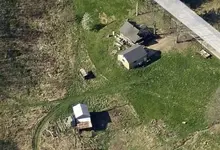
Try bing maps: Bing Maps - Driving Directions, Traffic and Road Conditions and use the "birds eye" view. There are only some areas that I have found that use high detail in birds eye. The areas that I have found available in higher detail are government owned. Corps of engineers and local watershed.

I attached a pic from one of these bird's eye view.

-Swartzie

2014-02-05_170957.webp
 
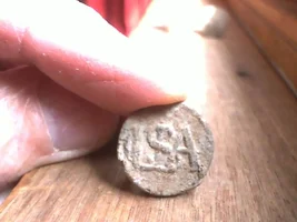
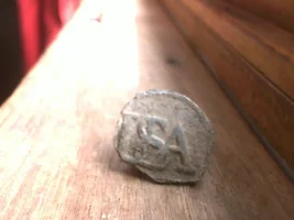
We have military satalites that can read the letters off of a coin laying on the street from space.
 
Holy moly Swartzie, now that's what I'm talking about. That picture doesn't seem as blurry when closer up. It probably has a lot to do with my laptop to. It's not the most expensive one in the world. Thanks for the tip, I'm going to go and try it. :)
Wishbone

 
I used google earth when we were in the market for a new house. Best tool ever for house hunting, scouting detecting sites, etc. The google car caught me riding my motorcycle, stopped at an intersection. I waved at it, took a couple of months for it to update my picture.
 
Your right ole miss, for city streets and houses, Google Earth is the best. If they had "street view" for logging roads and paths, we all would be in heaven.
I checked out a creek I know that was right beside a gravel back road that Google actually drove. It was so cool picking out possible locations to dig, right from your arm chair.
 
I have not figured out how to show " blue line streams" . Can you guys help me ?
 
Here's a link to Earth Lab rouddust66. It is suppose to show you how to get watersheds highlighted in Google Earth.
2B: Explore Your Watershed in Google Earth
I don't know if it works, because it seemed like a kind'a long and drawn process. Hell, I'll be honest, I dozed off (twice).
Hope it helps.
 
Well, if you are looking for old maps, The Congressional Library on line map room shows some old maps complete with the old land owner. Good for research on how it use to be. Frank...
hand print-2_edited-5.webp
 
I frequently use PennPilot photo center aerial photography which I find easy to use and navigate. It is operated by Penn State
b ut it shows areas in NJ and NY as well. Those in the covered areas might give it a try
 
I love google earth, use it to find address, locate beaver dams off the beaten path and to locate fallen and dead standing timber for fire wood harvesting, locating possible gold prospecting spots, hunting spots: etc. A very valueable tool and its free.

Paul
 
google has a set-up called Miner cache don't know if that will help you It might enhance the images don't know if it does, it does show all the claims in your area though for a fee of course.They give you a free look but not in your area.
 
Last edited:
Good tip. thanks
 

Users who are viewing this thread

Back
Top Bottom