What's new

Lidar & Metal Detecting - Help Needed

Joined
Sep 18, 2010
Messages
196
Reaction score
239
Golden Thread
0
Location
Ellisville, Mississippi
Detector(s) used
White's V3i, White's MXT Pro, and a White's Treasure Master, along with a White's TRX Pinpointer...
Primary Interest:
All Treasure Hunting
I'm in South Mississippi and am trying to learn how to use Lidar to locate Old Home Sites to Metal Detect at. That said I'm hoping some of you with experience with Lidar will be able to tell me which versions are best for locating old home sites and then how to actually read and understand what a Lidar Map is showing me.
 
Here are a few screen shots of my process

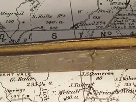
1868 Map showing a home site. I download old maps & overlay in google earth. Some websites like Historicmapworks.com already does this for you.

Map.webp


Then I go to the Lidar site and select Elevation & Hillshade

Lidar.webp


Then I find the cellar hole

Cellar Hole 1.webp


Then I get the GPS coordinates by hovering the plotter over the site

GPS.webp


I then plug the GPS coordinates into an app that I use, GPS waypoints Navigator, so I can hike to the site.


I then look at it in the woods to see what the area looks like.

Lidar 2.webp


Some cellar holes are easier to see, this one has a center chimney

Cellar Hole 2.webp
 
Learn how to use the layers.certain ones will show certain things.you can adjust the intensity of each one and over lap them.takes time but once you learn it is a game changer.
 

Attachments

  • IMG_3998.webp
    IMG_3998.webp
    5.4 MB · Views: 75
  • IMG_3999.webp
    IMG_3999.webp
    7 MB · Views: 99
I think learning how to use all of the layers and everything you can is even more important then going out swinging.this is by far the best tool.Ive located spots 5 miles out in the woods never been there before hiked out dropped my back pack and found good finds.It does take time to learn but you will be rewarded.
 
Last edited:
People in different areas and different times built things in different ways most cellar holes around here were round and on the side of a hill so as the ice melted the water would drain out.the one in the pic above is not normal for this area.look for ground that has been disturbed.pick out a spot and go out and look. you will began to know what to look for.I also have learned how to navigate by using the map.again not easy at first but once you learn just as easy as having road signs in the woods.I have a gps and never use it.
 
Folks this is some great info y'all are sharing.

As far as Navigating with Maps, I've been doing that for years, so it's not a problem. I've had good luck with the Old Soil Survey Maps and creating Overlays with them as my base, but I'm wanting to find home sites that there more than likely is no existing record of. I've been lucky enough to have a mentor who has given me some good tools/skills to find old home site's simply by physically searching the countryside, but this is a time consuming method & I am hoping that by Learning to use Lidar will speed this process up.

That said can Lidar show me old Road Beds even if Dozer work has been done. The area I live in was heavily Logged in the late 1800's & early 1900's and in many cases multiple times since then.

Also could Lidar show me Old Well's even if they have been filled in, or trash piles that are covered up. What about the piers that houses would have been built on, as opposed to full foundations.

Down here in the Deep South, the old homes didn't commonly have cellars, so what other features could I look for using the Lidar.
 
Lidar is like an X-ray, it will only show you what can be seen under the tree/leaf coverage.

It will not show you wells as they are too small to be seen from space.

Lidar will not show you what's underground. If an old dirt road has been bulldozed over you will not see it.

Folks this is some great info y'all are sharing.

As far as Navigating with Maps, I've been doing that for years, so it's not a problem. I've had good luck with the Old Soil Survey Maps and creating Overlays with them as my base, but I'm wanting to find home sites that there more than likely is no existing record of. I've been lucky enough to have a mentor who has given me some good tools/skills to find old home site's simply by physically searching the countryside, but this is a time consuming method & I am hoping that by Learning to use Lidar will speed this process up.

That said can Lidar show me old Road Beds even if Dozer work has been done. The area I live in was heavily Logged in the late 1800's & early 1900's and in many cases multiple times since then.

Also could Lidar show me Old Well's even if they have been filled in, or trash piles that are covered up. What about the piers that houses would have been built on, as opposed to full foundations.

Down here in the Deep South, the old homes didn't commonly have cellars, so what other features could I look for using the Lidar.
 
Here are a few screen shots of my process

1868 Map showing a home site. I download old maps & overlay in google earth. Some websites like Historicmapworks.com already does this for you.

View attachment 2242913

Then I go to the Lidar site and select Elevation & Hillshade

View attachment 2242914

Then I find the cellar hole

View attachment 2242915

Then I get the GPS coordinates by hovering the plotter over the site

View attachment 2242917

I then plug the GPS coordinates into an app that I use, GPS waypoints Navigator, so I can hike to the site.


I then look at it in the woods to see what the area looks like.

View attachment 2242918

Some cellar holes are easier to see, this one has a center chimney

View attachment 2242919
I really envy your tech skills. You have a system!
 
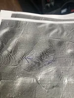
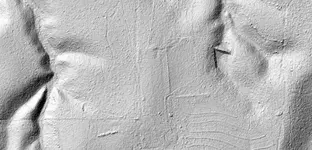
Here's a screen shot of an area does it show any signs of buildings or any other structures?
 

Attachments

  • Lidar Hillshade - 2 Homesites - 02.01.2026 -A - Darker - A.webp
    Lidar Hillshade - 2 Homesites - 02.01.2026 -A - Darker - A.webp
    223.9 KB · Views: 67
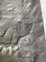
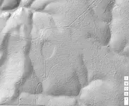
Here's another screenshot, is there anything on it?
 

Attachments

  • Lidar Hillshade - 2 Homesites - 02.01.2026 -A - Darker - B.webp
    Lidar Hillshade - 2 Homesites - 02.01.2026 -A - Darker - B.webp
    263.7 KB · Views: 63
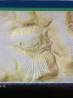
Here's one more area I am interested in. Is there anything here that suggest a home site?
 

Attachments

  • 02.01.2026 - Southern Property - B - Lidar Hillshade - A.webp
    02.01.2026 - Southern Property - B - Lidar Hillshade - A.webp
    202.6 KB · Views: 55
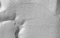
Here's one more area I am interested in. Is there anything here that suggest a home site?
This triangle looks like where the house would be on the road coming in. Their fields are behind the house to the southwest. Just a wild guess. I’m no lidar expert!
IMG_2451.webp
 
Are there any maps of the area in question.
I have found no maps that show anything from the era of the home sites I am looking for. By the time of the early 1900's soil surveys, the home sites I am looking for were long gone, and there are no good reference maps that I know of for South Mississippi before those as far as old home sites go.
 
there is one area that i would start with for some reason it wont let me add the file.If you want send me your Number and i will text it to you.I would also just walk the old roads and look for what i call exits.Follow all of them and check.Check in the roads and on the sides of the roads.Over time you will get a picture of what was there.the house site could have been farmed andplowed over for years there may not be any signs of it by now.if I suspect an old house being some were I will try and do a grid and do every 20 yards.Most old home sites will have at least a 20 debris field.It dosnt look real big you sould be able to cover all of it pretty quick.
 
Last edited:
I have found no maps that show anything from the era of the home sites I am looking for. By the time of the early 1900's soil surveys, the home sites I am looking for were long gone, and there are no good reference maps that I know of for South Mississippi before those as far as old home sites go.
Yesterday with the help of AI I have the Lidar figured out to best of its capabilities.
The resolution is still not as good as what ours can get in the States.
Ontario we are expecting a new version in late March.
I did see some spots that turned out to be ponds when I checked on Google Earth.

Managed to see a few new hidden cellar holes on a few old permissions as well.

Tilled fields seem to hide anything that was there at one time.
One permission has 4-5 sites on his tilled fields, but nothing shows up on Lidar.
 

Users who are viewing this thread

Back
Top Bottom