RTR
Gold Member
- Joined
- Nov 21, 2017
- Messages
- 8,197
- Reaction score
- 32,494
- Golden Thread
- 0
- Location
- Smith Mt. Lake Va.
- Detector(s) used
- Teknetics Liberator
Falcon MD-20
***********
Blue Bowl
Angus MacKirk sluice
Miller Table
- Primary Interest:
- All Treasure Hunting
I've looked high & low on line but came up empty.Maybe someone here can help.
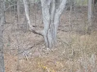
In my back yard, I have what I believe to be the remains of a old (perhaps 1800s) road.Perhaps a stage coach route at one time.
Definitely man made.Definitely old.Lower parts of it have been built up (leveled) with stones.Its not wide,maybe 12'-14'. Must be some OLD
Road/trail maps,someplace on file.Any ideas ? ...Thanks...
In my back yard, I have what I believe to be the remains of a old (perhaps 1800s) road.Perhaps a stage coach route at one time.
Definitely man made.Definitely old.Lower parts of it have been built up (leveled) with stones.Its not wide,maybe 12'-14'. Must be some OLD
Road/trail maps,someplace on file.Any ideas ? ...Thanks...
Last edited:
Upvote
0