the French on the coast of Florida

cornelis 816

Sr. Member
Sep 3, 2010
466
47
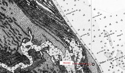
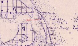
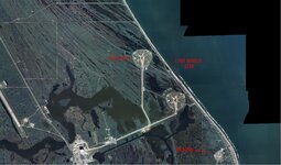
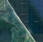
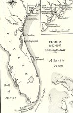
A small party sailed in two ships from Havre-de Grâce on February 18 , 1562 . Commander of this small fleet was Jean Ribaut out of the city Dieppe ( the same city that was famous for the raid on Dieppe by the English in the 2nd ww ) . I about 10 weeks the French came in sight of Florida . The next day they entered a river which they called the river May , in honor of May Day . Nowaday this river is better known by the name St Johns River .The French could not find a suitable entrance into the river across the bars . So they sailed further North and came upon the place they called Port Royal ( Sunday May 17th 1562 ) . Ribaut erected a small fort which he called Charlesfort in honor of his King . A lot of adventures happened to the French sailors . They were constantly under attack of the Spanish out of San Augustin under their leader Menèndez . At the time that Ribaut had his fleet complete again ( lots of the ship were scattered before ) he sailed South to attack Menèndez at San Augustin . Now comes the best part of this short story . A severe storm of hurricane force caught the elder Ribaut's ships South of St Augustin Not a single shipescaped . Some men from St Augustin found a Frenchman on the beach south of the settlement . He had come from a small vessel sent up to spy on the Spanish while they landed and had been stranded by the same storm that had driven the other French vessels ashore . A large party of Frenchmen was detected by Menèndez on the beach eighteen miles South of St Augustin . A messenger told Menèndez that the fleet was wrecked about sixty miles below the inlet . The messenger also stated that Ribaut's ship the ,, Trinity ,, was stranded 15 miles further south from the other wrecks . Is'nt this a good reason to do some more research and find these ships ? Cornelius
 

Attachments

  • Florida fort Carolina.jpg
    Florida fort Carolina.jpg
    670.5 KB · Views: 1,039

Vox veritas

Bronze Member
Aug 2, 2008
1,078
271
Primary Interest:
All Treasure Hunting
The French buried treasure and artillery. One of the Frenchmen, Lutheran, came to the Azores and told the whole story of buried treasure. I researched this story. The treasure should be where is now Cape Canaveral.
VV
 

mad4wrecks

Bronze Member
Dec 20, 2004
2,263
107
Detector(s) used
Aquapulse, DetectorPro Headhunter, Fisher F75
Primary Interest:
Shipwrecks
Great post Cornelis816. That stretch of coast from Ponce Inlet south to Cape Canaveral has a lot of potential for shipwreck discoveries. It is a difficult environment to work in however.

Doug Armstrong, a conservator and historian, has done some investigations on a site in the Mosquito Lagoon, that may be associated with Ribualt's 1565 fleet.

Here is a link to his book:
http://www.amazon.co.uk/French-castaways-Old-Cape-Canaveral/dp/B0006R19N4

Doug also has some very interesting artifacts he recovered from this camp on display in the McLarty museum in Sebastian, FL.

Tom
 

ivan salis

Gold Member
Feb 5, 2007
16,794
3,810
callahan,fl
🏆 Honorable Mentions:
1
Detector(s) used
delta 4000 / ace 250 - used BH and many others too
WHEN HAWKINS (THE ENGLISH TRADER /RAIDER) PULLED INTO FORT CAROLINE * HE TRADED small 50 ton vessel (the tiger) to the french there as well as giving them some food and shoes (and other assorted stuff) --the french that were there at the time planned to leave you see.*

however when Ribault --a short bit later on , he said "we 're staying" --he took every able bodied man avialible and put the own ship --despite being told that serious storms occur at that time of year.

ribault and his army was wiped out --then the spanish came northward to wipe out fort caroline --marching along during hurricane winds and rains steady northward

the fort was just about helpless when they got there --only a handful of folks (one being the fort commander--thru which we find out this info from his writings later on) they survived by fleeing to a small boat and sailing away from the landbound spanish forces --as they fled they burnt the other 3 vessels left there including the 50 ton vessel tiger that hawkins had traded them---- to prevent spanish using them to hunt them down with or future use of them as well.

from wood cut prints that show the french coming back later and wiping out the spanish that took over fort caroline --(a bit of tit for tat -- killing of the forts persons-- its clear that the fort was on a triangle shaped island --in the river --which would have made control of the river fairly easily and made attack from land hard --they have to cross the rivers water to attack it
 

bigscoop

Gold Member
Jun 4, 2010
13,406
8,755
Wherever there be treasure!
Detector(s) used
Older blue Excal with full mods, Equinox 800.
Primary Interest:
All Treasure Hunting
With such strong riptides/currents along this section of coast, how would you even begin to search the shallows for buried ships? Just curious as to how these rougher task would be undertaken. :dontknow:
 

LM

Hero Member
Dec 11, 2007
665
181
South
Detector(s) used
Charts and Maps.
Primary Interest:
Shipwrecks
bigscoop said:
With such strong riptides/currents along this section of coast, how would you even begin to search the shallows for buried ships? Just curious as to how these rougher task would be undertaken. :dontknow:

There has been significant human intervention as well.
Various beach "re-nourishment projects" , not to mention all the stuff the Army Corps of Engineers did years ago with the ICW. The Matanzas inlet today is entirely man-made and is about 1/4 mile south of where it used to be.

Still, I don't think St. Augustine is exactly 'neglected', as far as interest in its wrecks. Obviously, the place was a hugely relevant seaport in the 16th, 17th and 18th Centuries, has a big sandbar out there, subject to storms, etc. People know that stuff is out there and quietly look for it.... Artifacts wash up on the beach with semi-regularity.

The fact that they're still encountering ancient ships in the city harbor tells us that there's still plenty of work to be done offshore... which we aren't permitted to do, so we hand that task over to archies who will never do it, instead sitting in offices, giving lectures, writing books and waiting for 'the call' when someone else stumbles across something by accident, so they can jump in after the fact and pretend they're relevant to the process ::)
 

bigscoop

Gold Member
Jun 4, 2010
13,406
8,755
Wherever there be treasure!
Detector(s) used
Older blue Excal with full mods, Equinox 800.
Primary Interest:
All Treasure Hunting
LSMorgan said:
bigscoop said:
With such strong riptides/currents along this section of coast, how would you even begin to search the shallows for buried ships? Just curious as to how these rougher task would be undertaken. :dontknow:

There has been significant human intervention as well.
Various beach "re-nourishment projects" , not to mention all the stuff the Army Corps of Engineers did years ago with the ICW. The Matanzas inlet today is entirely man-made and is about 1/4 mile south of where it used to be.

Still, I don't think St. Augustine is exactly 'neglected', as far as interest in its wrecks. Obviously, the place was a hugely relevant seaport in the 16th, 17th and 18th Centuries, has a big sandbar out there, subject to storms, etc. People know that stuff is out there and quietly look for it.... Artifacts wash up on the beach with semi-regularity.

The fact that they're still encountering ancient ships in the city harbor tells us that there's still plenty of work to be done offshore... which we aren't permitted to do, so we hand that task over to archies who will never do it, instead sitting in offices, giving lectures, writing books and waiting for 'the call' when someone else stumbles across something by accident, so they can jump in after the fact and pretend they're relevant to the process ::)

I was actually more curious as to how these shallower wrecks in and around strong currents and under feet of sand are located and recovered. What's the actual process involve? Seems it would be much more challenging then some of the deeper wrecks. :dontknow:
 

barney

Full Member
Oct 5, 2006
238
168
FLORIDA
Volume I of the Encyclopedia of Florida Shipwrecks includes detailed entries for each of Ribault's vessels lost during the September 1565 hurricane (TRINITE, EPAULE DE MOUTON, TRIUTE, EMERILLION), as well as the two vessels scuttled near Fort Caroline (FALCON and TIGER).

The PERLE and LEVIERE survived the storm and eventually sailed back to France. It is unclear if a French privateer, as well as two small Spanish prize ships, were lost in the hurricane or not.

The wreck site of the TRINITE was likely destroyed (or at least significantly impacted) during the construction of Launch Complex 39B; the site's location is supported by observations from Canaveral Light keeper Captain Clinton P. Honeywell. Much more information can be found in the aforementioned Volume I of the Encyclopedia of Florida Shipwrecks... ;D

http://uwex.us

Cheers,
Mike
 

signumops

Hero Member
Feb 28, 2007
756
226
U.S.
Detector(s) used
Garrett, Minelab, Aqua-Pulse
Primary Interest:
All Treasure Hunting
Armstrong's book "French Castaways At Old Cape Canaveral" is not a book, but a CD. I bought my copy directly from him at his address. It is a significant piece of work which I highly recommend for anyone actually interested in this thread. Incidentally, Doug Armstrong is not related to me.

There's a little more background to his work that is not mentioned... there were other THr's he worked with before producing this CD which was originally copyrighted in 1996 (I have the 2002 revision). At the time that much of the current Canaveral National Seashore was being hunted, it was not a park, but a BLM tract, and, being largely wild, hosted numerous interesting locations, many of which are still intact. The 'Armstrong' site, produced a number of Charles & Joanna era coins along with spikes, jewelry, French coinage, gorgets, hammered trinkets, ect., which leads you to believe that this was probably a location used by the natives where they piled their shipwreck booty. The site is not at shore, but back further in the area of Cedar Island according to Armstrong.
 

signumops

Hero Member
Feb 28, 2007
756
226
U.S.
Detector(s) used
Garrett, Minelab, Aqua-Pulse
Primary Interest:
All Treasure Hunting
Bernard Romans cites a wreck dated 1768 in the area of the False Cape which may have been the subject mentioned by the lighthouse keeper. It is not far from 39B. Bill Andrews, who roamed the Canaveral Area for many years as a detectorist, and also worked on many of the gantry structures on the KSC as an iron worker, claimed that there were bronze guns in the lagoon waters near what is now 39B prior to its construction (sadly, the pads are being destructed as I write this).

The 1883 Coastal Geodetic chart of the Cape shows a very predominant Indian Mound on the False Cape. It is also shown on the Brevard County Map of 1885, but is missing on the 1937 Geodetic Chart. It was probably used for its shell content on the local roads, a practice common throughout Florida.
 

Attachments

  • saturnpads1883geodetic.jpg
    saturnpads1883geodetic.jpg
    536.5 KB · Views: 708
  • saturnpads1885.jpg
    saturnpads1885.jpg
    180.9 KB · Views: 678
  • saturnpads.jpg
    saturnpads.jpg
    323.6 KB · Views: 707

mad4wrecks

Bronze Member
Dec 20, 2004
2,263
107
Detector(s) used
Aquapulse, DetectorPro Headhunter, Fisher F75
Primary Interest:
Shipwrecks
Thanks for the input Terry. Great post as usual.

Somewhere I had a manuscript about the French site, which I assumed was a precusor to Doug's 'book' (which was actually a CD). I will see if I can dig it up somewhere. Though it's been a few years since I last visited Doug, I believe I may have gotten it from him directly. (Or maybe Bev Wotring from the McLarty gave it to me?)

Was the 1768 site the wreck that Randy Lathrop was working or was Randy on a different wreck?

Tom
 

signumops

Hero Member
Feb 28, 2007
756
226
U.S.
Detector(s) used
Garrett, Minelab, Aqua-Pulse
Primary Interest:
All Treasure Hunting
Tom:
The 1768 wreck, so far as I know, is not what Randy worked on. His dig was further north. I believe that it was closer to the northern access at Playalinda, Camera Pad AZ something or other... where the wire crosses the road. But, I'm not sure. I have Brandon's reports, so I guess I could look it up. Meanwhile, Romans posted a 1769 wreck near what we now know as the northern border of the park near Turtle Mound (Romans called it Mount Tucker). Fisheye might know more about that. I still have no idea why the cartographers did not name the big mound found in the Coastal Charts circa 1800's (?).

Sauerwalt, who is cited in Armstrong's work, has a coin in the Sedwick auction right now... he is deceased, but the 2 reale is a Charles and Johanna series. That probably came from the Silver Palm location. Sauerwalt and Andrews had two specific locations where they collected many coins: one produced Charles and Johanna era stuff and the other produced Pillar Dollars. I think that Randy's spot is neither one of these.
 

signumops

Hero Member
Feb 28, 2007
756
226
U.S.
Detector(s) used
Garrett, Minelab, Aqua-Pulse
Primary Interest:
All Treasure Hunting
Tom:
Checked out the LOPS for Randy's digs and it comes out roughly to 28 degrees 44 minutes 33 seconds N by 80 degrees 41 minutes 18 seconds W, or roughly in the area of the old Barraks 9 building at Cucumber Slough. See snapshot.
 

Attachments

  • barraks9.jpg
    barraks9.jpg
    87.4 KB · Views: 675

Salvor6

Silver Member
Feb 5, 2005
3,755
2,171
Port Richey, Florida
Detector(s) used
Aquapulse, J.W. Fisher Proton 3, Pulse Star II, Detector Pro Headhunter, AK-47
Primary Interest:
Shipwrecks
You are right Terry. Back in the 70's and 80's the developers used to bulldoze Indian mounds down and use the pottery shards, arrow heads and artifacts as land fill. Where were the archies then? Money talks and the politicians told the archies to keep their mouth shut! A good example is Mound Park Hospital in St. Petersburg. They leveled a dozen Indian mounds and built the hospital over a sacret Indian burial ground. Its now called Bayfront Hospital. Maybe the treasure hunters need to become real estate developers. Then we can dredge anywhere we want for a new marina.
 

signumops

Hero Member
Feb 28, 2007
756
226
U.S.
Detector(s) used
Garrett, Minelab, Aqua-Pulse
Primary Interest:
All Treasure Hunting
You know, I got to looking at the last aerial I posted, and I think that it may be possible that there is a wreck under that point of land laying east-west in the middle of the bar. Look it over. It's pretty obvious. Right in the middle of the bar where you would expect a wash-over.
 

billinstuart

Hero Member
Oct 17, 2004
578
11
stuart..the treasure coast..well, used to be
Detector(s) used
Minelab Excalibur with a WOT!
Primary Interest:
Beach & Shallow Water Hunting
I question the "man-made" aspect of Matanzas inlet. It is the last natural, un-stabilized inlet on the east coast of Florida. The original channel may have been further north, but in the 55 years that I've been familiar with this inlet, it hasn't changed much.

The stuff about cape canaveral is interesting. Went to high school in Titusville, back when Playalinda (beautiful beach) and JC Beach further south were open to the public. Rode motorcycles and drove 4wd stuff and fished all along the beach..no one even considered shipwrecks then....dammit. Watched 39 A&B being built, btw.
 

signumops

Hero Member
Feb 28, 2007
756
226
U.S.
Detector(s) used
Garrett, Minelab, Aqua-Pulse
Primary Interest:
All Treasure Hunting
There was a fortune under foot... in many different locations. Do you remember where Barracks 9 was?
 

Top Member Reactions

Users who are viewing this thread

Top