markmar
Silver Member
- Oct 17, 2012
- 4,152
- 6,326
- Primary Interest:
- All Treasure Hunting
Marius,
Frank Fish.
Joe Ribaudo
Joe
I can't see Frank Fish's signature . In what corner is ?
Follow along with the video below to see how to install our site as a web app on your home screen.
Note: This feature may not be available in some browsers.
Marius,
Frank Fish.
Joe Ribaudo
Hello Markmar
That's a bad copy of the Fish Map!
FEMF
Hello Markmar
That's a bad copy of the Fish Map!
FEMF

The "seventy-foot deep" comes directly from the Bark notes. Believe I stated that in the post.
Bark states that Jake told Julia and Rhiney that the mine was "about seventy-feet deep.
well.
I wish to see evidence this pit mine was Spanish or anything evidence beyond "we found it, you cant see a bit of what we found"
I am a historian...I want facts, not gold or tales...show me...
please..
OMG> is this a twilight zone episode?
If Thorne's story is true, he very likely found a cache of Mexican ore.


Hello FEMF
Copied by whom ? By Manuel Peralta ?

... Ore would have had to come from a mine right? Logically that mine would not be located far to the south into Old Mexico too right? I don't understand how we can seal up a lost mine story, with a cache of gold ore to explain it away. The gold ore came from a mine, and that is at the root of a lost mine story. If it were a lost cache story, I hold that it would evolve as a lost cache or treasure story, and if a cache of ore the ore came from a mine. Or am I way off in left field to think that gold ore must come from a gold mine originally?...

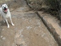
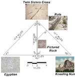
This is all probably old news to the aficionados, but I found this short video interesting, especially the ruts. Ironically, wagon-wheel ruts worn into rocks (or what appear to be so), IMO, may be more of a message than they are genuine - at least in some cases, one of which I've seen in New Mexico. It might be useful to plot these ruts' location and evaluate their position in relation to other map nodes in the Superstitions.
A shot from the same area....
looking southward
This is all probably old news to the aficionados, but I found this short video interesting, especially the ruts. Ironically, wagon-wheel ruts worn into rocks (or what appear to be so), IMO, may be more of a message than they are genuine - at least in some cases, one of which I've seen in New Mexico. It might be useful to plot these ruts' location and evaluate their position in relation to other map nodes in the Superstitions.
A shot from the same area....
View attachment 902629
looking southward
I believe I have a photo from one of my hikes that looks remarkably like that one - I'll see if I can find it tonight. I thought it was an interesting view as well.
Marius,
The Fish Map was said to be originally drawn by Don Pedro Peralta. He drew two maps and gave one each to his brothers, Ramon and Manuel. If the story is true, the one that Frank had was, likely, Manuel's.
The copy I posted was traced from the original map by my Uncle Chuck. To learn the story, find a copy of "Dead Men Do Tell Tales" by Lake Erie Schaefer. She and my uncle were good friends, and she wrote the book from the diary of Frank T. Fish.
It's highly unlikely that you will be able to find a copy.
Good luck,
Joe Ribaudo
Joe
So , the origin was from Peraltas and the map shows Weaver's Needle area . Is the proof which you wanted . So simple .

This is all probably old news to the aficionados, but I found this short video interesting, especially the ruts. Ironically, wagon-wheel ruts worn into rocks (or what appear to be so), IMO, may be more of a message than they are genuine - at least in some cases, one of which I've seen in New Mexico. It might be useful to plot these ruts' location and evaluate their position in relation to other map nodes in the Superstitions.
A shot from the same area....
View attachment 902629
looking southward
Hello Wayne
This picture was took from Black Cross Mesa ?
Springfield.
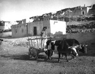
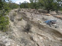
Here is a shot of some wagon tracks made by the ore wagons hauling silver ore through caliche.
Caliche when wet becomes soft. Not soft like mushy,but softer than in its original state.
I took this pic last week hiking with my wife.


Marius,
The map was said to have come from the Peralta family in Mexico. That is not proof. Frank Fish had been prospecting in the Superstitions, without finding anything, prior to his claim of acquiring the map.
You, my friend, are working at a distinct disadvantage......IMHO. Having never set foot in the area you are theorizing about, and only using Google Earth, as well as not being well read in the legends , you are looking for the proverbial needle in the haystack......so to speak.
We can trace the Fish Map only as far back as Frank Fish......using Lake Erie Schaefer as the only living source after Frank died.
The area that it shows has been searched by many, over many decades, including my family and myself. By, no doubt, a complete coincidence, there is an X just north of Weaver's Needle, which is shown on the Stone Maps, at least as I have laid it out.
Good luck,
Joe
 .
.Marius,
The map was said to have come from the Peralta family in Mexico. That is not proof. Frank Fish had been prospecting in the Superstitions, without finding anything, prior to his claim of acquiring the map.
You, my friend, are working at a distinct disadvantage......IMHO. Having never set foot in the area you are theorizing about, and only using Google Earth, as well as not being well read in the legends , you are looking for the proverbial needle in the haystack......so to speak.
We can trace the Fish Map only as far back as Frank Fish......using Lake Erie Schaefer as the only living source after Frank died.
The area that it shows has been searched by many, over many decades, including my family and myself. By, no doubt, a complete coincidence, there is an X just north of Weaver's Needle, which is shown on the Stone Maps, at least as I have laid it out.
Good luck,
Joe