I've been looking at photos of Weavers Needle to compare them with the Waltz Doodle. The view of the needle from Parker Pass is close to looking like the doodle, but isn't an exact match. Parker Pass seems to be too far west. The view of the needle from Black Top Mesa is also close to looking like the doodle, but again isn't an exact match. The view from Black Top Mesa seems to be a little too far east. I'd say the doodle seems to be a view of the needle seen just south of Black Top Mesa and a little to the west of the mesa. In any case, using the doodle alone as a clue, it rules out any possibility that it could be a view of the needle as seen from far east in the Superstitions. The doodle seems to show a view of the needle as seen in the western Superstitions and not far from the needle. If anyone has a photo of the needle that matches the doodle, please share it here.
View attachment 2220852
View attachment 2220853
Above, the needle seen from Parker Pass.
View attachment 2220854
Above, the needle seen from the top of Black Top Mesa.
Nice work narrowing the view with Parker Pass and Black Top Mesa. Reading the skyline of the doodle as a simplified silhouette, a few geometric tells stand out:
Single-spire profile – The doodle shows a rounded, single mass with a small right-hand spur. From far east (e.g., Fremont Saddle) the Needle famously splits into two horns. That split isn’t in the doodle, so an “eastern Superstitions” view is unlikely.
Left foreground ramp + central saddle – The sketch has a broad left ramp that rises above a low V-shaped saddle before the Needle. Your photo reproduces that 3-part composition (left ramp → central saddle → Needle), which argues for a western to southwest perspective, relatively close to the Needle.
Right-hand pyramid/knoll – In both the sketch and your photo a distinct triangular knoll sits to the right of the Needle. From Parker Pass this feature sits too far right; from Black Top Mesa it crowds the Needle too much. Best fit is a position just south of Black Top Mesa and slightly west of it.
Search corridor (most likely): the low benches and rises between Bluff Spring Wash and the west/southwest toe of Black Top Mesa, roughly 0.5–2 miles from the Needle (western Superstitions). Spots along the Bluff Spring Trail between the Mesa saddle and the Terrapin junction, and the open ground a bit west of there, give a skyline that matches the doodle’s proportions better than Parker Pass or the top of Black Top Mesa.
How to verify (quick method):
Stand where the left ramp consumes ~30–35% of your horizontal field, with the Needle placed right-of-center and a clean V-saddle between them.
Check the Needle’s right-hand spur angle; from the west/southwest it kinks slightly right, as in the doodle.
Take a telephoto shot (70–100 mm FF equivalent) so perspective compression matches a simple line sketch.


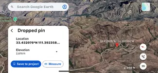


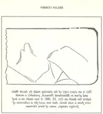
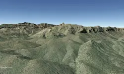
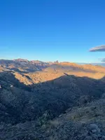


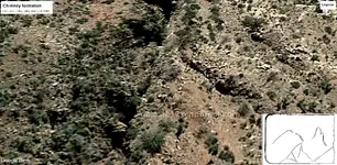
 . You are not misunderstanding. It's a good point and observation. What I think the Doodle is stating; is that in that Doodle is the general area of where Waltz had his mine and cache. Is it under the "crack" (yeah, I'm still laughing) as you stated, could very well be. I'm in the camp that, the Doodle is telling us - this is the location, figure out a compass direction and maneuver yourself into the area. I think the 'X marks the spot' has been purposely left out - as that would be too easy to decipher. It's probably telling us, come to this location within the Wilderness, and then remember the rest of the clues spoken by Waltz. Those two elements together - will get you there.