nc-joe
Hero Member
- Joined
- Dec 1, 2006
- Messages
- 710
- Reaction score
- 4
- Golden Thread
- 0
- Location
- Concord, NC
- Detector(s) used
- White's DFX and Minelab Explorer SE
- #1
Thread Owner
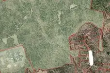
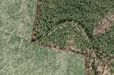
I am researching the area in shaded green and found this odd tree formation around one side. Any ideas. This is a satellite photo and it's not zoomed in very close. The scale is 1:6,253. The reason I am looking at this area, is there a good history back to 1749 in this spot.
The area in question is about 3 times wider than any road on the map.
The area in question is about 3 times wider than any road on the map.


")