OwenT
Hero Member
First thing I thought when I saw this on the Columbia River was dredge tailing, but it's actually more of a snaking pattern than the stacked arcs a dredge would make. This area on the river did produce gold.

Note to anyone beginning to read this thread: It was determined that the picture shows the remnants of some sort of gold mining operation. The thread then turns a little off track and there is a debate for several pages. Finally we discuss land status and I try to find out who owns this property.
Note to anyone beginning to read this thread: It was determined that the picture shows the remnants of some sort of gold mining operation. The thread then turns a little off track and there is a debate for several pages. Finally we discuss land status and I try to find out who owns this property.
Amazon Forum Fav 👍


Last edited:
Upvote
0
")


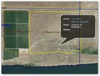
 More like 3 1/2 miles to the piles and 4.75 miles to chinaman bar. chinaman bar is on BLM land. It looks to me that the piles are on Grant County PUD land.
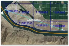
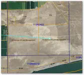

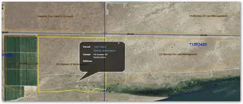
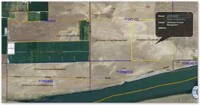
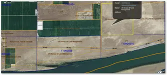
 There are cheat sheets, Land Matters has one... Once you have the cheat sheet, and spend a short bit of