David and the Peralta stone maps.

Nov 8, 2004
14,582
11,942
Alamos,Sonora,Mexico
Primary Interest:
All Treasure Hunting

Attachments

  • Satt picture corrected 2.jpg
    Satt picture corrected 2.jpg
    26.3 KB · Views: 679
  • Satt view orig..jpg
    Satt view orig..jpg
    34.3 KB · Views: 700
  • Satt 1 b.jpg
    Satt 1 b.jpg
    35.4 KB · Views: 693
OP
OP
Quinan Bear

Quinan Bear

Sr. Member
Nov 7, 2008
312
6
Grande Prairie Alberta
Hi Tayopa;

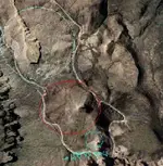
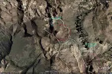
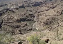
Good to hear from you again. My picture that I put up that showed a shaft area, was facing north #1 and #2 the shaft is more to the north of that rough circle that says "shaft". The purple circle is of a very rough country with tall pillar like stones. Battleship Mountain is more horizontal in the way the rocks are made, the upper circle had another type of stone, this is where a few faults meet.


Somehiker;
Just a thought.
Could there be yet another plastered rock in another area near by?
Perhaps they are "The three stones that are by themselves that make a triangle"?
 

OP
OP
Quinan Bear

Quinan Bear

Sr. Member
Nov 7, 2008
312
6
Grande Prairie Alberta
Tayopa;
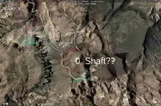
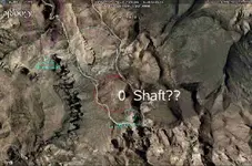
This picture that you added (below), is looking from north below, to south above. The 0 - shaft?? is an old cave, the real mine if not far. the shaft that I was trying to circle is just a bit off from the crude circle. The place you put the "0" at is very near a vein, if not on it.
 

Attachments

  • Satt 1 b.jpg
    Satt 1 b.jpg
    35.4 KB · Views: 663

somehiker

Silver Member
May 1, 2007
4,365
6,429
Primary Interest:
All Treasure Hunting
I believe that the "three stones" clue applies to the location of the LDM.
They are said to be relatively close together and shaped like "teepees"(or dome shaped since the description came via the Apache and may have been misrepresented by bad translation).I have seen nothing that suggests that those rocks were white.
These boulders are rectangular and about a mile apart,only standing out because they are both high on the slopes and everything else is dark or black rock,even the rock under the white substance.
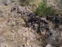
Before my last trip,noting that GE had recently improved the resolution in the western area of the mountains,I noted several dark spots in another area of interest that I thought might be pit mines.Every single one turned out to be a basaltic outcropping.
Here is a photo of one of them.
SH.
 

Attachments

  • 100_0547sm.jpg
    100_0547sm.jpg
    138.5 KB · Views: 652

somehiker

Silver Member
May 1, 2007
4,365
6,429
Primary Interest:
All Treasure Hunting
Cubfan64 said:
Great photos Somehiker! I'll have to see what happens this fall as I haven't heard whether the Rendezvous is "on" again or not. I think even if it's not, I'm going to convince my wife to join me on an October trip out there just so she can see the area and hopefully become as spellbound by it as I've been :)

I'd love to go exploring with you for a day or two, but not sure yet if my wife would be up for it physically, and I don't want to leave her behind when we're on a "vacation."

Let's stay in touch though and maybe we can work something out. You seem to have found some interesting things again.

Paul:
Set her up with a day at the spa and we can go out and look for something to pay for it with. :wink:
I haven't put the best pics up.Don't want a repeat of what happened when I first put the Bee Cave photos up.
I'll e-mail you one.The usual request applies...in spades.
Wayne
 

ghostdog

Sr. Member
Apr 22, 2007
286
15
SH , after seeing your recent posted photos, I have more of a desire to go see those locations. If you ever decide to a give a paid tour I want to make a reservation.I will bring my own referance material,and share it openly.Thanks for posting outstanding photos.
 

somehiker

Silver Member
May 1, 2007
4,365
6,429
Primary Interest:
All Treasure Hunting
GD:
;D ;D ;D ;D
Glad you enjoyed them.I enjoyed being there,in spite of the bee swarms,the scorpion nest that I accidentally uncovered between my knees (them suckers sure like denim)and the snakes of course.
Imagine that there will be a few that go out for a look.Not easy to get to some of it though,and rough as hell.Good place to go if you want some solitude.No footprints,no crushed grass,no broken twigs and no drink bottles or rusty tin cans to be seen anywhere.
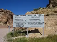
There is no fee for tours,but invites are very limited.I tend to like things the way they are,with no boundaries like this imposed.

Regards:SH.
 

Attachments

  • nogo sign.jpg
    nogo sign.jpg
    90.8 KB · Views: 670

somehiker

Silver Member
May 1, 2007
4,365
6,429
Primary Interest:
All Treasure Hunting
As a further observation re: GE.
They are about a half mile from the trail to the horse,on a side trail,but I shot this photo of three such boulders a couple of years ago.Might hike that trail next time and get some closeups.Can't find them on GE,but the trail seems to be there in places.
SH.
 

Attachments

  • three rocks.jpg
    three rocks.jpg
    39.8 KB · Views: 651
OP
OP
Quinan Bear

Quinan Bear

Sr. Member
Nov 7, 2008
312
6
Grande Prairie Alberta
Apache canyon is a good place, it has one of the mines that is on the "Heart" stone and is where i saw this to the east of that mine and farther south in the canyon.
Here is a pic of a nice white layer high up in the canyon wall on the left/west side.
 

Attachments

  • 4720673.jpg
    4720673.jpg
    114.1 KB · Views: 621
OP
OP
Quinan Bear

Quinan Bear

Sr. Member
Nov 7, 2008
312
6
Grande Prairie Alberta
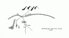
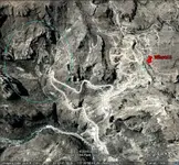
Someone posted this map of that same area, I have found the "finger of god" near them and had posted it to show everyone what I was talking about.
Here is the map and the pic.


Can you locate all the mines?


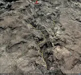
Sorry, my bad. Here is the correct canyon (in yellow) for those mines and the circle shows the mine areas in blue, your post is above. This pic shows that north, is to the left of pic and you are looking eastward.
 

Attachments

  • treasm19.gif
    treasm19.gif
    6.7 KB · Views: 602
  • Finger of god.jpg
    Finger of god.jpg
    121.9 KB · Views: 610
  • mines in map.jpg
    mines in map.jpg
    125.5 KB · Views: 605

somehiker

Silver Member
May 1, 2007
4,365
6,429
Primary Interest:
All Treasure Hunting
Just about anyone standing on the gravel berm at the outside of the hairpin turn could probably see them.All of the dam personnel,truck drivers,hikers and mountain bikers and construction workers that built and maintain that road have seen the mines as well,I'll bet.The Salt River Power Corp. huey pilots and the inspectors that fly the power lines that pass directly overhead,probably have the best view of them mines,though.I might have even seen them myself,since they are somewhere in this photo,that has almost all of your first circled area in it.
Regards:SH
 

Attachments

  • 100_0202sm.jpg
    100_0202sm.jpg
    74.9 KB · Views: 606

somehiker

Silver Member
May 1, 2007
4,365
6,429
Primary Interest:
All Treasure Hunting
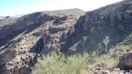
Nothing much,other than some iron staining in spots.No veins of quartz larger than 1/4" wide,and not very long.
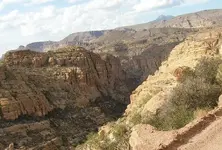
Here is a shot of what lies within the circled area in the second GE view.
A number of shallow prospects in that area as well,which may be part of a currently owned claim,I have been told.
Interesting area for a day hike,and a few caves to look into,but some disappointing modern graffiti as well.
Spent about five days in that area three or four years ago.
SH.
 

Attachments

  • canyon sm..jpg
    canyon sm..jpg
    112.3 KB · Views: 591

somehiker

Silver Member
May 1, 2007
4,365
6,429
Primary Interest:
All Treasure Hunting
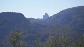
This is a view of what is usually called "the finger of god".It was taken from above the area that you showed in your first GE image.
It's some distance away.The place where I was standing,when this pic was taken,is called "OZ",(along with a couple of other places),by one long-standing poster on another site.There are some interesting things to the south,along Coronado mesa,though.
SH.
 

Attachments

  • 100_0205sm.jpg
    100_0205sm.jpg
    41 KB · Views: 579
OP
OP
Quinan Bear

Quinan Bear

Sr. Member
Nov 7, 2008
312
6
Grande Prairie Alberta
Somehiker;

Thanks for the info and pics.
I know that the people around there, call Weaver's needle as the Finger of god, but it is not what I was told, ment the finger of god when it comes to the earth and minerals.
Although you don't see it as well, there are a few fingers in that second pic and as you stated, "there are small veins in them".
If you can find these "fingers" you are very likely to find minerals.

There are supposed to be 4 mines in the first picture and 4 more running up the canyon on the second pic.
If you want a viable vein? then you need to head towards Geronimo Head.
 

OP
OP
Quinan Bear

Quinan Bear

Sr. Member
Nov 7, 2008
312
6
Grande Prairie Alberta
somehiker said:
This is a view of what is usually called "the finger of god".It was taken from above the area that you showed in your first GE image.
It's some distance away.The place where I was standing,when this pic was taken,is called "OZ",(along with a couple of other places),by one long-standing poster on another site.There are some interesting things to the south,along Coronado mesa,though.
SH.
The Heart stone map shows of a mine just east of that cliff of rock on the left and the bottom tip of the heart that i posted, is on the top of the hill on the far right. If you had one that was showing east from the right hill? i could point out the mine to you.
 

somehiker

Silver Member
May 1, 2007
4,365
6,429
Primary Interest:
All Treasure Hunting
What do you think is a mine symbol on the Heart Stone?
SH.
 

OP
OP
Quinan Bear

Quinan Bear

Sr. Member
Nov 7, 2008
312
6
Grande Prairie Alberta
somehiker said:
What do you think is a mine symbol on the Heart Stone?
SH.
I will try to explain this the best i can without a picture of the stone itself, so bare with me.
The heart stone is the one with the heart insert. Look at it with the river above.
To the left of the heart, you see the knife with a hole between the two (heart/knife). To the right of the heart, you see 2 holes. the top hole is the one that i wanted to show you.
 

Top Member Reactions

Users who are viewing this thread

Top