Just Drill Holes

keys diver

Newbie
May 25, 2012
2
2
tavernier Fl.
Detector(s) used
Whites 6000di pro
Primary Interest:
Shipwrecks
you are all out in left field on this one, Their is no rabbit or dog just a drill hole, and brent did not find this drill hole or any other symbol he has posted he has never found a symbol. This drill hole marks the outer boundry of a yard, in fact the church hollow treasure in the caplinger mills area.
 

keys diver

Newbie
May 25, 2012
2
2
tavernier Fl.
Detector(s) used
Whites 6000di pro
Primary Interest:
Shipwrecks
And brent how meany holes have you dug, zero because you cant find anywhere to dig. You must fail to move forward. As long as you continue to read photos of rocks you will never move forward to dig your first empty hole. Ive found more treasure diging mag targets then you will ever find trying to read everyones photos and coach them, you are simply in duck tails. Hows that shortstack do you like.
 

Jan 16, 2011
5,010
5,037
By, By Have fun.
Detector(s) used
Time to move on. Good luck everyone .
Primary Interest:
All Treasure Hunting
hey there dsty, heres a couple of drill holes in a area,i think anyways,that are not to far from the other large one i posted. i never measured them,because i always thought they where native grinding stones,but i have seen some of the native grinding stones now, and i know they are not that. heres the photos.when iam back out there ill get more info and photos. View attachment 661398 View attachment 661399 View attachment 661400 View attachment 661401 View attachment 661402 View attachment 661403 View attachment 661410
 

Last edited:
OP
OP
D

dsty

Bronze Member
Dec 2, 2007
1,300
736
Randal County
Dog one thing that is important is if the trail you are following seems to be on a cordell and then it changes to 2.5 cordell's then there's a chance that you may have found a windrose. Take your time and work it out, always degrees and distance and scale it out on paper,
 

OP
OP
D

dsty

Bronze Member
Dec 2, 2007
1,300
736
Randal County
Anyone interested in corner markers, large egg, podum, sitting frog, turtle, hog laying flat on top of a rock, eagle sitting on a nest. The library will be closed from the 22nd to the last of the month to replace furniture
 

OP
OP
D

dsty

Bronze Member
Dec 2, 2007
1,300
736
Randal County
It appears that one league square may have been alloted to each settler, with sections 25 leagues square with a place of worship ( church / cemetery) in the center of the 25 mile ( 10 Leagues ) section, each. We call the property sections / township / range - in modern times, they seem to have the same method / did we copy them ?, However they did it they left a trail of sympols what we must do is figger it out, they may have used church symbols between the churches ( trails layed out in a plus )+, corner markers at each corner of the property using a X, distance between the properties I have seen indications that each league was reduced by 4 paces for the church property which could be 4 paces x 5 = 20 paces, Time is up gotta go
 

uglymailman

Bronze Member
Feb 3, 2010
1,267
1,464
When I was surveying in Texas, I found much of the land in central TX. was done in Vara's. 1 yard= 1.08 Vara. They also measured in Leagues, little over 2.5 miles. Look at a map and you'll find in central TX. the county's mostly run NW to SE, not the N,S,E,W we use here west of the Mississippi.
I was told much of the land measurements were done by tying a rag on a wagon wheel and counting the number of rotations.
 

OP
OP
D

dsty

Bronze Member
Dec 2, 2007
1,300
736
Randal County
Hello Mailman, yes I agree with you, they did have several different pace measurement,s I really do think that the Spanish used the 36 inch pace for their measurements. The Royal Mesurement was different tho, I use the obsolete spanish and portugal unit of measurements which a certain king measurements was used and it seems to work on the cache sites and everything that I have been involved in, league = 2.33 miles pace = 33 inches, lots of folks have found W's there's some that indicate depth, portions of a league or perhaps portions of the 10 league theory. All the types of things you find in the field most will match the Washington D.C. street lay out, I,m on a different computer in a near-by town and I just thought I would stop and see what's going on. What did you find for a group of leagues, U.S. = 36 sections = tws = range Thanks for the reply
 

OP
OP
D

dsty

Bronze Member
Dec 2, 2007
1,300
736
Randal County
Something that seem's to work in all the areas that I have worked, the county phone book has a lot of info such as St. Gregorys, St Crispens, Sacred Heart, ( and may help locate some in your ) all were aprox 25 miles apart one that We found about 2 miles north of Spaulding Oklahoma that I think it was a church / place of worship, it was 10 inch X 10 inch with a sloped top and a 3"X3" drill hole in the NE corner, Several Larger rocks in the area could have been for sitting, the best I remember it was about 4 feet high. The Counties that I have mentioned is Pottawatomie / Seminole, the churches near Konawa / Seminole / Shawnee, some of the old forts were near the churches
 

OP
OP
D

dsty

Bronze Member
Dec 2, 2007
1,300
736
Randal County
Well here I go changing my mind one more time, this may have some interest to some, it concerns the letter 7 I know that there's a few around and I agree that they may indicate a rest area, possibly several other meaning along with a unit of measurement = labor = 1/4th of a mile 1320 feet X12 = 15840 divide by 33 =480 paces also = 7 cordel,fits pretty good and the square area may be 10 square miles, or 4 instead or 5 like I have been thinking, 0r 25, anyway look for corner markers, I do believe it can be figured, would be helpful to have others to help measure, compass, photos, The Large Rabbit head near the Drill hole that was posted may be corner markers showing two directions.
 

usernotfound

Sr. Member
Sep 7, 2011
495
148
Detector(s) used
T-2
Primary Interest:
All Treasure Hunting
hey there dsty, heres a couple of drill holes in a area,i think anyways,that are not to far from the other large one i posted. i never measured them,because i always thought they where native grinding stones,but i have seen some of the native grinding stones now, and i know they are not that. heres the photos.when iam back out there ill get more info and photoQUOTE]

Not Grinding stones at all. They are part of the S/S of the area. Pay attention to the Shadows of the area in combination with the holes.
 

OP
OP
D

dsty

Bronze Member
Dec 2, 2007
1,300
736
Randal County
Well I don't guess anyone is interested in how they may have layed out this country, Sooooooo good luck everyone
 

OP
OP
D

dsty

Bronze Member
Dec 2, 2007
1,300
736
Randal County
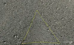
Hello All, This will be what WHAT I THINK about corner markers, They were placed at the corners of a league square, seems to be boulders aprox 6 / 8 feet high and 6 / 10 feet long, some are smaller some may be larger, they can be flat, on edge as the one that was recently posted, ( a side view would be nice ) they can be just boulders but they will have some kind of mark to identify them anything will do, and should have something to indicate at least 3 directions of travel, hopeful 4, if not then it indicates the line between the 25 square block distance between trail markers on those may be 480 feet, Large corner markers can possibly be seen from a greater perhaps 2.5 miles, trail markers between the corners markers be 40 inches or so and be large enough to be seen from that distance, no tricks, just plain ole trail markers such as a pig walking, anything you find sitting down or a head is not a trail marker its just saying look this way. The directions should be N. S. E. W. compass degrees is another clue, your corners will be sitting or resting, something on a nest, Its easy it only took me 45 years. Yes they very possibly all had cache sites,
 

OP
OP
D

dsty

Bronze Member
Dec 2, 2007
1,300
736
Randal County
Sometimes thats why just one drill hole on a boulder, its for distance, something else shows the direction.
 

Shortstack

Silver Member
Jan 22, 2007
4,305
416
Detector(s) used
Tesoro Bandido II and DeLeon. also a Detector Pro Headhunter Diver, and a Garrett BFO called The Hunter & a Garrett Ace 250.
Primary Interest:
All Treasure Hunting
Sometimes thats why just one drill hole on a boulder, its for distance, something else shows the direction.

dsty:
I was watching a program on Sci-Fi a few days ago, called Ghost Mine. It's a reality show in series about this man who opened an old gold mine and brought in a small crew to work it. Turns out there's paranormal activity in and around the mine, plus in the nearby small town. He brought in a couple to investigate the ghostly stuff.
Well, in this last episode, that couple was contacted by a local business man who told them that the mine had been owned by a Masonic organization many years ago and that they were the ones who closed it down. He sketched a layout of 3 granite boulders that were supposed to be on the access road, close to the diggings and said that he didn't know what their importance were, but that they should be found and investigated.
Long story short...........the 3 granite rocks were found and each rock had 3 drill holes in it. Within the triangular area formed by those stones was a depressed area. They dug there and uncovered another entrance to the mine complex that had been boarded shut and completely covered in dirt to match the surrounding grade.
This would give even more evidence that the KGC did use drill holes and other signs pioneered by the Spanish and Ancients in their own activities of the treasure sort.


EDIT: I forgot to mention that those 3 granite rocks / boulders were "out of place" for this area. Granite was NOT a common stone found in this area. These 3 stones were about 3 to 4 feet in diameter and the triangle they formed was about 200 feet on a side.
 

Last edited:

usernotfound

Sr. Member
Sep 7, 2011
495
148
Detector(s) used
T-2
Primary Interest:
All Treasure Hunting
dsty:
I was watching a program on Sci-Fi a few days ago, called Ghost Mine. It's a reality show in series about this man who opened an old gold mine and brought in a small crew to work it. Turns out there's paranormal activity in and around the mine, plus in the nearby small town. He brought in a couple to investigate the ghostly stuff.
Well, in this last episode, that couple was contacted by a local business man who told them that the mine had been owned by a Masonic organization many years ago and that they were the ones who closed it down. He sketched a layout of 3 granite boulders that were supposed to be on the access road, close to the diggings and said that he didn't know what their importance were, but that they should be found and investigated.
Long story short...........the 3 granite rocks were found and each rock had 3 drill holes in it. Within the triangular area formed by those stones was a depressed area. They dug there and uncovered another entrance to the mine complex that had been boarded shut and completely covered in dirt to match the surrounding grade.
This would give even more evidence that the KGC did use drill holes and other signs pioneered by the Spanish and Ancients in their own activities of the treasure sort.


EDIT: I forgot to mention that those 3 granite rocks / boulders were "out of place" for this area. Granite was NOT a common stone found in this area. These 3 stones were about 3 to 4 feet in diameter and the triangle they formed was about 200 feet on a side.


Out of place like a triangle of empty space when the whole hill is covered with rocks?

Not perfect mark up, but enough to get the idea.
 

Attachments

  • lacking.png
    lacking.png
    462.7 KB · Views: 168

Shortstack

Silver Member
Jan 22, 2007
4,305
416
Detector(s) used
Tesoro Bandido II and DeLeon. also a Detector Pro Headhunter Diver, and a Garrett BFO called The Hunter & a Garrett Ace 250.
Primary Interest:
All Treasure Hunting
Yep, user. Works for me. :coffee2:
 

usernotfound

Sr. Member
Sep 7, 2011
495
148
Detector(s) used
T-2
Primary Interest:
All Treasure Hunting
Yep, user. Works for me. :coffee2:

How misleading, of me. The left corner of that triangle is a Diamond. Approx. Two meters by two meters. Sad to say, but I've never touched ground near the stone...yet. That's for anther day and a looooong hike. IF someone wants to check it out for me, drop me a e-mail...
 

Top Member Reactions

Users who are viewing this thread

Top