Pics for dowsing

Pic%202.webp

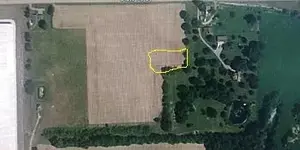
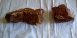
Have made 3 trips to the location and searched with 3 different detectors and a 2-box detector. The area marked on my pic was the area that had been said to be possible cache locations. In the area I marked is several dozen "hot rocks" all over the field. I have since been told by a old timer that there was a natural gas or oil well in that area in the past ( early 1900's ). So I am guessing that is the reason for the "hot rocks" being all over. I am also guessing that is why everyone zeroed in on that area when dowsing?
 

If cant find it, walk the area and take pictures then publish here or PM (private message)
 

Convince me that dowsing axctually works other than for water buried
 

If the red rectangle is where, that only was indicated as a deepr than 2 feet deep signal. A deep cache would show up as a deeper signal but so do some other things.
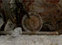
Here are a few examples of deeper stuff have been found at deeper marked red spots.

vaultLG_handle2.webp

vaultLG_plate.webp

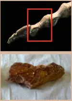
Petrified dino bones at 18-22 feet down.

dinosaur-3-left-footcompare.webp

097-red_rock-Amjad.webp

Vault-inoceramus.webp

Vault-inoceramus2.webp

Old bag very deep.

vaultLG_1fabric2handle.webp

I dowsed a map for oil once, the person took the dowsing results to a university to be checked out. Experts from that university confirmed the right geological formation was present for oil, at all marked spots on the map. Only a few things which have showed up for deeper signals. I had my L-rods cross over a place in our lawn, happened many times. A few years later the utilities company came out and beeped a gas line there. That was a natural gas pipeline, so maybe we did identify the location of a natural gas well... I would consider it the target and not a cache. To ID a dowsed signal is not always easy or can be misunderstood a similar problem like to your coin detector ID.
 

Last edited:
Here is from my file of definitions for suspected targets, red of course, is generally from searches which are NOT gold or silver specific.

"
[FONT=Verdana,Arial,Tahoma,Calibri,Geneva,sans-serif]Red circle is to mark areas, of loose or surface coins/treasure and artifacts of value, down to 1-2 feet deep.
Red line box (or solid filled circles) for very deep coins/treasure or artifacts of value."

"[FONT=Verdana,Arial,Tahoma,Calibri,Geneva,sans-serif]Orange line box (or solid filled circles) for deeper man made gold objects or pocket gold in veins.
Orange outline circles, for man made gold objects from surface down to 1-2 feet or shallow rich native gold."

"[FONT=Verdana,Arial,Tahoma,Calibri,Geneva,sans-serif]Green in general is a color indicator, I use for various other targets mostly archaeological (old ruins or foundations but especially those non-metallic objects such as Indian flints, glass, pottery, carved stone with treasure signs)"

"[FONT=Verdana,Arial,Tahoma,Calibri,Geneva,sans-serif]Turquoise (or aqua blue) circles for paper currency, usually hidden in the ground as a cache"

"[FONT=Verdana,Arial,Tahoma,Calibri,Geneva,sans-serif]Blue line box (or solid filled circles) for deeper silver targets.
Blue circle is to mark areas of loose or surface silver coins/treasure, down to 1-2 feet deep."

[/FONT]
[/FONT]
[/FONT]
[/FONT][SUB][SUP]"[/SUP][/SUB][FONT=Verdana,Arial,Tahoma,Calibri,Geneva,sans-serif]Lilac colored line box (or solid filled circles) for rough (uncut) crystals and gemstones, jewels (cut, polished or faceted), pearls"

"[FONT=Verdana,Arial,Tahoma,Calibri,Geneva,sans-serif]White in general is a color indicator, I use for natural caves or man made tunnel entrances and mine shafts, other similar type excavations (including old wells, tombs, etc.)."[/FONT]
[/FONT]
[SUB][SUP]
[/SUP][/SUB]
[/FONT]
 

Top Member Reactions

Users who are viewing this thread

Back
Top Bottom